
We left St. Augustine and are on our way to continue our Loop Adventure.
We had watched boats of different sizes leaving the Camachee Cove Marina struggle with the current of the Tolomato River colliding with the St. Augustine inlet of the Atlantic Ocean. Some of the boats would ‘crab’ or ‘walk’ as they entered the river. That means the current is moving the boat sideways even though the boat captain wants to go straight. We decided to go just after low tide when it seemed that the current was marginal and we were ready with both engines to ‘gun it’ if needed. We certainly didn’t want to end up on a sand bar. I was watching the boat traffic, depth gage, and telling Wayne to turn into the ICW!!! We made it without too much trouble. Anxiety mostly. Wayne piloted us gently in the ICW and we are off! Road Trip aka Looping Waterway Trip!!

Leaving Camache Cove Marina, St. Augustine
Marsh is on both sides of the Tolomato River.
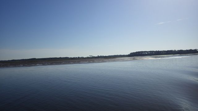
Early morning Florida Marsh
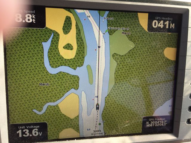
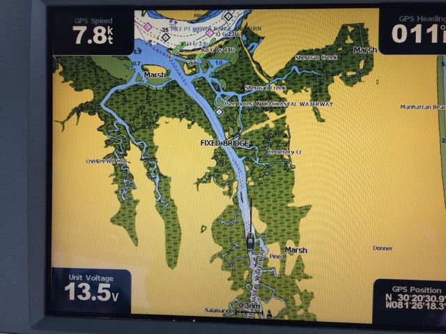
On the chart plotter, it looks like this…
Marsh on both sides of the river
I spied a long pier jutting out into the river but saw no house attached. Maybe there used to be one in the clump of bushes and trees to the left. Hard to tell. Nothing obvious. The pier looks in good shape though sadly by itself.
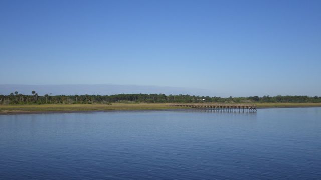
Long pier with no house in sight.
This morning I saw my first naked sailor. I was driving to give Wayne a break. I couldn’t see what was going on until after we passed each other when I saw the man stand up. The “crack of dawn” greeted me. Wayne said, “I thought I saw a lot of skin!” The sailor must believe in taking what Benjamin Franklin used to call “Air Baths”. hahaha Yes, dear sister, he gave us a wave with his hand and not anything else. 😉
As we approached our first bridge, we noticed what looked like a human settlement. We likened it to “shanty town”. From far away, it looks like huts that I have seen on Discovery Channel. Open sided huts with a roof near the water’s edge. It seems that people live near bridges. We didn’t see many house in the marsh. Maybe what is so attractive to build near bridges is that they can get to the other side?

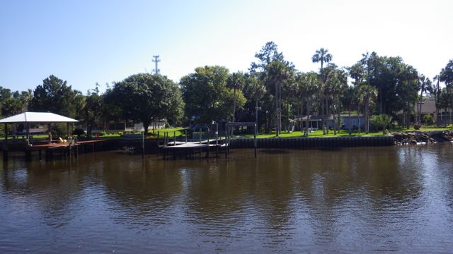
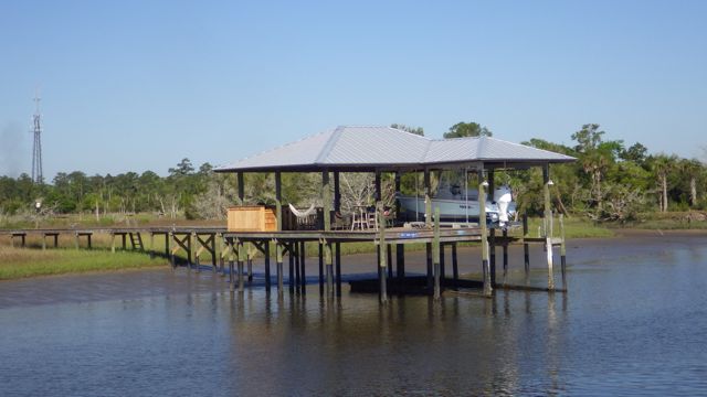
Dock covers along the port side

Boat Covers off the port bow.
These open sided buildings are not homes but dock covers. These aren’t shanties. These are attached to very nice homes. Some of the homes are hiding amongst the trees. They tend to be single level ranch homes blending into their environment. I much prefer these. The trees providing shade during the hot humid months of summer.
Camouflaged Homes
Others are just huge mansions. This house has … 1… 2 chimneys. Does it really get that cold here in upper Florida? Nicely groomed lawn and lovely flowers.
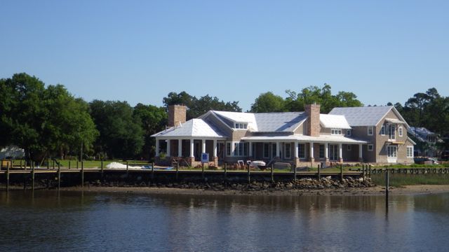
Modern house with 2 chimneys.
Our first impression when we saw this was… dock with a hot tub? It isn’t a hot tub. It is a Green Egg BBQ smoker. No smoke today, folks, move along. Wonder if they give handouts to boaters passing by.
BBQ on the dock!
Most of the bridges we were going to travel under were all over 65 feet over the water. With a rising tide, this bridge indicates there is almost 66 feet of water. No problem for us! We are glad to see such tall bridges. Easier for the boaters and for the car drivers. Neither one is hampered by the other.
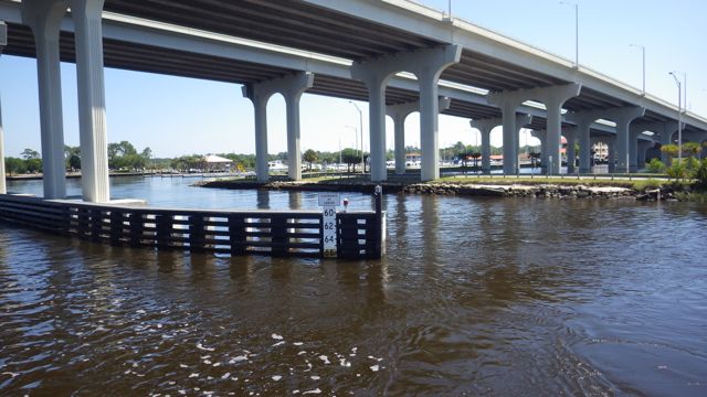
65 ft bridge clearance
We followed this sail boat under one of the fixed bridges. Oh dear, will it make it? Surely, they know whether they could or not. Surely. Or the boat would go outside into the Atlantic to avoid getting stuck.
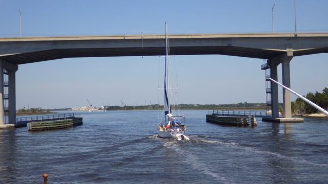
Will the sail boat make it under the bridge?
With inches to spare! Maybe a foot! Whew, we were relieved. From our vantage point, we weren’t sure it would go under the bridge safely. Whew.
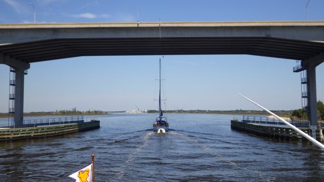
Sail boat cleared the bridge
We noticed that in areas along our way, the waters turned coffee colored. Tannic acid from the trees and leaves decomposing in the water. Does look like coffee, doesn’t it? We didn’t see any dolphins when we were in these colored waters. We did have a pod of 4 dolphins follow us for almost 10 minutes when the water turned more green.
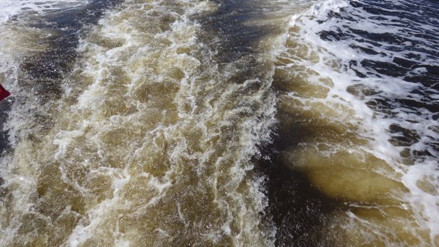
Brown tannic waters.
We expected a serious cross current as we entered St. Johns River. St Johns River is a very busy commercial marine inlet/outlet with access to the Atlantic Ocean. Wide and deep.
Getty ready to enter St. John’s River, Jacksonville, FL
Very few boats out today. On the eastern shore near the we saw this large operation. The sign out front said “BAE Systems”. These boats they are working on look like small cruise ships with at least 4 levels.
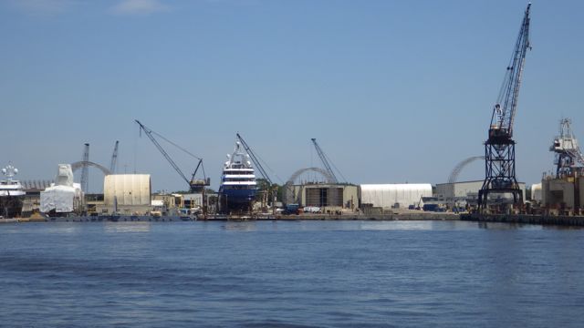
Boat Building Operation
Or that ultimate yacht for the “rich and famous” as Robin Leach used to say.
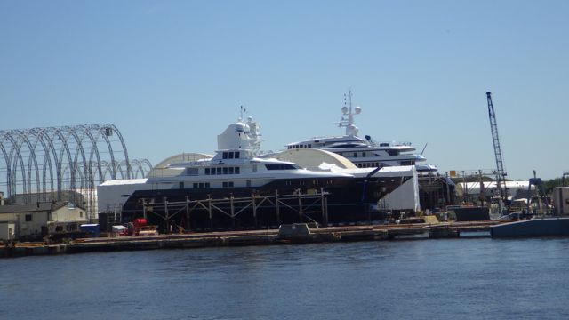
Boat building in progress
Just north of Jacksonville, I saw these tall trees. Don’t these trees look like they belong in a savannah in Africa? Tall and graceful. Almost out of character with the other trees under them.
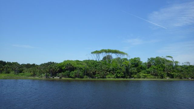
Tree Canopy
We passed through Nassua sound. Sounds are large bodies of water …. larger than a river and often times similar to “bays” in that they connect the ocean to the rivers inland. The charts call these areas “sounds”. We shall also.
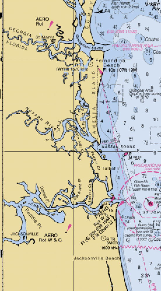
Nassau Sound and St Johns River
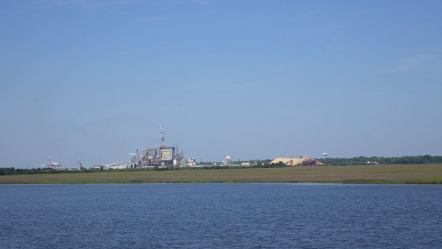
As we approached our destination for the day, Fernandina Harbor Marina, we saw an industrial company. Huge piles of orange sand? Or ?? We were thinking concrete or rock quarry. Rocks don’t grow near marshes do they?
Factory with huge pile of ??
It is wood or saw dust! This is a paper factory right next door to the marina. Actually, there is another one north of the marina. Yet, no smells. Remember in the olden days when you knew you were close to a paper mill? Sulfur smelling ugliness. Not these!

Sunset at Fernandina, FL
Till tomorrow

Looks like you are having a great trip. Pictures are great.
Have fun!
Marilyn
LikeLike
Again, enjoy our travel-log. About that naked sailor . . . was the hand waving above the shoulders or below the waist? 🙂
LikeLike