September 22, 2015 – from Kimmswick, MO to Little Diversion Canal in MO

Good Morning Upper Mississippi Cruisers!!

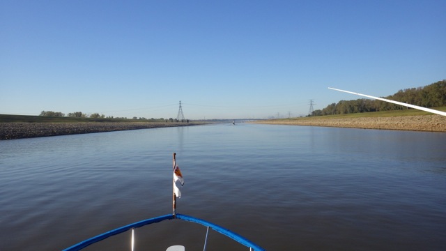
Today we have a long day planned.  Again.  We expect the current on the Mississippi River to give us 3-4knots making the day shorter.   We waited until most of the fog had lifted.

6.36am misty morning at Hoppies 9-22-15

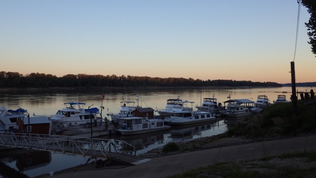
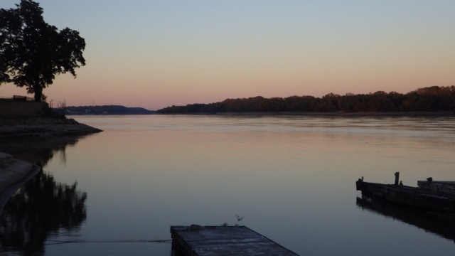
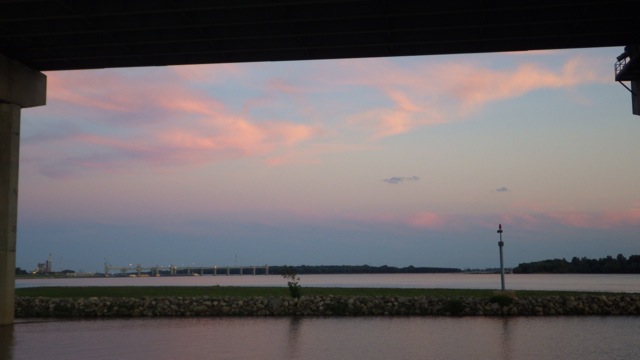
Misty Morning in Kimmswick, MO

6.36am misty morning looking upstream 9-22-15

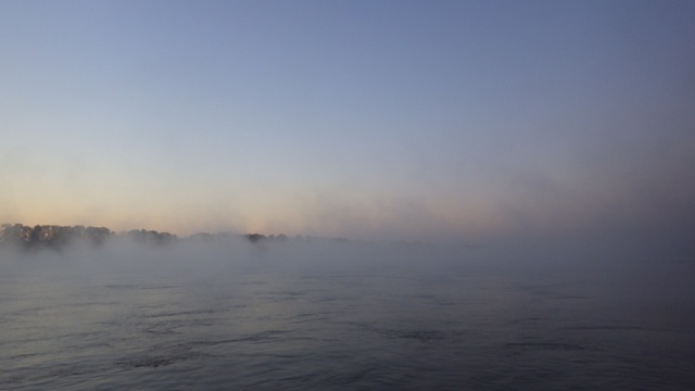
Misty Morning Looking upstream

6.58am sunrise at Hoppies 9-22-15

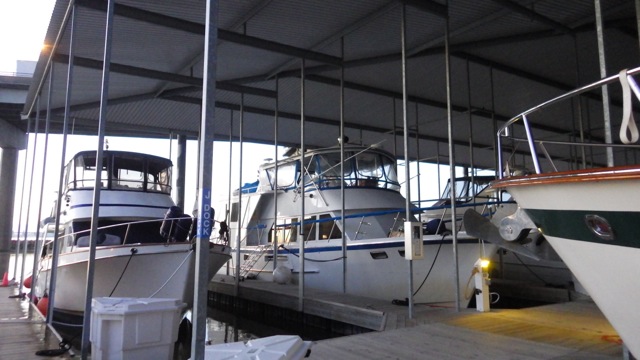
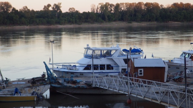
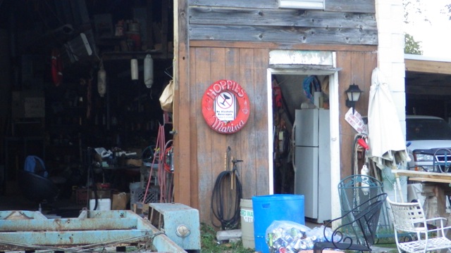
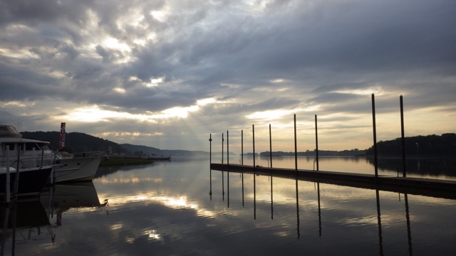
Sunrise at Hoppies, Kimmswick, MO

7.27am - leaving Hoppies 9-22-15

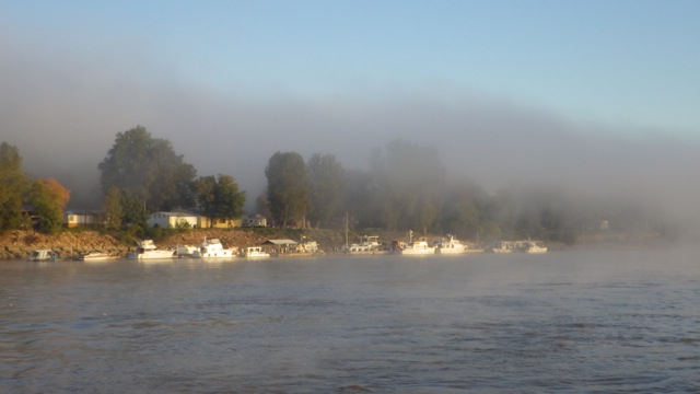
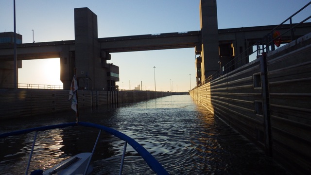
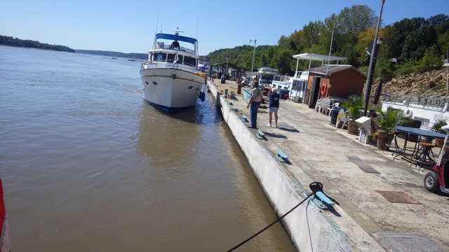
Leaving Hoppies on our way south

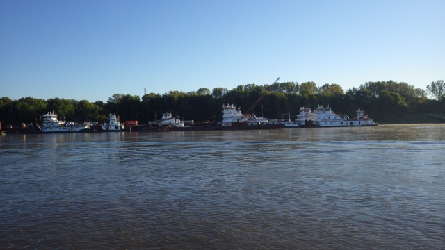
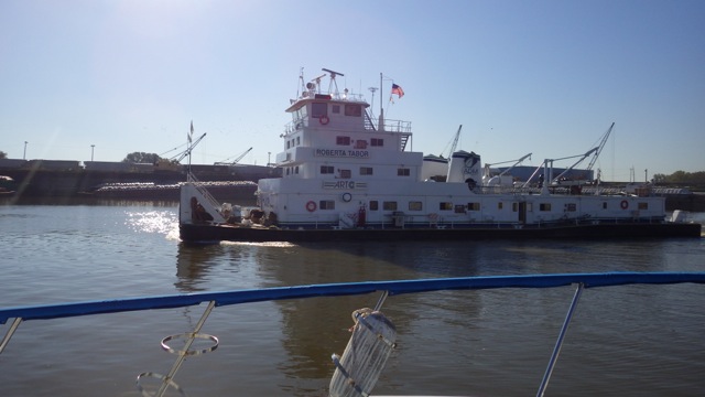
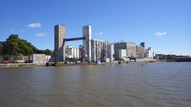
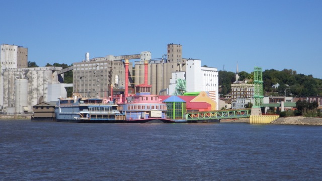
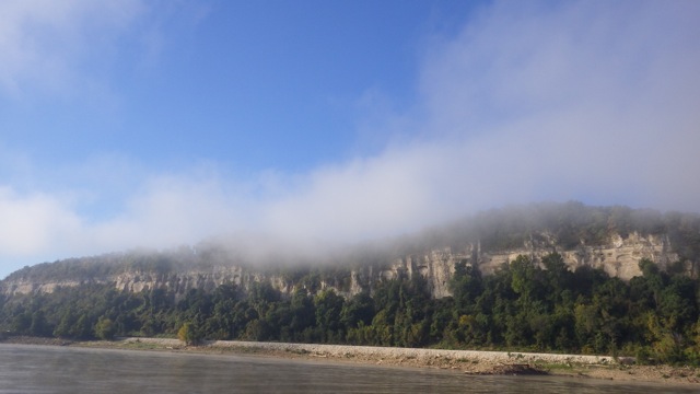
Pictures along the Illinois River heading southbound.  We noticed many full and empty barges tied together heading northward.  Now that we know, they are obvious to us.  Can you tell the difference?

8.24am - full and empty barges 9-22-15

8.25am - randomly parked barges 9-22-15

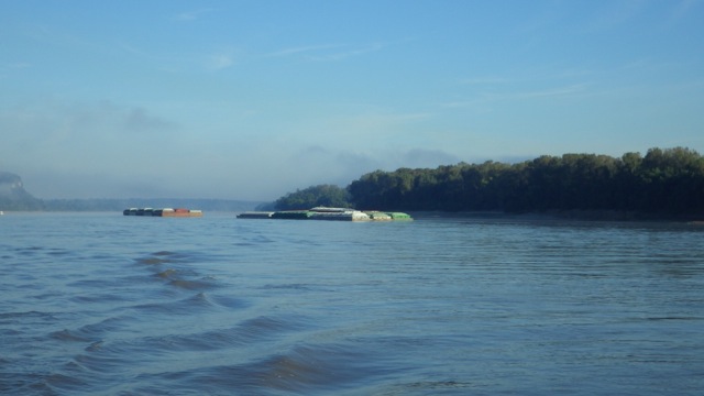
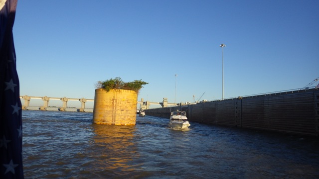
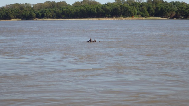
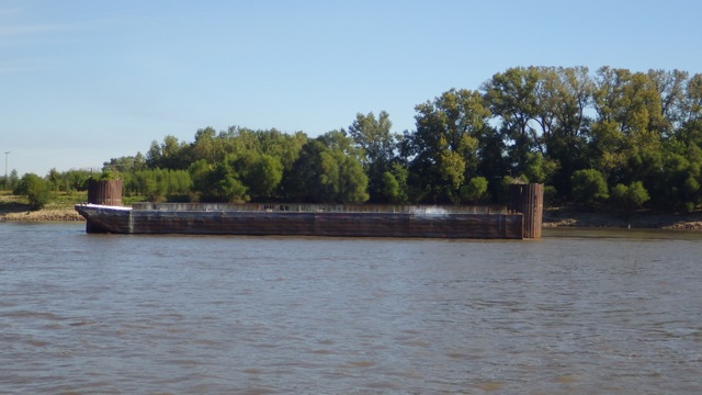
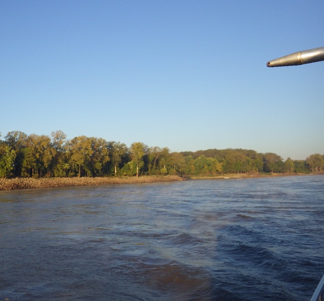
Randomly parked barges in the middle of the Mississippi

8.24am - full and empty barges 2 9-22-15

8.38am - half filled barge 9-22-15

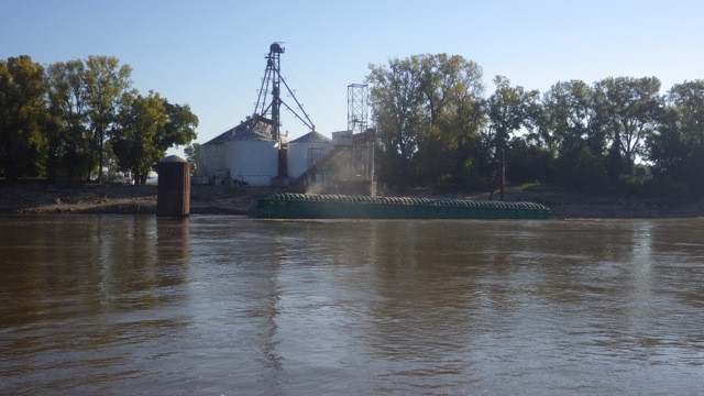
Filling a barge!! Looks almost 1/2 full by now

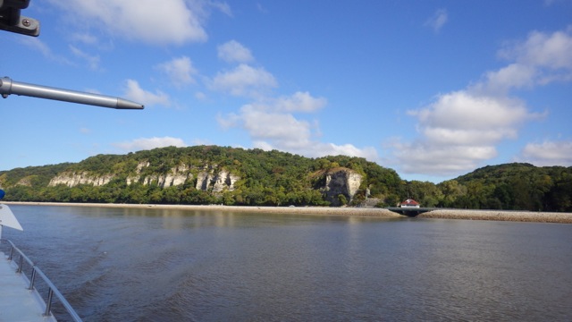
Wing dams!  They are apparently supposed to help keep the Mississippi from silting in.  According to Fern at Hoppies, that is debatable.  The wing dams look like rock outcroppings to me.  Something you certainly wouldn’t want to hit.  Sand and shallow areas are sometimes visible behind the dams.  Sometimes, not so much.  The current changes around them.

9.05am - wing dam 2 9-22-15

Wing dam

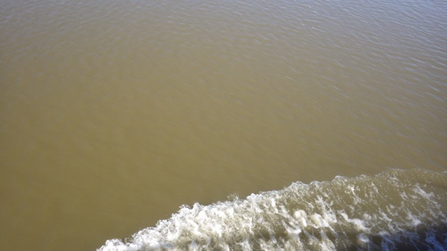
We also heard about the weir dams.  They are structures under the water deep enough that we can safely cruise over them.  However, and you knew there would be a however…. they cause severe turbulence at some spots especially around corners of the Mississippi.  Turbulence is a nice way of saying…whorl pool!!   Lots of whorls and circles and frothing waters.  I was able to capture one of the circles.  Some of the areas look like the water is bubbling from beneath.  Fascinating.  Keeping both hands on the wheel keeps us true to the channel.

9.32am - sworl!! 9-22-15

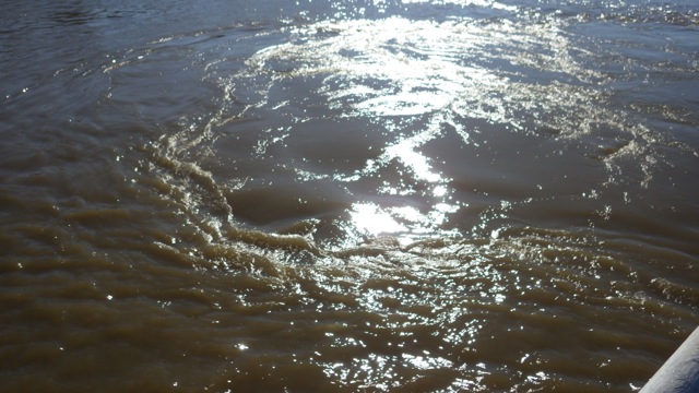
Sworl near a turbulent area

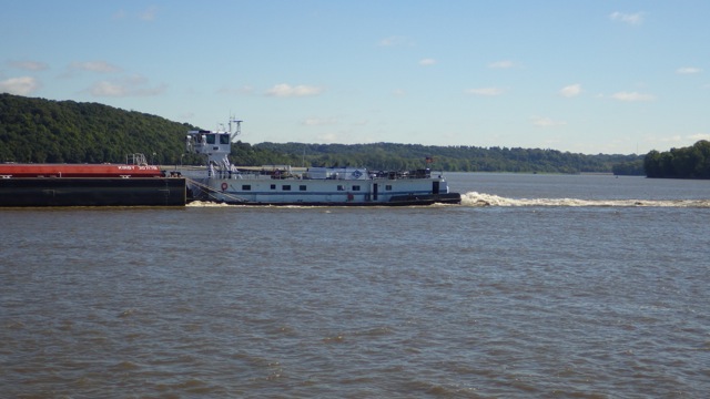
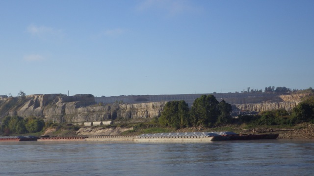
Obvious full and empty barges found side by side.

9.55am - full barge 9-22-15  9.55am - empty barge 9-22-15

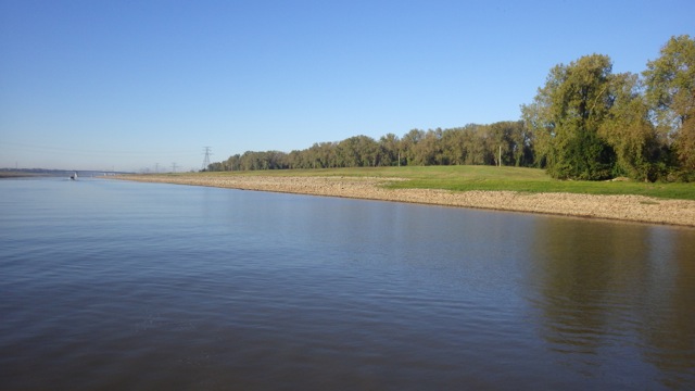
The non-industrial areas are beautiful. 13.49 - 1.49pm - scenery 9-22-15
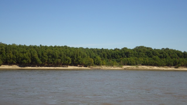
We encountered more barge traffic heading in both directions today than on the Illinois.  The upbound or northbound barges have to overcome the 3 knot flow and can stir up quite a bit of wake behind them.

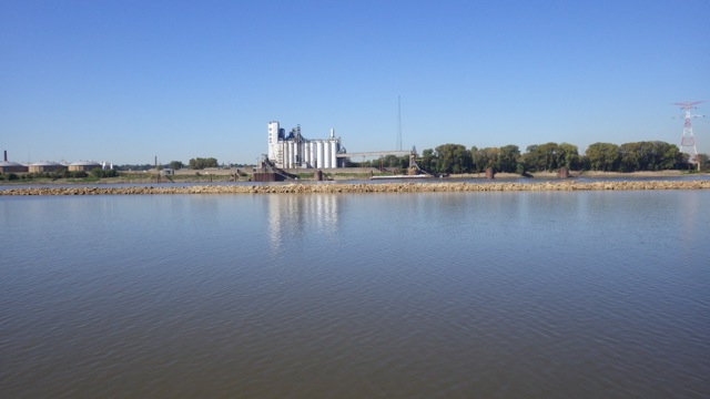
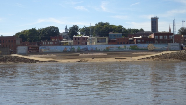
Approaching Cape Girardeau.  A few more miles and we are at our destination for the night.

15.20 - 3.20pm - cape girardeau mural 9-22-15

Our destination is an anchorage called Little Diversion Canal.  110 miles in 8.6 hours!!  We averaged 13mph at a engine rpm normally would give us 10mph.  We made excellent time!  We do appreciate the Mississippi giving us a helping hand.  The entrance to the canal is difficult to see.  We had to drive past it, turn around, and then we saw the entrance.  Wayne had to really power up the engines to overcome the river current at the entrance to the canal.  The fact that several Loopers had their AIS signals on helped.  We knew at least 2 boats had found the entrance.   Once in, we found 12 foot calm water.  A bit of debris ( tree limbs ) in the canal that were easily avoided.  No wind, almost no current, a peaceful evening.

We traveled with 2 other Loopers today.  We all made it safe and sound.  We found 3 other boats in the canal plus our 3.  Lots of room.  We rafted our 3 boats, had dinner together and shared Looper stores.  A wonderful evening meal shared between Always Home, Bama Dream, and Fryedaze crews.

Little Diversion Channel inlet in the morning 9-23-15

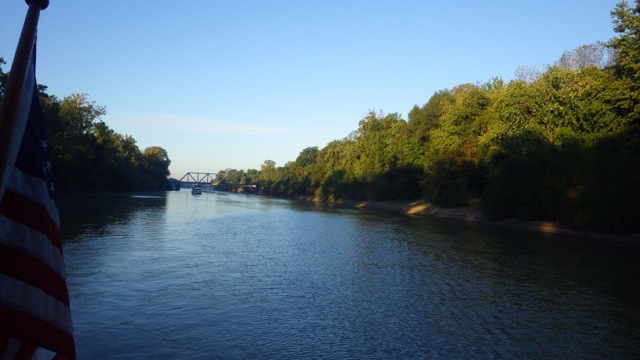
Little Diversion Canal inlet in the morning sun

Little Diversion Channel in the morning 9-23-15

Little Diversion Canal in the early morning


Posted in Looping | 1 Comment

September 21, 2015 – from Alton, IL to Kimmswick, MO (Hoppies)

Good morning, Lock Buddies!  We are planning to get up early and hope we can get an early lock through at the Mel Price Lock and the Chain of Rocks Lock ( #27 ).  Fingers crossed!!  We can see the lock from our back door.  Surely, that will give us an advantage?

6.30am - covered parking 9-21-15

Covered Docks – Always Home under cover

We were drinking our cup of coffee when we heard on the VHF someone asking about a pleasure craft locking through.  I called the Lock Master and he told me that “come on” or you will have to wait for the tow which will be in another 1.5 hour wait.  We hustled.  We threw our lines off and were on the way within 10 minutes.  We told our Looper neighbors and they hustled right after us.  There was a Looper, Sweet Sensation, waiting patiently for us.  There were 4 pleasure craft that glided into the lock as the tow was slowing down just north of the marina.

7.23am - entering Mel Price Lock 9-21-15

Entering Mel Price Lock

7.40am - leaving Mel PRice lock 9-21-15

Leaving Mel Price Lock going down 23 feet

On the other side of the Mel Price Lock was lots and lots of barges and tows.  Many barges just anchored in the middle of the river.  These tows looked like they were in line for a barge.  Lots of activity that kept us on our toes.  I keep thinking about all the industry and commerce that the river systems handle.  Just amazing.

7.50am - barge terminal 9-21-15

In 10 miles is the next lock.  The Missouri River joins the Mississippi amongst all these barges, tows, and boats.  We have to divert into the “Chain of Rocks Canal” since continuing down the Mississippi is prohibitive.  Signage indicates NO BOATS in this particular part of the river because of rapids!!  That would not be too friendly to barges, tows, or pleasure craft to be sure.  To get around the rapids, this canal was constructed.  Very deep and clean canal.

8.17am - Chain of Rocks canal 9-21-15

Chain of Rocks canal

8.18am - Chain of rocks canal 9-21-15

Chain of rocks canal is almost 10 miles long

We had a 10-15 minute wait for a north bound tow to come out of the lock.  No big deal since the water was almost still.  Up to this point all the locks had names.  Now, this lock goes by a number.  Lock 27.  Could it be that “Chain of Rocks Lock” is just too darn long to say and remember?  Lock 27, it is!!

9.17am - barge coming out of Chain of Rocks Lock 27 9-21-15

Tow coming out of Lock 27

9.20am - entering Lock 27 9-21-15

Entering Lock 27

We went all the way to the front of the lock to find a floating bollard on the starboard side of the lock.  The lock master didn’t care which side we went to.  This picture shows you how long the lock is.  3 boats behind us and plenty of wiggle room between each boat.  Quite a bit larger than the locks on the Erie and Trent Severn.

9.36am - looking back lock 27 9-21-15

Looking back in Lock 27

As we come out of the Lock 27, we approach the re-joining of the Mississippi River and the Chain of Rocks Canal.  We picked up at least 3-4 knots speed through this area.

9.46am - meeting up with main river 2 9-21-15

Rock dam separating the Miss. River and the Chain of Rocks Canal

Speaking of the Mississippi River.  The Mighty Mississippi.

9.47am - muddy Miss 9-21-15

Muddy Mississippi

With quite a bit of debris.  Large tree limbs and tree trunks.  I thought that by now all this debris would have been washed down the river.

12.52pm debris!! 9-21-15

9.55am approaching St Louis 9-21-15

Approaching St Louis

Approaching St. Louis, MO.  Contrary to early Loopers in years past, you cannot stop in the downtown area in St. Louis.  There is no place for boaters to stop.  No anchorage.  Nothing.  There is a lot of barge traffic that we need to keep an eye out for.  A greater view of the Arch!!

10.07am arch 9-21-15

Arch with river front work on-going

There are cruise boats and a helicopter business along the river’s edge.  We didn’t see an easy road access to either.  Lots of construction going on as if they are fortifying the edge for the next flood.  Great view of the arch.  We need to come sometime and take the ride to the top.  Or, at least, I will.  Wayne is leery of heights.

10.09am - arch and capital building 9-21-15

Arch with Capital Building

We arrived at Hoppies Marina in the early afternoon.  We made excellent time with the added push from the river current.  Hoppies is a mainstay along the river.  They have been in business at this location since 1934.  Fern is the owner, manager, and person to talk to about the river.  She conducts daily briefings for the Transients that are docked at her marina.  Where to go, what to expect.  The Mighty Mississippi is to be respected!!

12.07pm - barge at Hoppies 9-21-15

We are tied up.

12.07pm - fern telling Looper how to dock 9-21-15

Fern is directing Elizabear where to go behind us.

Plate on the second barge….

12.44pm - barge inscription 9-21-15

Built by Missouri Valley Steel, Levenworth, Kansas. 1949

The town of Kimmswick is not open on Mondays.  No restaurants.  No shops.  Nothing.  Strange.  I did walk toward town and saw some fungi I thought was interesting.  Delicate little plants that are very important to nature’s cycle of life.

18.23 - 6.23pm - fungus!! 3- 9-21-15

Mushrooms! near a decaying log

18.45 - 6.45pm - Always Home at Hoppies 9-21-15

Always Home at Hoppies Marina

18.45 - 6.45pm - boats along the barges 9-21-15

Line of boats along the barges at Hoppies

18.43 - 6.43pm - Hoppies sign

A great day on the water.  Sunshine.  Cool temperatures.  It will be going down to the mid 50°s tonight.  Glad we never put the comforter away.

18.48 - 6.48pm - sunset looking upriver at Hoppies 9-21-15

Sunset looking up river at Hoppies

It is late and time for bed.  The barge traffic has increased. We are beginning to rock and roll. That might let us get to sleep even faster.  More barge traffic tonight in the last half hour than all afternoon.  Curious.

Posted in Looping | Leave a comment

September 20, 2015 – Alton, IL

Good morning!!  We are still in Alton Marina waiting for tomorrow to go down the river to Hoppies.  That is a completely different story.

Notice the water line on the tall posts?  It is about 5 foot higher than the current water level.  Nice floating docks!!  Here at Alton Marina, like at Grafton, everything is floating.  The bathrooms, pool (only 3 ft deep), all the docks, and adjacent buildings.  Obviously, the waters have recently risen 5 feet.

Nice covered parking, don’t you think?  The staff were extremely nice and helpful.  The bathrooms are top notch.  Each bathroom is really a bath suite with a toilet, shower, and sink in each one.  Very nice.

8.52am - water line on floating dock 9-20-15

Our day was filled with reading and preparing for our river voyage.  Which locks are we going through?  Which marinas?  Which anchorages?  There is a huge bottle-neck at Lock 52 & 53.  Where is that?  We didn’t venture too far from the marina with so much homework to do.  What rivers are we cruising on?  Where are the charts?  Can we download the charts?  Really?

We will be leaving here to go to Hoppies Marina.  It is a small marina along the Upper Mississippi River.  Hoppies is the last place to get diesel fuel for over 200 miles.  Hoppies is really a collection of barges tied together on the side of the river bank that Loopers and other transients try to get a space on.  There are only 3 barges…100 feet long.  Which means an average of 6 boats can tie along the side of Hoppies each night.  Space is tight and we were able to find space for tomorrow.

Posted in Looping | Leave a comment

September 19, 2015 – From Grafton, IL to Alton, IL

Good morning, Loopers and Cruisers.  Another easy day today.  We are going down the river to Alton, IL just a stone’s throw away from Grafton.  One reason is to make the next stop shorter and to be on the door step of the Mel Price’s Lock.  Ok.  The third reason is get my wifi and phone reception back again.

The wind was a bit higher than I expected and after getting fuel and a pump out, we were on the water.  With the confluence of the Illinois and the Mississippi Rivers together, I was helping Wayne get to the right channel to head south that I didn’t take any ‘going away’ pictures.

We did see this fascinating structure shortly after leaving Grafton.  Get your swimsuits ready!!

9.39am - water slide outside of grafton 9-19-15

Raging Water Water Park

Scenery along the way to Alton.  Mixture of natural rock and trees and Industry.

9.45am - scenery 9-19-15

10.09am - barge going north - look at the churn 9-19-15

Tow pushing a barge north against the current -alot of energy to go against a 3knot current

10.52am - scenery along the river 9-19-15

Commerce along the Upper Mississippi River

10.56am - casino 9-19-15

Argosy Casino – how colorful


Another Looper and I shared a cab to go to the closest Walmart to get some last minute food items before going down the Mississippi River.  I don’t exactly know where we went but it was 20 minutes from the marina.  We passed three oil refineries and a granary.  When we were returning to the marina after our shopping trip, the cab started to stink.  The cab driver blamed the smell on the oil refineries.  I just thought he farted and it smell like he ate sauerkraut the day before.  Opening the window was not an option.  Being an adult, I didn’t say a word.  😉

Along the way, I saw a nicely done mural on the side of a corner cafe that had motorcycles in front of it.  Cafe?  Hmmm Looks like more of a hot-rod hangout to me.

15.37 - 3.37pm - mural 9-19-15

Mural outside of a speakeasy

15.46 - 3.36pm - better view of the mural 9-19-15

Mural outside of the Alton Marina

When we got to the Alton Marina, they put us under a high covered dock.  It was so cool under there!!  The wind was gently blowing a cool breeze under the canopy.  We didn’t have to use the air conditioner at all during the day even though the outside temperature go to the high 80°F.

This picture out of our back door is toward the Mel Price Lock and Dam.  We can watch the barges and boats going and coming in/out of the dam.  Just how busy will it be when it is time for us to go through it?

19.07 - 7.07pm - evening sky at Alton 9-19-15

Evening sky outside our back door


Posted in Looping | Leave a comment

September 18, 2015 – Grafton, IL

Good morning!  We are taking a day off to rest after yesterday’s long journey.  I will say I was awoken at 3am with thunder and a lightning show that was pretty good.  But, promptly went back to sleep.  Haha.  We did beat the wind and rain to our safe harbor, after all!

7.43am - sunrise in Grafton 9-18-15

Sunrise in Grafton, IL

Did you notice the tall posts along that far dock?  This is a floating dock system.  The fuel dock, boaters dock, restrooms, marina office, and restaurant are all floating.  I assume the reason for the tall posts is because the water can actually get that high?  If everything floats, it wouldn’t matter as long as the water doesn’t get over the top of the posts.  From what the Logsdon Tug Service Manager/Owner said, the water can actually get up 30 feet.  Fascinating!

This is a day of rest and recuperation.  Time for reading the cruising guides to get ready for our trip down river.  Time for several loads of laundry.  Time for lunch at the marina restaurant.

Grafton is famous for their ‘winery’.  Looks like a popular place for tourist buses.  Two bus loads.  By the time we finished lunch, we saw an additional 3 buses.  Good for business!

13.31 - 1.31pm - a popular stop for the tourist 9-18-15

Grafton Winery

Since this is a relaxing day, we didn’t do much than read, nap, and do laundry.  I thought I would show you where we are.   You can see the Illinois River and the Mississippi River meeting at Grafton, IL.

Illinois - Miss river at Grafton

Illinois River ends at Grafton

You can also go to the MAP page at the top of the blog for our travel map.  We have traveled over 3400 miles on this Loop in the last 8.5 months.  Wow!!

Screen Shot 2015-09-20 at 10.17.48 PM


Posted in Looping | 1 Comment