February 25, 2015 – St. Augustine, FL – New Surroundings

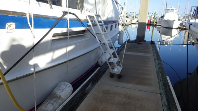
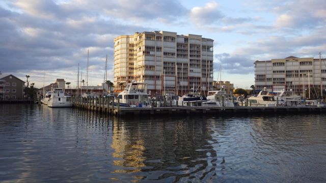
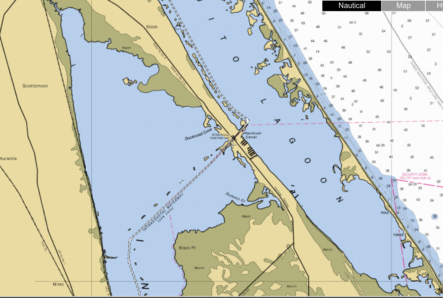
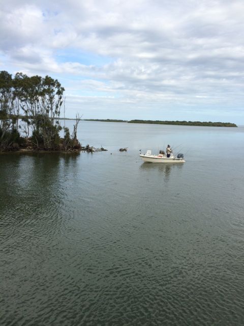
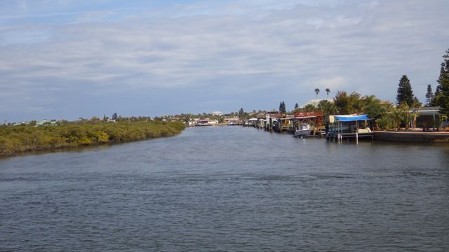
We had to park the boat along a dock as a “Side Tie” rather than docking in a slip when we first arrived at Camachee Cove Yacht Harbor Marina.  It was fun to be right near the inlet to the marina and see the tides come and go as it turns out.

Always Home - Camachee Cove, St Augustine, FL

Always Home – Camachee Cove, St Augustine, FL

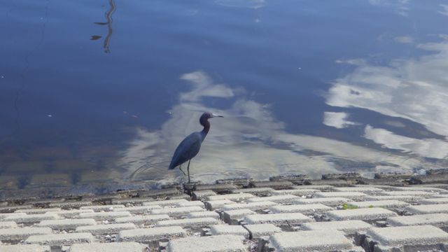
It was low tide when we first arrived.  We didn’t know what that actually meant to the wet lands near the boat.  I took some pictures of our new neighbor who seemed oblivious to us as we scurried about setting the lines, connecting the power cord, and getting the ladder down.  Surely, this guy can see us humans as close as we were.  Dinner time waits for no humans and their foolishness!

Great heron with snack 5.28pm Feb 23 2015

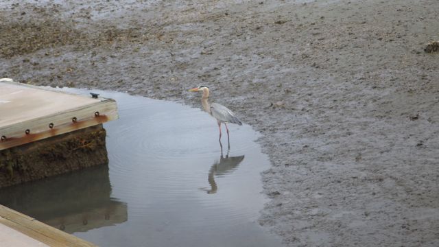
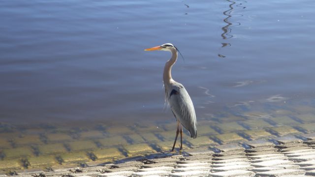
Great Heron taking advantage of low tide

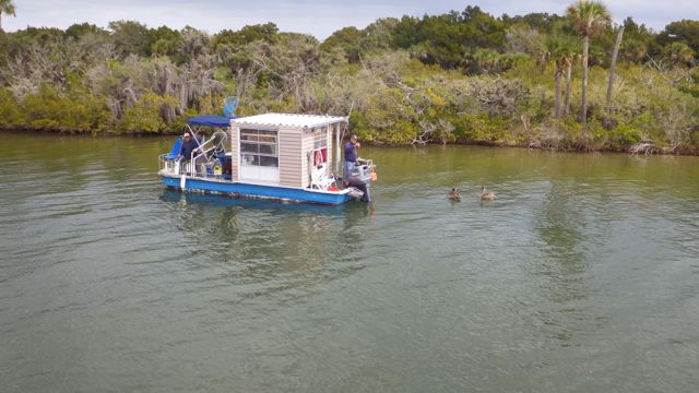
There was always at least one Great Heron during every low tide.  Oftentimes, white herons would also be in the grasses waiting for something interesting to float by.  THEN I saw this little blob on top of the sand.  I quickly took a picture while Wayne was busy setting the lines like he wanted for the upcoming weather front.   I forgot to get a broader landscape photo so I could document where exactly this blob was to check it out during daylight hours.  I was curious but distracted with getting the boat settled in its new location.  We have to set up different lines (ropes) with each new location.  Doubling up the lines depending on the wind direction and weather forecast.

BlOB!! - feb 23 2015 Camachee Cove

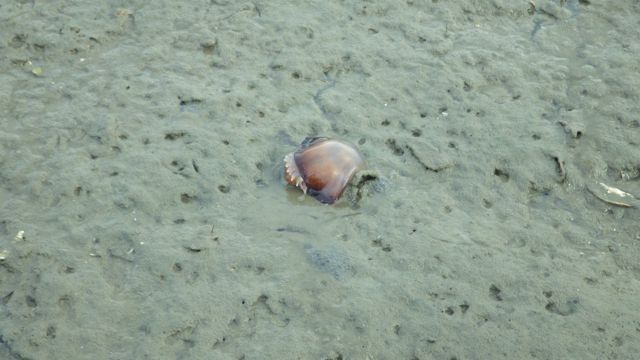
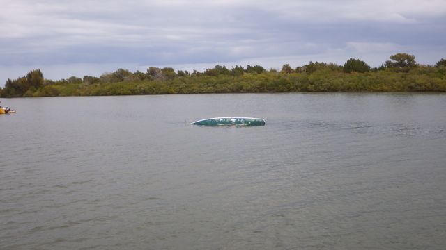
Blob in the sand! Low tide on the day we arrived

The Blob was gone the next day.  Probably because we were now at a higher tide than the night before.

! high tide - marsh

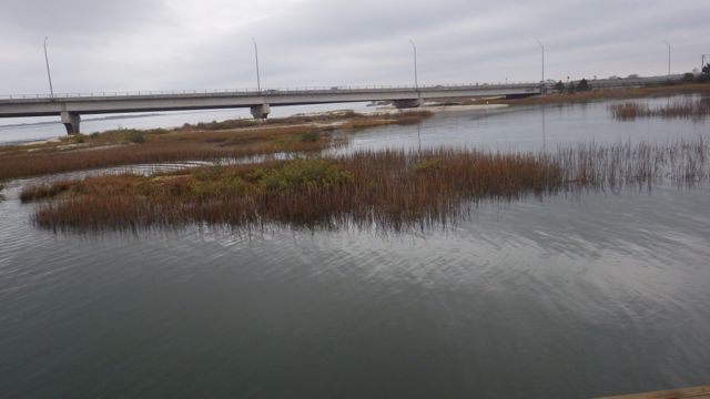
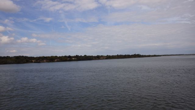
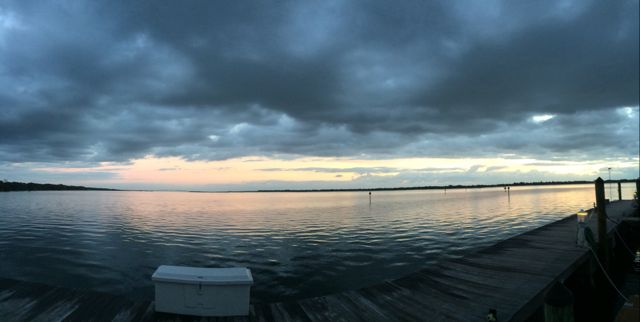
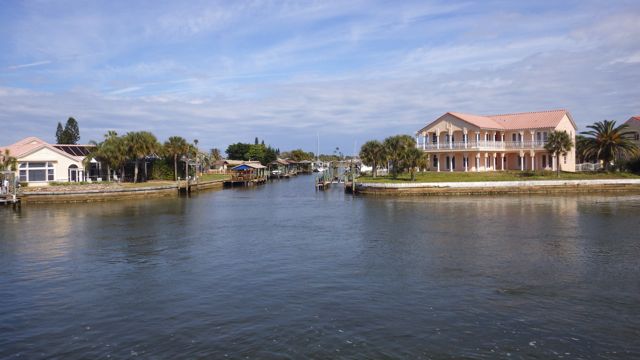
High Tide along the marina front entrance – facing southeast

I wonder what happened to the blob??  I looked around and didn’t see anything.  That is why I regretted not getting a more landscape picture so I would know exactly where the blob was yesterday.  Until the tide was falling again.  Could this be the blob from last night?!

! A jelly fish 3

A Jelly Fish!!

How exciting!!  Another Jelly!!

jelly fish - good - mar 5 2015 5.04pm

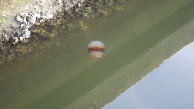
Jelly Fish near the dock wall

Actually, these are Cannonball JellyFish I found out.

Cannonball Jellyfish may or may not be poisonous.  Very definitive, isn’t that.  Some folks feel a sting.  Most people don’t.  The jelly fish toxins are mild as compared to other jelly fish.  Apparently, these jelly fish are pretty common along the Gulf Coast. The first time we have seen them, however.  According to Wikipedia, Cannonball Jelly fish are a commercial product.  Only 5 boats are allowed to harvest them because there is only one processing plant that can dry, preserve and package the “Jellyball” for the Asian market.  Who knew?

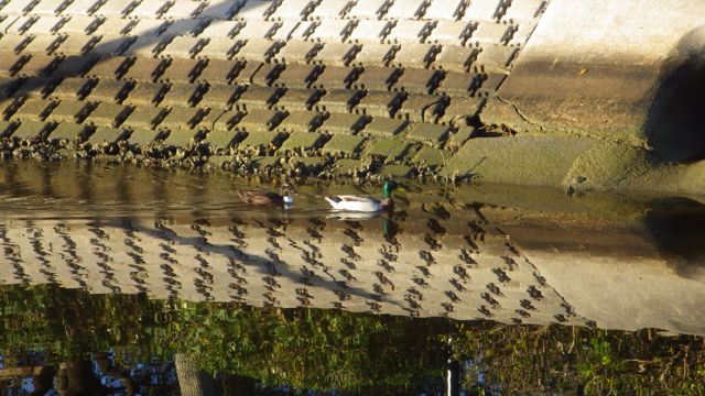
As we were getting familiar to our new surroundings, I noticed the nails on top of the nearby piling.  Ahhh…. I said to myself….to keep the birds from stopping and taking a rest.

Spikes on Piling

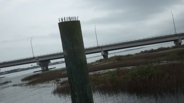
Spikes on a nearby piling

Someone forgot to tell this fellow he wasn’t allowed to tiptoe amongst the spikes!

! white heron on top of spikes Camachee Cove - Feb 25 2015 7.14am B

White Heron standing on top of the piling


As you probably can tell, we had some very cloudy cool days.  Like most folks around the country.  Everything is relative.  Our cool days meant 48°F in the morning.  Brrr  Water temperature is around 59°F.  Still too cold for me to go swimming.

Sunset Camachee Cove Feb 26 2015  6.23pm

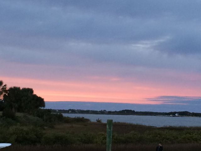
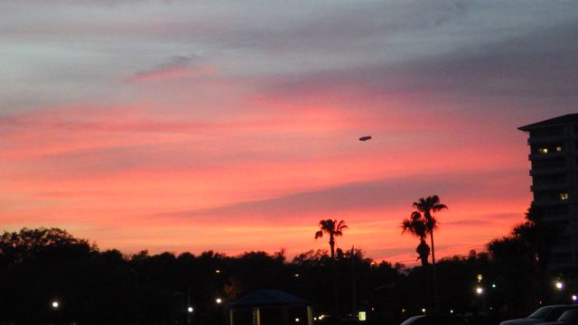
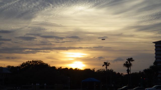
Sunset – St. Augustine, FL


Posted in Looping | 2 Comments

February 23, 2015 – Onward to St. Augustine, FL

We picked today to travel again because of wind and weather.  We reluctantly left beautiful Halifax Harbor Marina and went north on the ICW to our next stop for the next month or so.  The wind was forecasted to be coming from the south / south east direction at less than 10mph.  Since we are traveling north, I figured the extra boost from southwardly winds couldn’t hurt.

leaving Halifax Harbor Daytona FL feb 23 2015 - B

Leaving Halifax Harbor Marina

The first bridge heading north is the Broadway Bridge.  I was busy with pulling in the fenders and lines when I noticed the color on the bridge supports.  It wasn’t paint.  Mosaics of dolphins, manatees and other water life on all the bridge supports.  They really made me smile!  Aren’t they gorgeous!  Looks like they are maintenance free.

! bridge with mosiac 9.03am E

Broadway Bridge with mosaics

It was early and I was ever vigilant in looking for more sunken boats near our waterway.   We were warned that there were a couple sunken vessels yesterday.  We almost didn’t see this one.  The boat was out of the channel and not in our way.  It just seemed sad to see.

sunken sail boat 9.25am

Sunken sail boat


Only one bridge opening today for us.  Wayne called ahead and asked about the next opening for the Knox Memorial bridge. The bridge is only 15 feet height.  We need at least 19 feet.  The bridge was opened right away and we sailed through easily.   This picture is the bridge closing behind us because I was unprepared not to wait.  How exciting.   A good omen for the rest of the day.

bridge closing feb 23 2015 10.42am

Knox Memorial Bridge closing behind us

As we motored along we saw these crab cages sitting on the end of a pier.  Can’t catch much that way.

crab pots on end of pier 2 - Feb 23 2015 9.59am

Crab baskets – crab pots waiting

These guys are getting their crab pots out!!  Good thing they are headed south.  We shouldn’t have to worry about these pots getting in our way.

crab pots on back of boat 9.21am

Boat loaded with with Crab cages

These guys have been out for a while.  They have a crowd waiting for any goodies thrown their way.  Pelicans are such beggars!

crabber with pelicans A - 10.49am

Crabber checking their pots

Water still looks pretty smooth.  We did have moments later in the day of small waves the wind would kick up from time to time.  Nothing major.  We just noticed we were expecting to be traveling at about 8.8 knots (10.1 mph).  Sometimes we got 10.4 knots (12 mph) with a tail current/wind and other times we were going 7.8 knots (9 mph) without changing the engines rpms.  Currents were a bit challenging around inlets of creeks and marshy areas.

We did see crab pot buoys all day.  Sometimes they were lined up like road markers.  All in a row along the side of the channel just where the water starts to get more shallow.  Later in the afternoon, when I was driving, I had to zig zag the boat because crab pot balls were IN our channel!!  I was weaving through a land mine of little red, orange, and white balls.  Wayne was downstairs taking a break.  He comes running up to the fly bridge wondering if I had gone crazy.  Me zigzagging and he sees that I am out of the channel on the chart plotter.  He was wondering what in the heck happened in just the few minutes he was not on the flybridge. OF Course, no such hazards occurred when he was driving.  Of course.  Once he saw the little buoys in front of our path, he calmed down and said I must have really been paying attention!  Yes.  My job driving the boat is not to fall asleep at the wheel!  As soon as we were out of the buoy field Wayne took over.  No more alarming obstacles the rest of the trip.  Of course.  😉

The landscape went from marsh to trees and back again to marshy lands.  I thought this was a sunken boat but as we got closer I saw a crafty opportunity.  Slow down, Wayne.  I want to get some of that ‘driftwood’.  You can see a table ornament in the making.  OR a neat wall hanging.  Right?  People pay big bucks for bleached out wood limbs like these.

drift wood feb 23 2015  10.46am

Drift wood

Can you see how far away the boat shed is from the house?  It looks like half a mile!!  This was typical of many locations along the ICW.  There must be a reason for this.

boats a long way away 2.01 Feb 23 2015

A long way from dock to home


Looks like someone has made a home of this old tug.  There was a car out in front.  Maybe they are in the process of refurbishing it.  Looks like it needs several gallons of rustoleum!

grey tug Feb 23 2015 B 10.16am

Grey Tug


We passed Flagler Beach just before noon.

flagler beach water tower - 10.50am Feb 23 2015

Flagler Beach Water Tower

We could see in the distance the Atlantic on and off to our east.  As the sliver of land between the ICW and the Atlantic narrowed in places.

The Atlantic!!  12.54pm  Feb 23 2015

The Atlantic Ocean!!

Beach House On Atlantic 12.46pm FEb 23 2015 D

Beach houses. Ocean view and ICW view. How sweet!

Many of the ocean view homes were on stilts.  Obviously, for high water.  Hurricanes come through here?

Again, we had several pods of dolphins following us.  I never tire of watching them swim with us for a few minutes.  For you folks who are patiently watching, the first good jump out of the water is at around 26 seconds. Hope you enjoy this video as well.

We read about the extra strong currents near the inlet.  Makes sense that water from the ICW and Atlantic meeting together would create a bit of a challenge.  Getting off the ICW and going into the marina presented the challenge pushing us sideways until we were in the marina entrance.

Screen Shot 2015-03-08 at 8.27.44 AM

Chart of St Augustine Inlet

Very few boats on the water all day.  At this inlet, no sail boats either were seen.  Where is everyone??  Bahamas?  Ft. Lauderdale?  I guess we are just not normal boaters.  Hahaha  Normal is so boring.  Family knows just how not normal we are!!  After all, we own a boat!

St augustine Inlet 2.46pm Feb 23 2015

St. Augustine Inlet

We knew we had arrived when we saw…

frigate 2.38pm Feb 23 2015 C

Frigate – St. Augustine


Posted in Looping | 1 Comment

February 22, 2015 – Halifax Harbor Marina, Daytona Beach, FL

A beautiful Sunday was expected.  Sunny, warm, and calm.

sunrise Halifax Harbor - Feb 22 2015 7.04am

Sunrise in Halifax Harbor Marina


The Daytona 500is going on  today.  The Blue Angles were supposed to fly over.  We heard 2 roars.  No sound barrier was passed.  By the time we got outside, they were gone.  A sailboat neighbor said he saw them on TV better than we did in real life.  Interestingly, we heard the car noise as they rounded the bend on the track.  According to Google maps, the track was less than a mile away.

This marina has floating docks.  A good thing since we really don’t want to have to climb up and down the back swim platform ladder.  This was a stretch though.  The docks were low.  Our ladder was fully extended and sometimes it didn’t look like it hit the ground.  We were very careful getting on / off the boat.  Have I said that I love this little ladder?

Ladder - fully extended at Halifax Harbor - Daytona Beach FL

Ladder – fully extended


We were met at the dock by a dock hand who checked us in right at the slip.  No need to go to the Marina office.  He gave us the codes, keys, and visitor packet.  All very neat and easy.  We later decided to go to the office just to check it out.  We walked.  Walked.  The grey outline in Google Maps isn’t a sidewalk.  It is the water containment cement.  Thus, we walked on the road and never got to it!  The maps show that it is over a mile away from where we were docked.  How did the dockhand get to our slip so quickly?  By dingy!! I saw him motor over to a nearby slip the next day when he was helping another boat come in.  Very nice.

Our new neighbors:

Mallard duck pair - c - Halifax Harbor - Feb 22 2015

Mallard duck pair

There were several pairs and single Mallard ducks.  Vying for space under the bushes or on the end of the docks.

blue heron

Blue Heron


This Great Heron was very still but I saw it eye-ball me as I approached to take this picture.  Somewhat tame enough to tolerate a human to come within yards but not within feet before flying away.

Great Heron giving me the eye

Great Heron giving me the eye


We did pass by a nice Bar & Grill.  Since we couldn’t find the marina office, it must mean it is time to take a rest and watch the sunset.  This Bar & Grill had a painted floor.  We walked by so quickly I only got a glimpse.

Floor at Bar & Grill - Feb 21 2015 5.35pm - B                 Floor at Bar & Grill - Feb 21 2015 5.35pm -

I wonder how well it wears.  I could see this painted on my back patio.  Right?

As we were sipping our Yuengling beer, we watched the Goodyear at sunset, again.

!Sunset RED BLIMP Feb 21 2015 6.30pm - Halifax Harbor Daytona Beach FL

Sunset at Halifax Harbor Marina


Posted in Looping | Leave a comment

February 21, 2015 – Onward to Daytona Beach, FL – part 2

So, onward North in the afternoon.  The landscape changed from Marsh and Mangrove intermittently with houses dotting a section then nothing but short shrubs and more lowlands.

landscape Feb 21 2015 1.32pm

Landscape to the port side

landscape Feb 21 2015  2.07pm

Landscape on the starboard side

“Active Captain” warned that there was a hazard approaching.  A sunken boat and although it was out of the channel be aware incase the current moved it.  So, with anticipation and my binoculars I spied:

! Tb power line in the water - feb 21 2015 - 12.20pm

Sunken boat or Power Pole?

This can’t be the sunken ship.  It is at the wrong mile marker.  As we passed it, we realized it was a power pole.  Oh my!!  It is leaning over and looked like it was still functional.  Hmmm who gets to repair that when it finally succumbs to the water gods?

! Tb turned over boat - feb 21 2015 - 12.34pm

Turned over boat

Ah ha!!  This was the overturned boat.  There were a couple other small sail boats guarding it.  It looks like it is well out of the channel.  No problem for us!

How about this pretty boat?  An actual fishing Trawler.  Of course, it isn’t catching anything if it is sitting in port.  Looks nice, tho.

! Trawler - with nets Feb 21 2015  2.22pm B

Trawler with fishing nets

The weather stayed cool and cloudy most of our trip to Daytona Beach, FL.  It looks like rain up ahead several times but we never had any hit our boat this time.

! F rain in the distance 12.06pm - Feb 21 2015

Rain in the distance.


As we were getting close to Daytona Beach, we noticed something in the sky up ahead.

! Goodyear Blimp Feb 21 2015 1.50pm B

Goodyear Blimp

The Goodyear Blimp??  Whatever for??  Right!!  The Daytona 500 was supposed to be this weekend.  Ahhhh….  I tried to get a picture of the 4 planes off in the distance pulling banners behind them but the picture didn’t look very good.  We couldn’t read the banners but we watched the planes go back and forth pulling the banners, the blimp circling around, and airplanes taking off from the airport.  All in the same relative air space.  Wow!

We arrived at our destination around 4pm.  A long day.  Time for rest and relaxation.

! Sunset Feb 21 2015 5.58pm - Halifax Harbor Daytona Beach FL

Sunset at Halifax Harbor in Daytona Beach, FL


Posted in Looping | Leave a comment

February 21, 2015 – Onward to Daytona Beach, FL – part 1

We have been in Cocoa, FL for a month.  It is time for us to move again.  I find it very interesting that although we have been on a boat for just a short time, we feel a need to move on.  Because we can?

A multitude of conditions were considered for us to select today as our move day.  Weather and wind being the most important.  Days up to today and following were expected to be quite windy.  We are talking about winds of 10 – 15 mph with gusts up to 30mph.  The wind was also coming from the north.  I figured that with a north wind, the white caps would be showing ( as I have shown before ) and to drive the boat against them seemed counterproductive.  So, we waited.  Yesterday was actually a calm day with winds less than 10mph.  BUT it was very very cold first thing in the morning.  If we just waited to Saturday morning to leave the beautiful marina of Cocoa Village, the temperatures would be at least 10 degrees warmer.  What’s the difference?  38°F vs 48°F  may not seem much but for a cold natured human as I am, it sounds significant!

! Aaa Sunrise - Pano - Feb 21 2015 6.53am

Sunrise greeting us just before leaving Cocoa Village Marina

Time to leave.  Water looks pretty calm. Winds were around 7 mph when we left. Wonderful!

! AB Leaving Cocoa FL - 7.23am Feb 21 2015- b

Leaving Cocoa Village Marina, Cocoa, FL

! Ac Leaving Cocoa FL - 7.23am Feb 21 2015 C

Seagulls and pelicans were waving goodbye as we motored by

The distance between Cocoa, FL and Daytona Beach, FL where we will spend 2 nights is 58 nautical miles.  Going at a speedy 10 mph, we figured it will take us at least 6 hours.  Well, it took longer.  More like 9 hours due to “slow manatee zones”, slowing down as we approached bridges, and being courteous to other boaters and slowing down to let them pass ( mostly going south).  We expected only one tricky area where many boaters have raised concerns about shoaling and skinny water.  Otherwise, it was a straight run up the coast.

My job when I am not driving the boat is to keep an eye out for boats coming towards us and for boats trying to catch up to us and pass us by.  The lookout and navigator.  I am supposed to say things like “Go fast boat off the port bow”!  Which is supposed to let Wayne know that a fast boat is approaching from the front and should go down our left side.  Sounds really official if I can actually convey those words correctly.  I usually say things like… “go fast boat on your left..see it?”

What are you supposed to say when you look behind as we entered the ICW from the marina and see a bunch of gulls following us as they did when transiting Lake Okeechobee?  Other than, “lots of birds following us, skipper!”

Gulls following us leaving Cocoa Village Marina - Feb 21 2015 7.44am

Gulls following us leaving Cocoa Village Marina

They weren’t having a good a ride as the last time.  Instead of riding our air, they actually had to flap their wings.

It seems that anytime we see curves and 90° angles, there is usually shoaling.  Basically, the water gets shallow due to the sand and sediment shifting with the currents.  We tend to slow down and monitor our depth gauge constantly and paranoically.  ( That is a real word, by the way. I looked it up. )

Thru the Canal

Haulover Canal joining Indian River and Mosquito Lagoon

Lots of fishing folks along the Haulover Canal banks as well as in skiffs, dinghies, and midsize fishing boats.  Very slow in the canal to minimize our wake for these fishing folks as well as possible manatees.  We didn’t see any manatees.  Probably too cold.

! D fishing feb 21 2015 10.25am after the canal

Trying their luck fishing near the Haulover Canal

During our trip north today, we expect to see lots of small land masses. Very few had names other than “Marsh” and “Mangrove”.  Isn’t that a TV reference??  Marsha, Marsha, Marsha?!?!

! B Map going north along little islands Feb 21 2015 11.33am

Green marshlands and mangroves to the right of our boat


We saw several examples of “Manmade” land and water areas.  At least to my untrained eyes.  Either waterways cut into the land or land created into the waterway.  Fascinating.

! H manmade canals feb 21 2015  12.16pm

! H manmade canals feb 21 2015  12.16pm.

Houses!!  On both sides of the canals.

! Ha Canals -manmade Feb 21 2015 2.03pm 2nd

Homes along the man-made canals.


! Hb Canals -manmade Feb 21 2015 2.03pm D

Homes along the canals


Most of the bridges were tall enough for us to go under without any concern.  Anywhere from 65 ft to 23 ft in the center.  We did have one railroad crossing to make.  Luckily, the railroad bridge was open and we had an easy time to go through.  It is “normally open unless a train is crossing”.  Of course.

! C Jay Jay Rail road bridge - normally open 9.34am Feb 21 2015

Jay Jay Rail Road Bridge

As we approached midday, we saw a couple of other unique fishing boats.

! Fishing hut - 11.57am with pelicans following Feb 21 2015

Fishing boat? Or Fishing Hut?

Pelicans following behind the fishing boat/hut in hopes of getting easy food.  This is too small to be a real houseboat isn’t it?

As we were running pretty steady we had more dolphins!!

I never tire from watching these creatures play in our wake!

Posted in Looping | 1 Comment