May 26-27, 2015 – Stayed in Solomons, MD due to weather.

5.59am sunrise 5-26-15 Solomon MD

Sunrise in Solomon, MD

It was a gorgeous day!!  The water right outside of our boat was pretty smooth.  The sky blue.  The wind was gusting but it didn’t seem too terribly bad.  But there was a weather advisory for the Chesapeake Bay area we were in.  Small craft warnings.  We didn’t want to encounter 3-6ft waves so we stayed in our nice cozy slip.

We decided to stretch our legs and go around the marina to the “other side”.  To see what we could find.  Actually, the touristy map – the kind that makes caricatures of the stores and local area – indicated there were 2 ice-cream stores.  How exciting.  One is hand dipped ice-cream store and the other offers soft serve.  It is hot outside and ice cream will definitely cool us down!

We walked down the driveway to the main street behind the marina.  It is residential and quiet.  We had always heard about “the Solomon’s” as being a very touristy kind of place so where are all the tourists?  Is it too soon?  Ahhhh, here they are!!  Boat rentals, Bait shops, 2 restaurants, and more.  People and the cars they bring.  Traffic!!  We haven’t seen traffic in a while.  We even had to remember to look both ways before crossing the street.  How soon we forget the simple things when you are on a boat.

18.01 - 6.01 here is where all the people are - 5-26-15

Here is where all the people are!

Bait and Tackle… and Hershey’s Icecream?  The Hershey Ice Cream sign is just behind the bait & tackle sign.   All from the same store front.  Hmmm do they ever mixup the two??  We did walk up to the ice-cream window and didn’t see or hear anyone.  Maybe we should have walked up to the Bait window??

18.02 - 6.02pm - bait and icecream?  5-26-15

Bait and Ice Cream… a perfect combination

We looked across the street.  People hanging out in front of the soft serve ice creamery.  Perfect!!  We enjoyed a cone of soft serve  which, of course, dribbled on my shirt before I could eat it.   hahaha  This always happens.  You wash your favorite shirt, eat ice cream, and find dribbles all down the front of it.  Wayne had the young lady put his ice-cream in a cup.  He was much smarter than I.  😉

For you history buffs.

18.25 - 6.25pm - solomon's island sign 5-26-15

Short history of Solomon’s Island

We were buzzed by planes almost every day.

15.26 - 3.26 - aircraft above - Better - 5-26-15

Aircraft in the bright blue sky

Today, I was able to quickly take pictures as they zoomed overhead.  I cropped them as best as I could.  I don’t know anything about the planes.  They look different.  One a trainer??  You men know this innately.  Which one is which?  Any ideas?
15.26 - 3.26 - aircraft above -Good - 5-26-15

Sometimes, there is only the one dark plane zooming overhead.  No sound barrier broken but an awful lot of noise!!

The afternoon storm finally came.  The electricity for much of the Solomon’s was off for about an hour.  People popped their heads out of their boats when the power went out.  Just like gophers.  Is it me?? Or the marina?? or the whole town??  A great way to meet your neighbor is when the power goes off.

20.07 - 8.07pm sunset 5-27-15

Sunset – Solomon’s Island – waiting for the power to come return

We met a lovely couple that had docked in the marina late in the afternoon, just before the thunderclouds opened up.  They said their trip on the Chesapeake Bay was a bad one.  4-6ft seas and lots of rolling.  The small craft advisory was accurate after all!!  Glad we stayed an extra day.  Otherwise, we would have missed this great sunset!

20.19 - 8.19pm sunset red- solomon 5-27-15

Sunset in the Solomon’s

Posted in Looping | 1 Comment

May 25, 2015 – From Deltaville, VA to Solomons, MD

Good morning!  Rise and shine!!  Time to hit the road for an 60 mile day today.  Got your dramamine ready?  Ginger ale in the cooler?  Let’s go!!

6.59am leaving Deltaville 5-25-15

Leaving Deltaville, VA

Back into the Rappahannock River toward the Chesapeake Bay.  We need to head north.  The Chesapeake Bay may be rougher in the next couple of days due to a cold front moving in – again.

7.02am outinto the river - 5-25-15


Yep. We are on track.  That is the “Windmill Point Light”.  Right where it is supposed to be.  At least, I think it is.  Let me check the charts….

7.31am - marker?  ck notes  5-25-15

This freighter is off in the distance.  No problems with us.

7.43am long view of cargo ship  5-25-15


Wayne turned around expecting to see absolutely no one behind us as a normal safety check.  He saw these two cargo ships came up behind us rather suddenly.  From our previous experience, Wayne decided to get out of the way of these cargo ships!!  They are in the commercial channel.  We shouldn’t have had to move this far away, but the water is deep and wide.  Surely there is plenty of room for everyone.

10.32am cargo ship beside us  5-25-15

10.27am cargo ship 1 of 2  5-25-15


Can you tell that this morning the water is flatter than it was yesterday?  It seems that in the early morning, the water is calmer.  By afternoon, the water starts churning and the wind kicks up a few knots.  Right now, blissful!

7.17am chesapeake flatter  5-25-15


Really, the water was smooth.  This picture of the Smith Point Light is straight!

8.24am marker again 5-25-15

Smith Point Light ??

You can also see there are very few other boaters out this morning.  Fascinating.  At approximately 9:46am, we entered the beautiful state of Maryland!  Another milestone.

9.46am now in Maryland chesapeake  5-25-15

Now in Maryland!!


We found all the Chesapeake Bay markers we expected.  So uneventful, we were able to get into the Solomon’s Island area just after 1pm.  Wayne is becoming used to no ‘magenta line’ to follow. The magenta line of the ICW will come back from time to time we hear.  There are a couple of places in Delaware and New Jersey.  Really?!

Finding the marina was trickier.  The area was buzzing with activity and noise being Memorial Day.  We hailed the marina on the radio and got no response.  There are over 22 marinas in this protected cove off the Patuxent River in the Solomons.  We are looking for number 18.  They are all jammed in so close.  AND the marina has a very little sign.

Finally, a young lady answered the radio and gave us a wave.  She was in a black dress and fancy flip flops.  It was a holiday, so we figured it was ok.  She handled the lines like a pro, helped us dock for fuel and get our berth for 2 nights.

Screen Shot 2015-05-27 at 9.38.56 PM


This is what I was looking for in the water.  I found it on the street as we walked around a bit.  The dock master said the county won’t let the marina put up a bigger sign than they have now.  It is the best kept secret in the area.  All the other marinas had large signs.  By eliminating the others, it should have been easier to find this one?!

17.54 - 5.54pm - Solomon Yachting Center sign - 5-26-15

Cool wind.  Music in the air.  Beer flowing on all the docks.  Party – On!!  Memorial Day on the Chesapeake!!  We are safe and sound and had a great day on the water.  Ginger ale wasn’t even needed.

20.49 - 8.49pm sunset in 5-25-15

Sunset at Solomons Yachting Center


Posted in Looping | Leave a comment

May 24, 2015 – Out into the Chesapeake Bay!!

A beautiful morning greeted us on our maiden voyage into the Chesapeake Bay.

5.54am sunrise AYB - 5-24-15

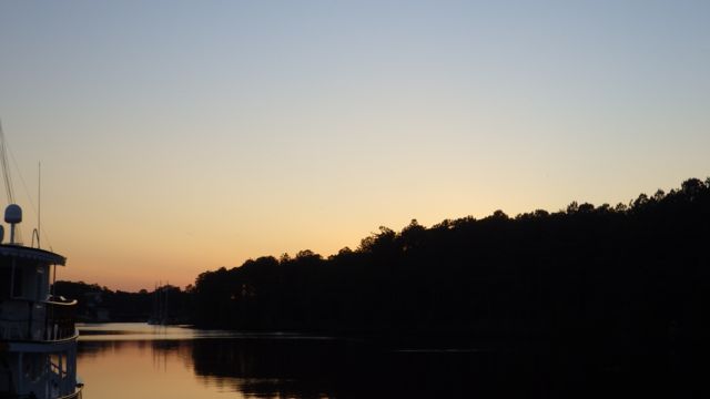
Sunrise in Chesapeake, VA

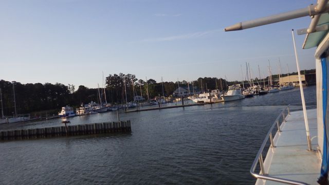
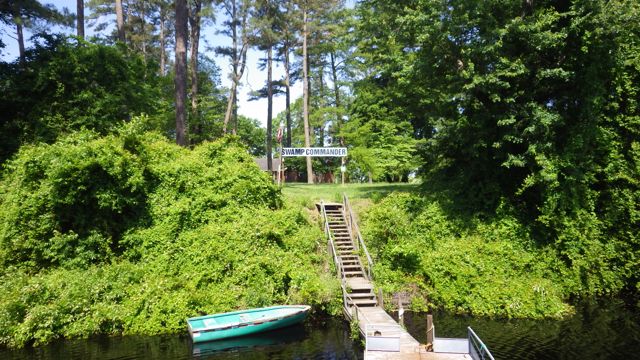
Goodbye Atlantic Yacht Basin, Chesapeake, VA.

6.37am - Coastal Queen - 5-24-15

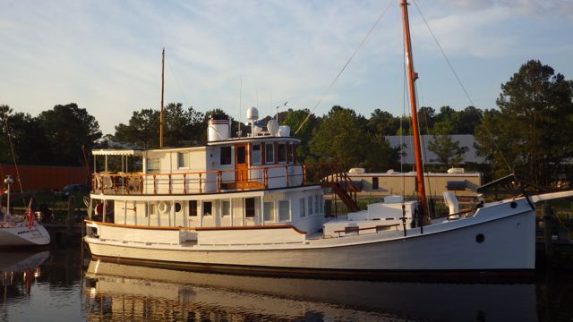
Coastal Queen – down the dock from us

6.39am - goodbye to AYB - 5-24-15

Leaving Atlantic Yacht Basin

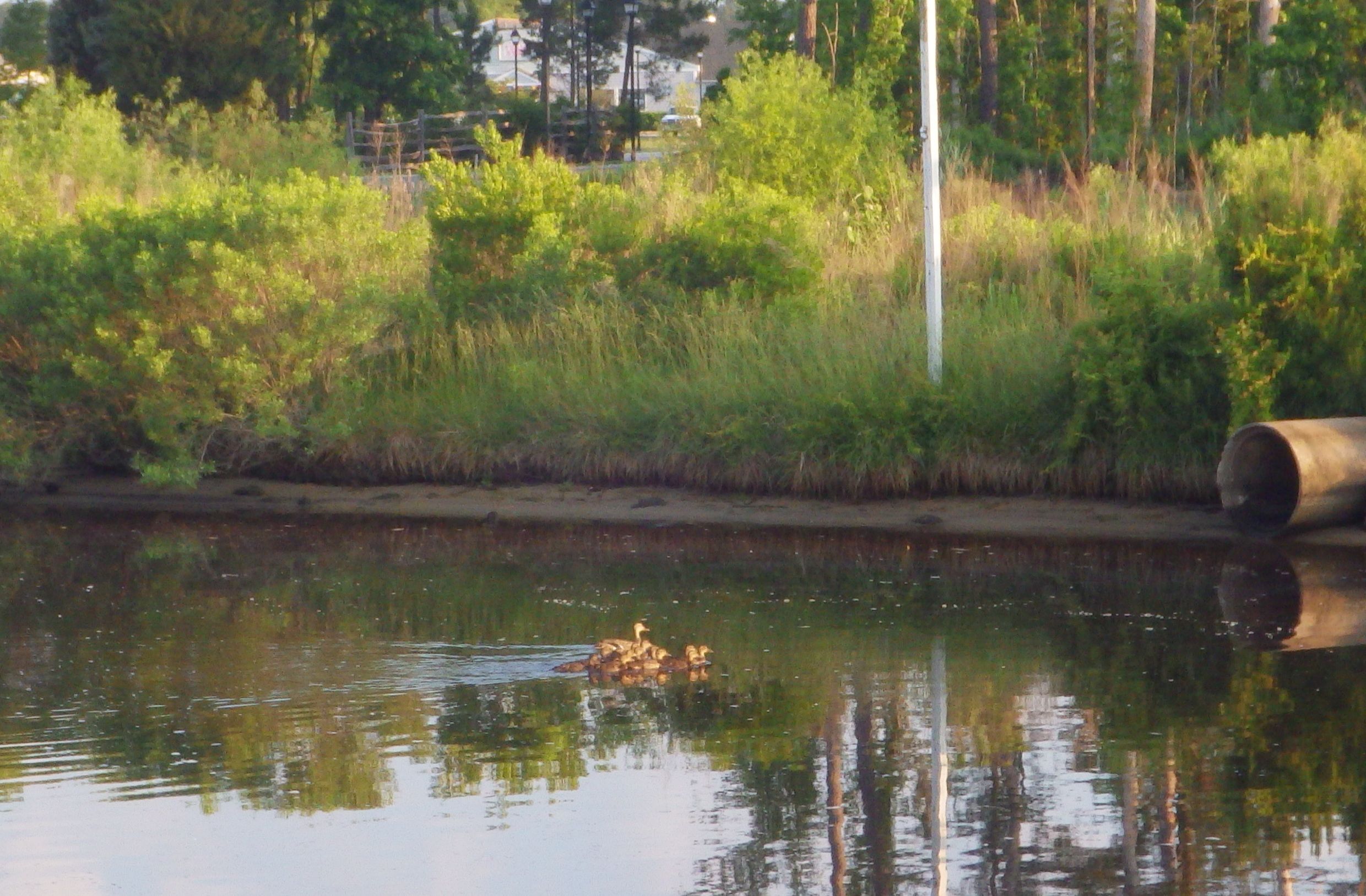
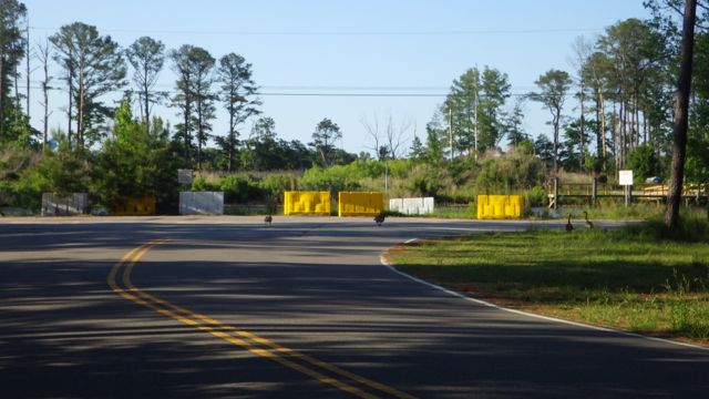
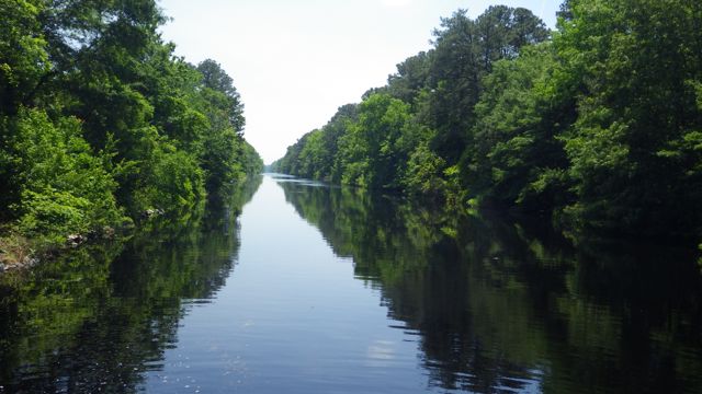
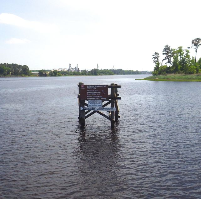
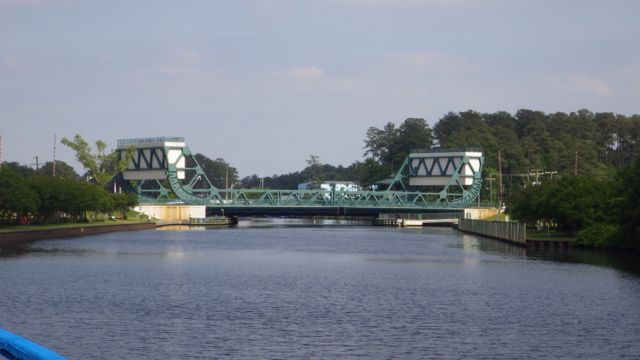
You remember from the last posting that we will have the Great Bridge Bridge and Great Bridge Lock to go through on our way out of the Norfolk area.  We left the dock around 6:45am for the 7:00am bridge opening.  As we were idling in the channel, a duck and 6-7 ducklings scampered from one side to the other.  Barely making it before the horns blew and the barricades went down for the few Sunday morning automobile travelers.

6.56am - a-duck with chicks - 5-24-15

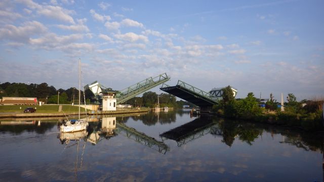
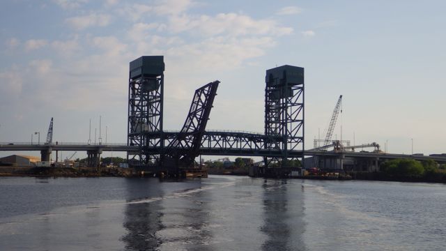
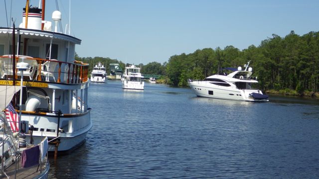
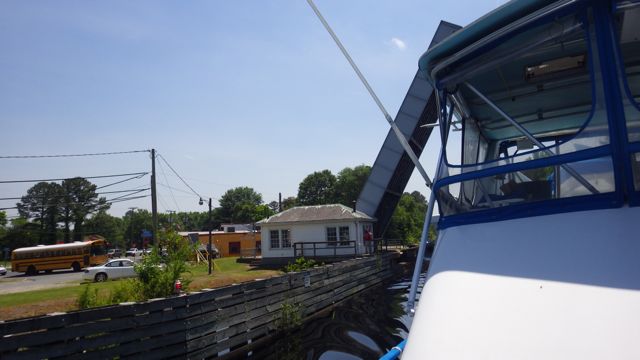
The Great Bridge opened for two trawlers and two sail boats.  I am on the bow of the boat waiting for passage under the bridge and into the lock.  I have the lines ready to a port side tie where the fancy new black rubber bumpers are located.

6.59am -great bridge opens  5-24-15

Great Bridge Bridge opens

7.08am lock opens for us to enter  5-24-15

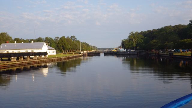
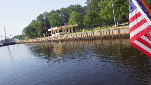
The Great Bridge Lock opens for us 4 boats

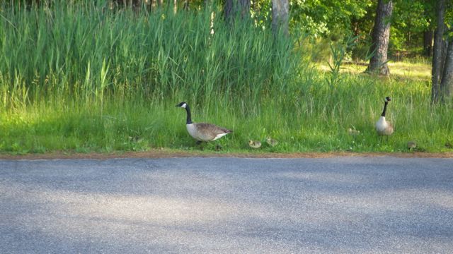
Interestingly, the two trawlers parked on the nice protected side of the lock.  The two sail boats went on the other side with the concrete and steel.  I don’t know why.  Just thought it was curious.  Especially, since there was room for all of us on the the same side.  Even with the goose protecting her nest there was room.

7.12am rubber bumpers 5-24-15

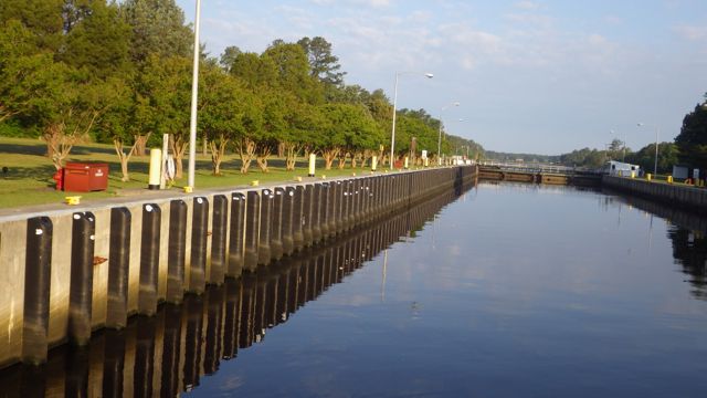
A better picture of the nice bumpers on this side of the lock.

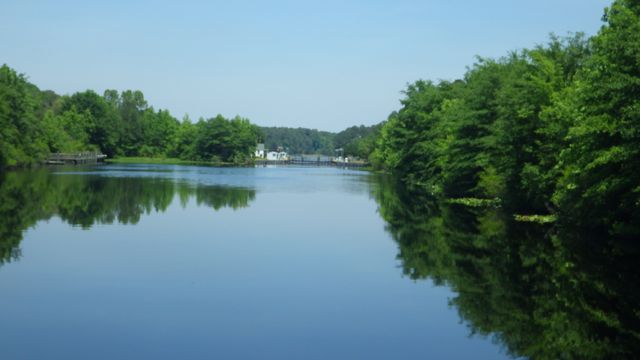
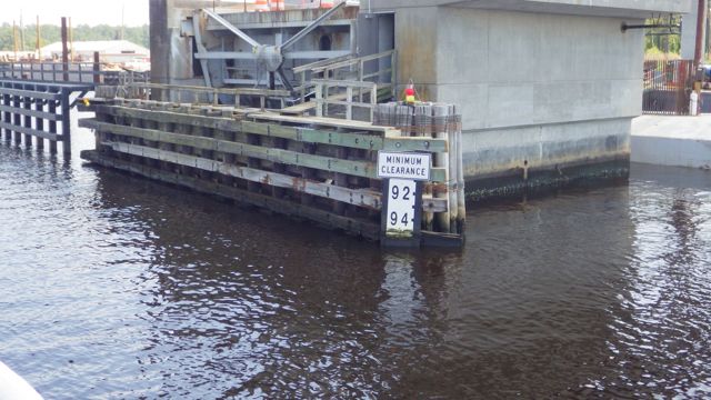
We will be traveling through Portsmouth and Norfolk on our way out to the Chesapeake Bay.  There were at least 2 rail road lift bridges that we expected to be open.  The fixed bridges were of no concern to us being that they are higher than what we are worried about.  Norfolk Southern #7 Railroad Bridge is usually open or it may be a rather lengthy delay if a train comes by of at least 30 minutes for more.

8.09am bridge and RR opening  5-24-15

Gilmerton Highway Bridge

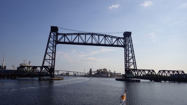
These lift bridges look simple and complicated all at the same time.  This one is over 135 feet when open.  Straight edges against blue sky – pretty.

8.24am - RR bridge up 5-24-15

Norfolk and Western Railroad Lift Bridge (aka Old Virginia RR Bridge)

8.25am - Another tall bridge -

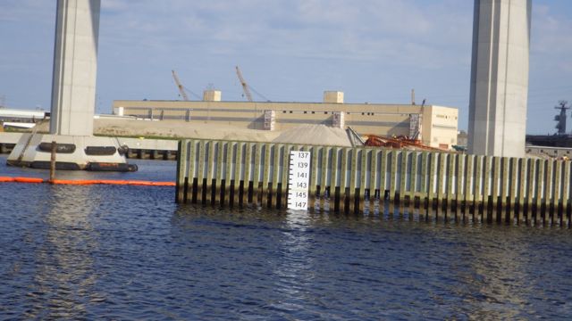
South Norfolk Jordan Bridge

8.29am - 148 ft tall!  5-24-15

145 ft – with low tide it looks like 148 ft

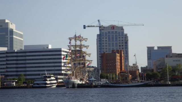
Just how big would the boat have be that couldn’t go under this bridge?  As we wove our way through the harbors, we just saw

8.44am old mast ship in harbor 5-24-15

Old Sailing Ship

8.34am - robocons - 5-24-15

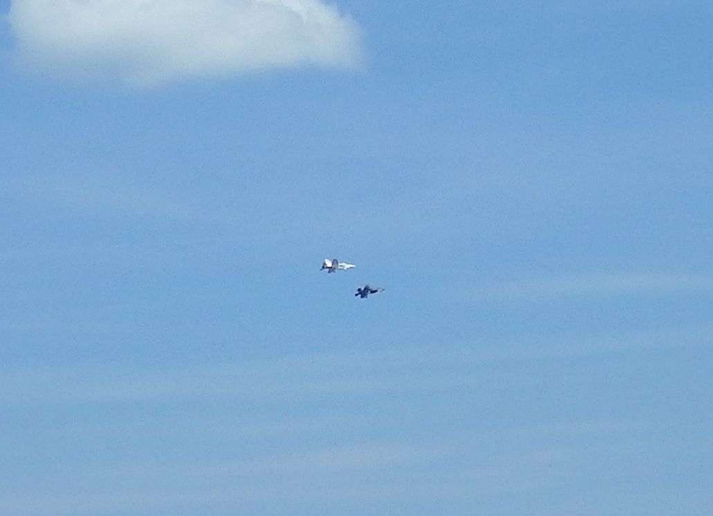
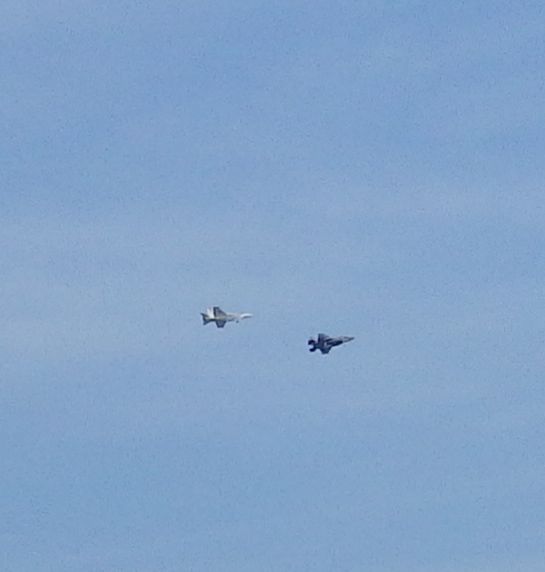
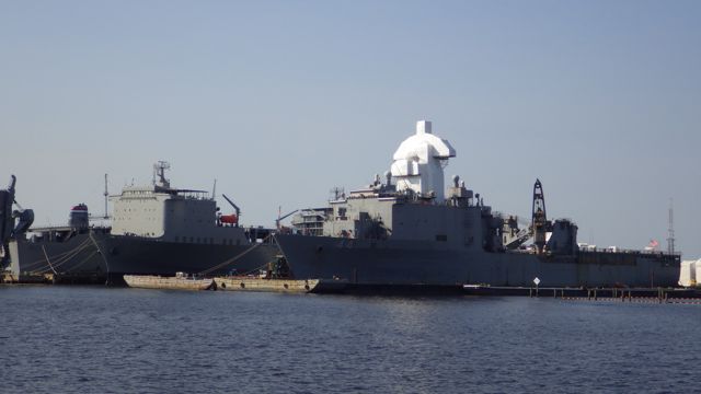
Is this an Autobot?? escape from the Transformer Movie. Dozen of these all over the place.

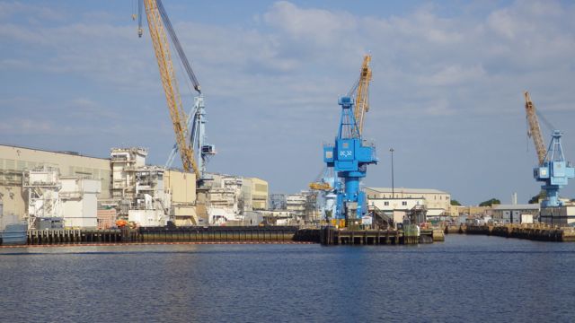
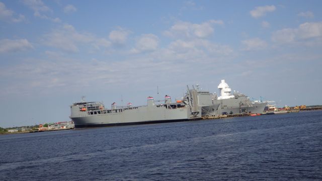
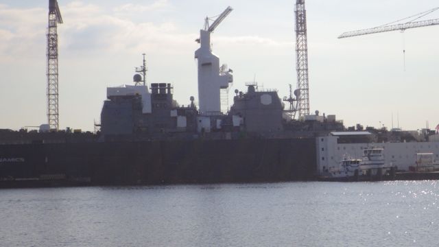
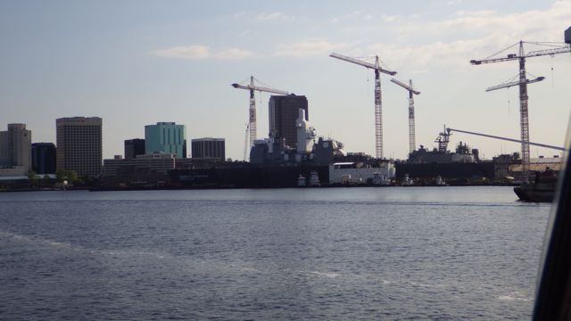
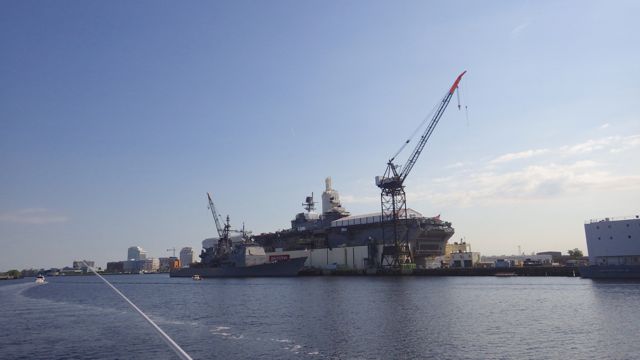
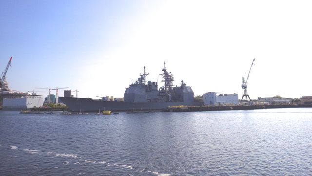
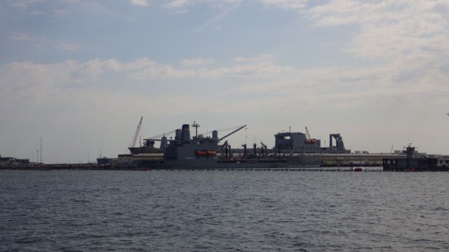
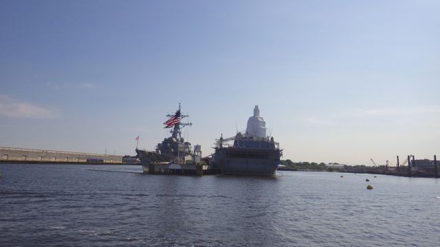
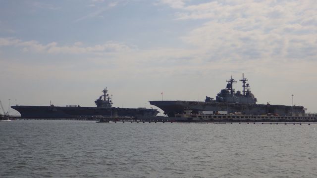
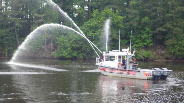
Then a bunch of military boats.  I have no clue what they are.  Wayne got nervous with me taking pictures of this military gear.  I figured if they didn’t want the public to take pictures then they wouldn’t put the boats on display in public.  They would be within a building like Building 51 or is that Area 51?   There was a security boat hovering around most of these boats so that the public wouldn’t get too close.  Besides, we saw a “tour” boat filled with people go down the row of grey painted boats.  No secrets here!

8.51am - eye candy for men - 5-24-15

8.44am - eye candy for men - 5-24-15 8.42am - eye candy for men - 5-24-15 8.40am - eye candy for men - 5-24-15 8.39am - eye candy for men - 5-24-15

9.34am - eye candy for men - 5-24-15
 8.56am - eye candy for men - 5-24-15

8.54am - eye candy for men - 5-24-159.36am - eye candy for men - 5-24-15

Earlier when we were still in the ICW, we heard over the VHF radio broadcasts like ” to all marine concerns, this is Battleship 5 performing maneuvers between some gps coordinates.  We cannot deviate from our course.  All marine craft must stay over 3 nautical miles from our location.”  Something like that.  There were discussions from the Battleship and sailboats because the sail boats didn’t get out of the way or keep their distance.  Fascinating.

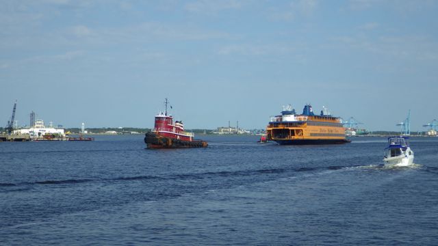
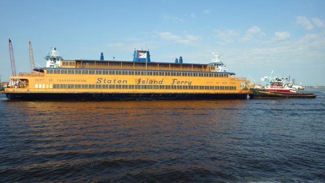
Then we see a tug boat hauling, pulling, a big orange flat bottom boat.  I couldn’t read the side of the boat until it got closer.

8.54am - NY Staten Island Ferry - 5-24-15

8.55am - staten isalnd ferry - towed pushed 5-24-15

Staten Island Ferry

The question I have…. was it tugged/ pushed all the way from Staten Island??  And if so, why here in Norfolk?  Aren’t there boat yards big enough to handle this sized boat in NY?

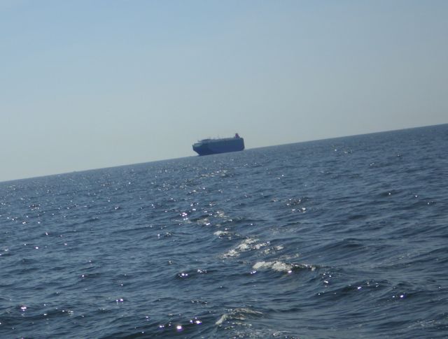
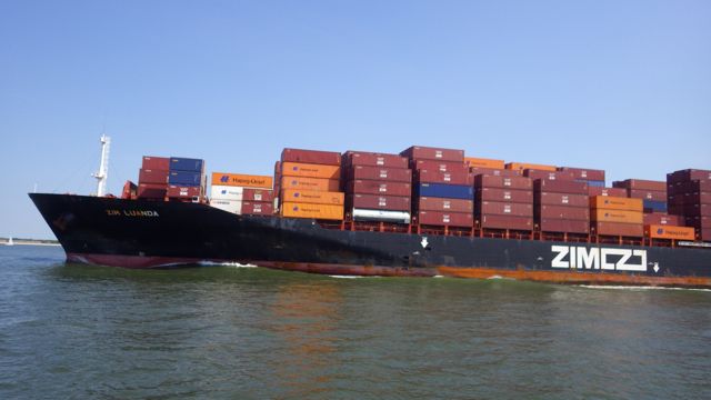
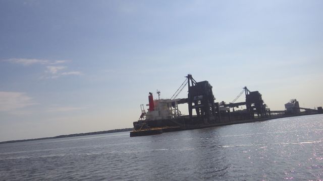
We actually picked a good day to drive through the busy bustling harbor of Portsmouth and Norfolk.  Hardly any boats on the water for an early Sunday morning.  Until this behemoth drove by.  We were NOT expecting it to be going so fast, for one.  The wake it caused was the worst ever.  We tipped over and back.  Wayne tried to mitigate the roll as much as possible.   I thought we were going to go all the way over on our side.  We heard a couple crashing noises downstairs.  Things moved in the salon and lower rooms.  Nothing Broke, thankfully.  Unexpected.  Not delightful.  We will give these gargantuan boats a wide berth!!  OR they should give us pleasure craft more space.  ugh!

10.00am freighter passing us  5-24-15

Freighter passing us at 10am

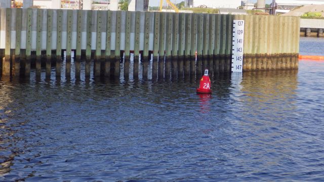
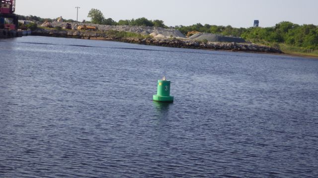
We are finally out of the harbor.  It took over 2 hours to get out of town and into the Bay.  We are approaching big water.  Where’d the “ICW” go?  The ICW starts in Norfolk with a number 1 buoy and goes south.  I saw  2A Red and 3Green.  No Number 1.

8.29am 2A - near 148ft bridge  5-24-15

8.22am Buoy Number 3 - 5-24-15

There is no magenta line from here north.  No real canal or path to follow.  Wayne got concerned.  I told him we just go north!  Follow a heading and go north.  Hahaha  He was not happy at first.  Then he realized that the paper charts do have a magenta type line.  A heading of sorts.  Channels for commercial traffic where the deepest waters are located.

Screen Shot 2015-05-25 at 8.37.39 PM

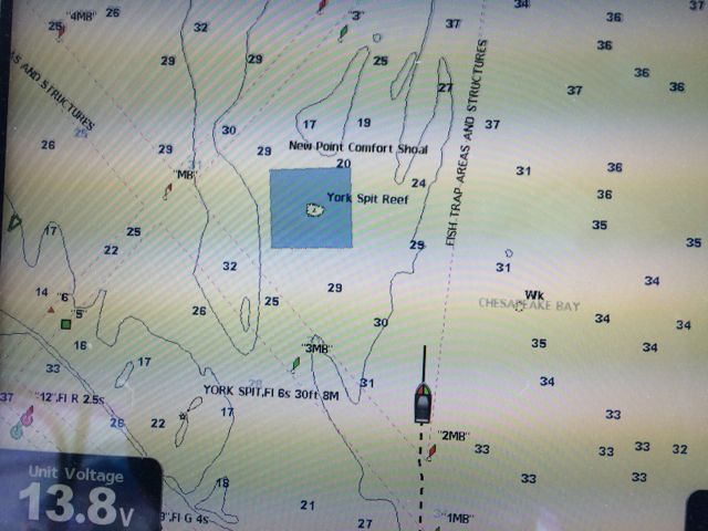
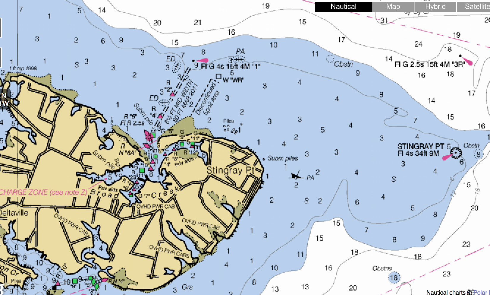
Chesapeake Bay Channels

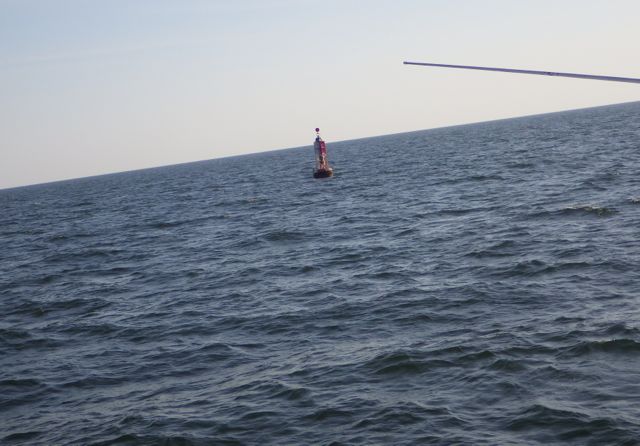
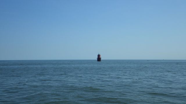
We took a heading north to Deltaville, VA.   Captain Dana mentioned that we might have to do this during our training.  She was so right!  We rounded the “Thimble Shoal Light” marker.  It did look like a little can in the water.  If you can see the light for 18 miles at night, it is bigger than it appears.  From here we turned north.

10.16am - Thimble Shoal light - 5-24-15

White flashing light every 10 seconds – range of 18 miles


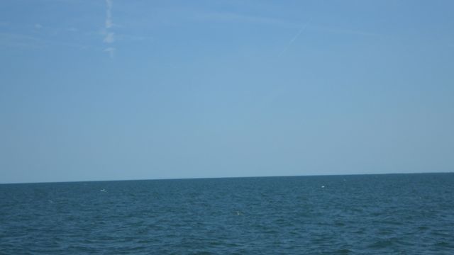
The water was reasonably calm during the morning hours.  It was cool in the mid 60’s.  Not bad for a morning drive on “The Bay”.  This is an image of our boat and you can see the words… “Chesapeake Bay”.  Proof we are here.  😉

In the bay 5-24-15

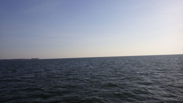
In the Chesapeake Bay

The Chesapeake Bay.  Didn’t see too many boaters at 12:29pm.

12.19am looking around 5-24-15

Looking around on the Chesapeake Bay

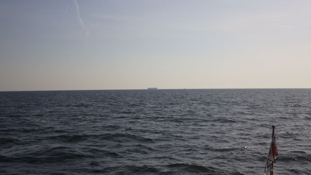
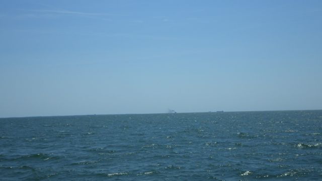
Off in the distance you can see a couple of freighters going north.  Far far away from us!!

12.18am looking around 5-24-15

Freighters in the distance

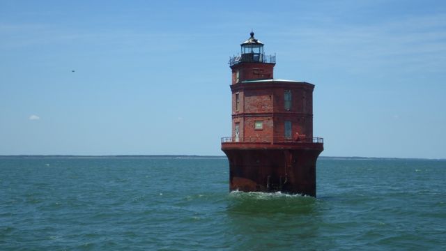
Into the afternoon, the waves were higher.  The wind picked up and it was rocking and rolling again for us.  Wayne swears the seas were 4 ft tall.  He saw completely different waves than I saw.  Mine were closer to 2ft.  The wind was coming from the south so it should have helped push us up the Bay.  It must have been tides or underwater unidentified objects that kept the water moving.  We were delighted to see the next marker “Wolf Trap Light”.  This meant that we weren’t lost.  We were actually on track!

12.58pm Wolf Trap Light  5-24-15

Wolf Trap Light

It does look like we got a little too close, don’t you think?

After arguing about exactly where we are as we were rolling and pitching from side to side, we finally found the channel into the marina.  Just take a left after “Stingray Point” and look for the markers to get into the protective cove for the night.  Mind the shallow waters. Keep in mind “Right Red Return” so you are on the correct side of the markers.  Mind the go-fast boats and sailors taking advantage of the wind.  It was gusting up to 15 mph or higher.  Don’t tell Wayne.  Within that little cove at the top of Stingray Point are several marinas.  We found ours and they gave us a slip in quiet water.  Whew!

Screen Shot 2015-05-25 at 9.44.13 PM

A successful day.  A beautiful day.  The seas were not 4 ft.  Okay, maybe 3ft.  Maybe.  😉

sunset Deltaville 5-24-15

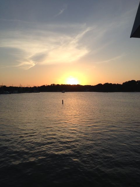
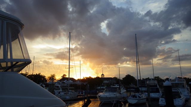
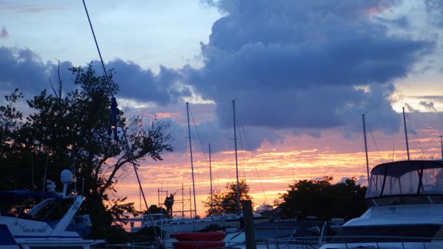
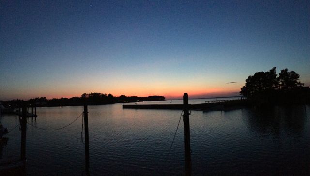
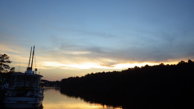
Sunset in Deltaville, VA


Posted in Looping | 1 Comment

May 21 – 23, 2015 – in Atlantic Yacht Basin, Chesapeake, VA

When we arrived at the Atlantic Yacht Basin in Chesapeake, Va, we knew we would be here at least 2 nights.  We arrived on a Wednesday afternoon exhausted from our wonderful day going through the Great Dismal Swamp Canal.   Thursday was forecasted to be rainy.  Who likes to boat in the rain?   Not us!

Then I looked at the wind forecasts.  The marine forecast was 3-4 foot seas with winds from the north.  We are traveling north.  I don’t want to try to go north against a 15 knot wind.  We might make more progress if we just stayed put for another couple of days.  So we stayed another 2 nights.

The Atlantic Yacht Basin is a working boat yard.  Several boats were up on supports getting  work done on them.  They also have covered boat slips.  People were very friendly and helpful.  Also, a good deal on their nightly rates for transients.

Atlantic Yacht Basin sign -5-22-15

Rain and mist over the water on Thursday.  It was a day of rest and get caught up on the blog.  59°F greeted us this morning.  A cold front, apparently.

Rain and Mist coming off the water - AYB - 5-21-15

Rain and Mist coming off the water

Mist coming off the water - AYB - 5-21-15


We are near the Great Bridge Bridge and can see and even experience boats going up and down the Southern Elizabeth River.  We saw barges pushing their wares.  If they came at night, we didn’t see them.  Most of the times, these barges did not cause our boat to move too much.

18.09 - 6.09pm - barge pushing metal scrap?  5-22-15

Barge pushing scrap metal?

13.24 - 1.54pm - barge passing by  AYB - 5-22-15

Barge pushing fuel / oil

At the top of the hour, the parade of boats would slowly ooze up the river to wait their turn in passing under the Great Bridge Bridge and Lock.  These boats often forgot there are boats tied alongside a dock and there is a no-wake zone around us.  Boats of every kind and flavor waited patiently.

10.58am - top of the hour wait for the bridge to open - 5-23-15

Top of the hour wait for the Great Bridge to open


However, the best part of our stay was on Friday.  The neighbor just ahead of us told me about a log that was in the river right along the bank.  We should keep our eye on it because we wouldn’t want that to get wrapped around our propellers.  At first, I only saw a small part of the trunk.  Then I saw the root or larger part of the tree.  Oh dear.  That would indeed do some damage to a boat.

12.10pm - log without snake!!  5-22-15

Log floating near the shore

The log moved down stream.  I went around to get a better idea of the log as it got stopped under the dock.  Wait.  Is that what it looks like on the tree stump?  Hey, Wayne!  Is that what I think it is?  Yes, a snake!!  “Now, I wish you hadn’t shown me that”, says Wayne.  hahaha   The neighbor never mentioned the snake!!  Looked well fed.

10.27am - log with snake - AYB - 5-22-15

Current occupant


The log moved throughout the day.  Up and down the dock as boat waves rocked it about.  The funniest thing??  This is the only time we saw the snake.  It disappeared and THAT got Wayne more worried than ever!!  I should admit that I heard the barn swallows kick up some noise when the snake disappeared.  We were told that it is common for snakes to eat a baby chick or two.  With all the barn swallows flying around under the docks, I don’t think the snake came aboard.  😉

We did take our little red cart around the corner and stock up on vittles.  Within a mile of the marina is a Farm Fresh Grocery store.  We were impressed.  Looked like a Publix grocery store.  A man grabbing a cart at the same time as us looked at us and asked… “you boaters?”  Yep.  “thought so.”  I wonder what gave it away?  Wayne’s beard?  Or the cart?  Or a combination?  hahaha

17.53 - 5.53pm on our way back from grocery 5-23-15

On our way back from grocery

On the way back we were greeted by some geese crossing the road.  4 tall adults and ??

17.56 - 5.56pm - geese crossing the road  5-23-15

A passel of little fuzzy ones.  I counted 6 fur balls.  They were walking so they weren’t too young.  The adults let us walk calmly and quietly by without chasing us.  OR snapping at us.  Whew!

1800 - 6.00pm geese with chicks 5-23-15 - AyB


Friday and Saturday were absolutely beautiful days.  The wind and waves were still bad enough for NOAA to have small craft advisory warnings out.  We caught up with laundry, naps, and started researching how to get from here to there in our next several days of travel.

20.04 - 8.04pm  AYB - sunset - 5-22-15

Sunset in Chesapeake, VA


Posted in Looping | 1 Comment

May 20, 2015 – Through The Great Dismal Swamp – 2

9.44am - vistor center truck stop sign  5-20-15

This is where I left off.  We are now officially in the Great Dismal Swamp Canal.

9.46am - Dismal Swamp  5-20-15

Dismal Swamp Canal

It is 10:15am and we are now entering Virginia!!  I still don’t feel any different than in Florida.  Although, the trees are definitely different than the palm trees there.

10.16am - welcome to Virginia!!   5-20-15

Welcome to Virgina


I believe I mentioned that there are a couple of feeder ditches that the Corp of Engineers use to maintain the Dismal Swamp Canal water level.  Here is one of the signs.  I figured anything called “Big Entry Ditch” deserved a picture.

12.21pm - Big Entry Ditch Sign- 5-20-15

Big Entry Ditch

This is what I saw!!  I am sure amongst all that foliage, the ditch is big?!  Maybe it was really big at some point in the past and the name stuck.

12.21pm - pic of Big Entry   5-20-15

The Big Entry Ditch

We were going slow enough not to disturb these fellows…

12.11pm - turtle on limb - crop? - 5-20-15

Turtle on a stump

11.57am - turtles -crop - 5-20-15

Bunch of turtles


You may not be able to see these guys.  We almost ran them over.  A mother duck and her 3 little ducklings.  The babies were paddling so hard but just couldn’t get out of the way.  Wayne swerved, hit some tree limbs, and barely missed the little guys.  Whew!!  And we didn’t hit anything under the water.  Everyone survived.

11.19am - shimmers in the water  5-20-15

Brown duck with ducklings with the shadows

Tree in the middle of the channel.  We had just enough room to go around this obstruction.  See it really does happen…trees falling in the forest when no one is around.

10.57am - tree in the middle - 5-20-15

Tree in the middle of the Dismal Swamp Canal

A local resident has designated himself as the Swamp Commander.  Say Hello!!

10.53am - Swamp Commander - 5-20-15

Swamp Commander?

Is this not the best picture?  We saw ripples in the water up ahead and never could figure out why.  Wind maybe.  Or something under-the-water.  I did see bubbles rising from underneath the water at one point.  Alligator??  The boat makes enough noise to scare away most critters.

10.37am - pictureque view of Dismal Swamp 5-20-15

Just Gorgeous!!

13.23 - 1.23pm - more Dismal Swamp  5-20-15

As we approached the most northern part of the Great Dismal Swamp Canal we encountered the “Deep Creek Bridge” followed by the “Deep Creek Lock”.  The man who opened the bridge is also the lock master.  In this case we had the bridge first and the lock afterward.  We lost the 6 feet we gained in the morning.   I was getting fenders out and lines ready for the lock that I almost didn’t get a picture of the bridge.

13.26pm - approaching Bridge - lock on far end  5-20-15

Deep Creek Bridge opening for us

We slowly went forward to give the bridge tender time to jump in his car and race to the lock.  There was something going on.  A camera man was filming us as we went under the bridge and through the lock from a local TV station.  We assumed it was going to be one of those “the life of a bridge tender” kind of stories.  Maybe it was Wayne’s beard?

13.38 - 1.38pm waiting for lock to be opened  5-20-15

Waiting for the bridge tender to open the lock

13.51 - 1.51 lock doors ready to open  5-20-15

The locks doors are ready to open just before 2pm


Thus, we traveled through the Great Dismal Swamp Canal!!  We were abruptly back in civilization.  For the past 6 hours we heard birds and an occasional car.  Rather quiet and solitude.  We moment we left the canal we heard sirens, honks, bullhorns, and excessive chatter on the VHF radio.  Goodness.  We are back in the thick of things again.

14.35 - 2.35pm directional sign - lighten - 5-20-15

Directional Sign… So you don’t take the wrong turn

We decided to go to the Atlantic Yacht Basin for 2 nights.  It is right around the corner from the Dismal Swamp exit and it looked like a good stopover.  However, we need to negotiate another lock and bridge.

This isn’t it.  This bridge is a newly constructed bridge.  They are still removing some of the construction supports and old bridge remains.  We knew it was tall…. but

14.23 - 2.43pm - new bridge under construction  5-20-15

Veteran’s Bridge

14.45 - 2.45pm - new bridge 95 ft tall!  5-20-15

95 feet tall.

This should be tall enough for almost any tall boat or small building can go under.

Just beyond the Veteran’s Bridge is the Great Bridge Lock and the Great Bridge Bridge.  Really.  The lock helps to control the confluence of the different rivers coming into the same location around Norfolk.  The Great Bridge Lock just had new fenders put on the south side of the lock.  Really nice rubber bumpers.   We were asked to tie up just beyond the midpoint.   We went up about 2 feet.

15.33 - 3.33pm - new lock wall - bumpers  5-20-15

New rubber bumpers in the Great Bridge Lock

The other side doesn’t look very friendly, at all.  The Lock Tender put all the boats on the rubber bumper side.  How thoughtful!

15.33 - 3.33pm - other side concrete and steel - 5-20-15

Concret and Steel on the other side of the lock

This is the reason we couldn’t tie closer to the front of the lock.  A goose has decided to lay her eggs right at the edge of the lock.  She gets ornery if the lock tenders get too close.  The lock tender kept apologizing for not letting us move all the way forward.

15.37 - 3.37pm - duck nesting - crop - 5-20-15

Goose and her nest


Then we had to wait for the top of the hour for the Great Bridge Bridge to open.  Wayne had to keep the boat in the middle of the lock.  No current to speak of for about 45 minutes.  ugh!  We had just missed the opening.  There are separate folks that manage the locks and bridge.  There is only 6 ft of clearance under the bridge.  I don’t think anyone can sneak by if they wanted to.

15.51 - 3.51pm - waiting for Great Bridge -Bridge to open 5-20-15


16.01 = 4.01pm - great bridge opening  -5-20-15

At last – Great Bridge Bridge is opening

16.03 - 4.06pm - great bridge cantelever - 5-20-15

Huge cantilevers to raise and lower the Great Bridge


We are on the Elizabeth River at the Atlantic Yacht Basin in Chesapeake, Va.  We are docked along a long wall.  Shortly after we arrived, the Chesapeake City Fire Department was out on the water exercising their water cannons.  Very cool.

18.07 - 6.07pm - local fire dept practicing  5-20-15

Fire Department Training

Exhausted after a very long day, we bid you all goodnight!

20.06 - 8.06pm - sunset at Atlantic Yacht Basin  5-20-15

Sunset from Chesapeake, VA

Posted in Looping | 1 Comment