June 13 – 14, 2015 – Half Moon Bay Marina, Croton-on-Hudson, NY

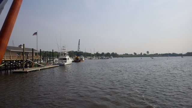
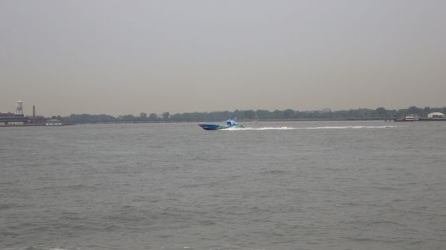
We were planning on staying only one night in Croton-on-Hudson, NY at Half Moon Bay Marina.  That was the plan.  However, during the night the wind kicked up something fierce.  At 4 in the morning, Wayne calls for me to help him outside. Bang. Knock. Knock.  What?  I barely have time to get my glasses on, still in stocking feet (and not much else), I race outside.  The wind had blown our boat away from  the dock enough that the wonderful ladder of ours popped off the dock!  We hustled and re-tied the lines. AND took the ladder up to secure it on the boat until the wind stopped.  Later, we found out we were experiencing those 20mph gusts… again.  We decided to stay one more night to let this “whatever weather” blow over.  Cheeze. We were supposed to have <8mph winds and calm waters.  My weather apps have never been that wrong before!!

6.29am Sunrise  6-13-2015

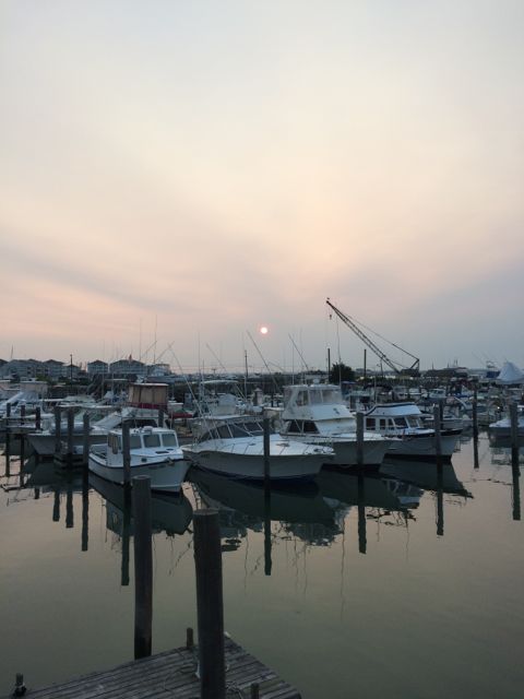
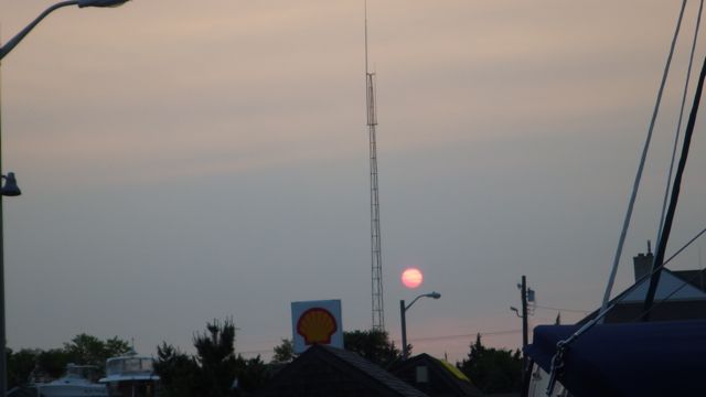
Sunrise at Half Moon Bay Marina

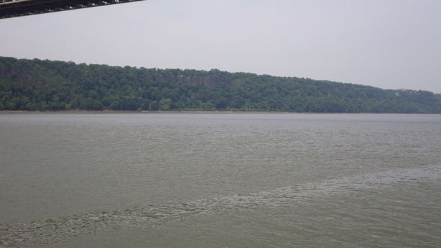
Rise and shine… again!  You can see the Hudson River moving.

We took a nap.  Is it a nap if you get up at 4am and go back to bed?  OR is that still apart of the night-time sleep.  I am not sure.  Then, can I take another nap later and call legit?

Since we are here for another night, we might as well go walk up town and take in the sights.  Well, find the BBQ place and have a late lunch.  Remember…those naps meant that we had a early light breakfast.  😉   Along the way, we crossed over the rail road tracks.  We have been hearing and seeing the train go by yesterday afternoon and all day today.

13.40 - 1.41bpm railroad tracks Half Moon Bay  6-13-15

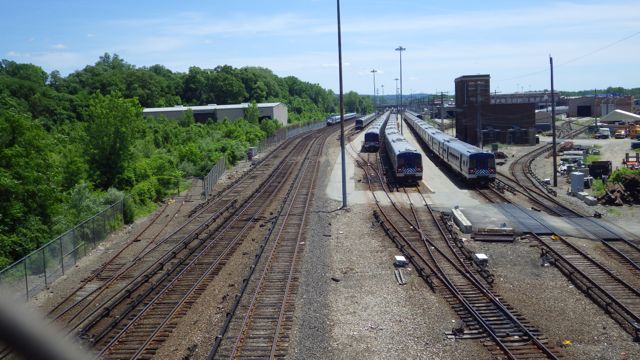
Tracks with Trains waiting

Are these the kinds of trains we see people jumping from the bridge on top of?  Mission Impossible?  Seems like timing would be very important.   (by the way, that is part of the chain link fence in the picture frame, not my finger! Probably to keep someone from wanting to be a daredevil.)
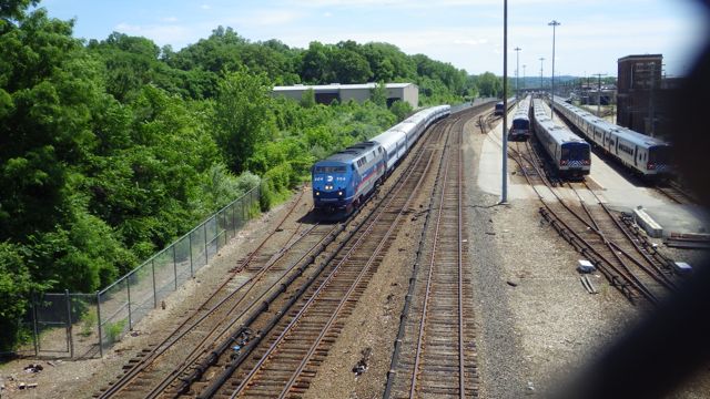
13.40 - 1.40pm railroad train coming Half Moon Bay  6-13-15

Train approaching!!

We were famished and the meal was delicious.  I decided I wouldn’t partake any beer with lunch because it didn’t matter if it was draft or in a bottle… $6.50 each.  A bit steep even for me.  Drafts should have been quite a bit less.  Especially, America’s Beer…Bud.

13.46 - 1.46pm - lined walkway to restaurant 6-13-15

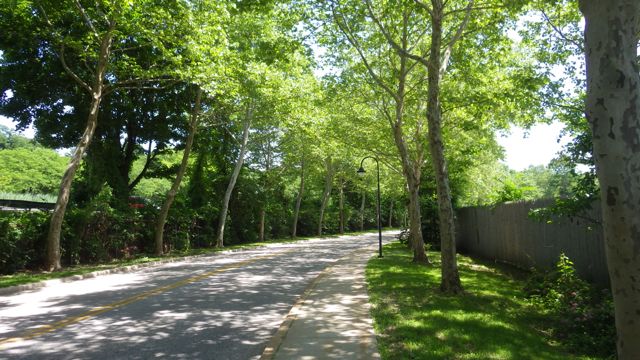
Tree lined sidewalk to the restaurant

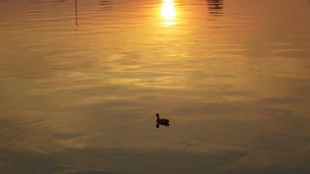
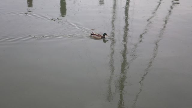
After lunch we had time to walk along the River Walk in front of the condos and marina.  I hadn’t seen these geese and ducks from our slip.  How exciting.  Wild life.  Do you see the one geese standing on one leg?  How do they do that?  If I tried, I know I would fall over in an instant.
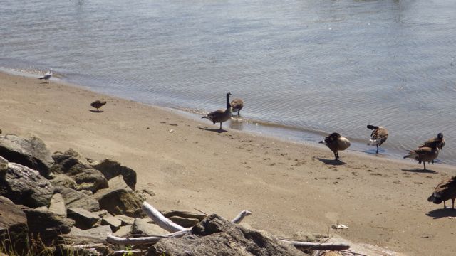
15.17 - 3.17pm - gaggle on one foot 6-13-15

Resting one leg

15.17 - 3.17pm - gaggle  6-13-15

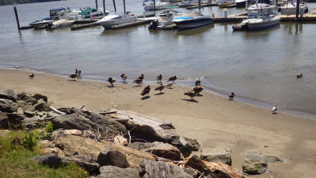
The whole Gaggle of them!

15.15 - 3.15pm - mom duck with 3 babies  6-13-15

Mommy duck and her 3 babies – so cute

We were invited to a group gathering of Loopers.  Dock-Tails.  We gather on part of the dock and share Looper stories. Bring a dish and your own beverage of choice.  The Marina supplied metal chairs and a table for us. Very nice of them.  There were at least 10 Looper boats here at Half Moon Bay Marina today.  We had a great time sharing stories.  Instead of the normal 1 hour meet and great, everyone stayed almost 2 hours.  The stories were that good.

The wind died down and tomorrow we go up the Hudson River – north!!

20.25 - 8.25pm - sunset Half Moon Bay - 6-13-15

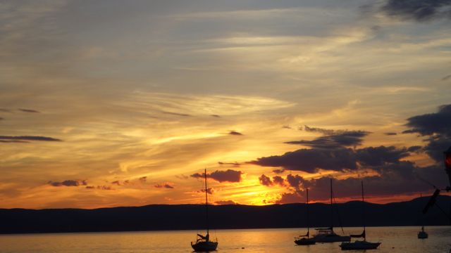
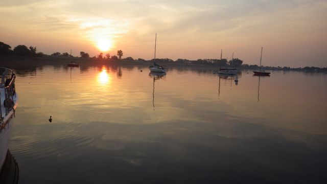
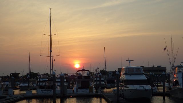
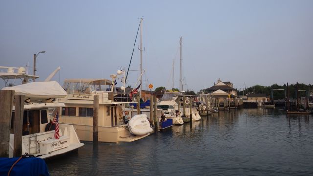
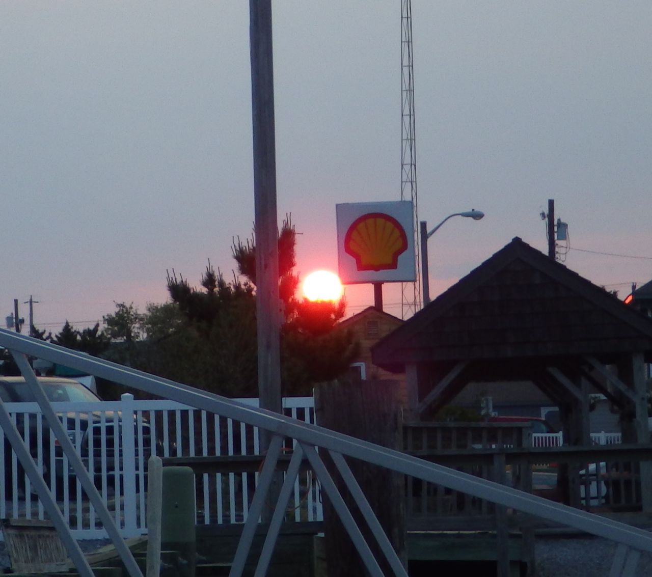
Sunset at Half Moon Bay Marina

Posted in Looping | Leave a comment

June 12, 2015 – New York Harbor and up the Hudson

I am behind, again, in posting our latest travels.  We are on the road again and sometimes time just passes by so fast that I don’t have a chance to take a breath.

5.46am B - sunrise at Great Kills, NY  6-12-15

Sunrise at Great Kill, NY

5.47am -duck - sunrise at Great Kills, NY  6-12-15

A lone duck quaking at sunrise.

We left Great Kills Yacht Club by 10am.  It is a tidal thing.  Here goes…. if you don’t want to fight the “ebb” tide ( out going tide that goes to low tide ) in the NY Harbor and Hudson River.  Because then it would be like you are walking up hill against the wind.  A stiff current going the opposite direction might make a slow boat actually make no progress at all.  You want to catch the water “flooding” into the harbor and Hudson River.  That would mean a rising tide and current going in the same direction as the boat.  Theoretically.  Makes sense until you THEN look at the tidal table for Great Kills.  At 10am, it was just coming off low tide.  It might be a little shallow getting out of here!!

9.52am - leaving Great Kills Yacht Club - 6-12-15

Leaving Great Kills Yacht Club

9.59am - shallow waters near entrance Great Kills - 6-12-15

Shallow waters near the entrance to Great Kills Harbor

As we were on our way into NY Harbor, we actually heard the Coast Guard mention on the VHF radio that a boat got stuck getting into Great Kills Harbor.  Oh dear!!  We are lucky we made it out when we did!!

Turning left out of Great Kills we headed toward New York!!  That glittering town, one heck of a town!  See that bridge?  Point the bow of the boat in that direction.  It looks like the bridge that capture Godzilla ( Mathew Broderick version ).  Yep.  I can almost see that poor creature stuck in the bridge suspension cables.  Can’t you?

10.48am - Verrazano-Narrows bridge in distance  6-12-15

Verrazono-Narrows Bridge

We are approximately 20 miles from NY City.  Today looks a bit hazy and gray.  Maybe a bit of smog thrown in since this is a big city!  We were told to watch out for all the boat traffic in the NY Harbor.  We were hoping that by going later in the morning we would avoid some of the rush hour ferries.

11.28am - NY skyline  6-12-15

New York Skyline at 11:30am

The Statue of Liberty!  We drove by the Lady, herself!!  How exciting!  She isn’t as huge as I had imagined all these years.  Dwarfed by her neighbors in the Big Apple, maybe?  Too bad is wasn’t a better picture taking day.

11.35am - Statue of Liberty - 6-12-15.

Statute of Liberty

The Twin Towers are gone.  There is the single Tower now.  Very dramatic!!

11.49am - Trade Center Skyline - 6-12-15

Trade Center Skyline

Water vessels seen while driving through the NY Harbor and lower Hudson River.

11.30am - red barge - 6-12 15

Red Barge in no particular hurry

11.46am - Staten Island Ferry  - 6-12-15

Staten Island Ferry carrying a few folks

11.55am - speed boat on the Hudson 6-12-15

Speed Boat! in a hurry

11.55am - NYPD boat - 6-12-15

NYPD boat

12.02pm - sky-dos on the Hudson 6-12-15

A pair of Jet Skis in the NY Harbor!

These jet skiers were the most bizarre.  They were so small in comparison to the numerous ferries, tankers, barges, and us boaters.  Crazy!!

The Hudson River is split down the middle.  The west side is New Jersey.  The east side is New York.  Fascinating to see the difference between the two.  It also looks like NJ has the Statue Of Liberty on its side of the river.  Who knew?

11.49am - Jersey skyline - 6-12-15

Jersey Skyline

11.59am - colgate sign closer - 6-12-15

Colgate Clock on NJ side

Couldn’t tell if this fence was to capture bats, pterodactyls, or keep something in.  Strange skies.

12.15pm B - cage??  NY  6-12-15

Large fence near marina?

12.08pm - Pier 40 NY  PINK trees- 6-12-15

Yacht with Pink Trees along side of Pier 40

12.27pm b - Pier 88 - security zone - 6-12-15

Pier 88 – Security Zone?!?!  Couldn’t see anything – maybe it is cloaked….

12.26pm - frontal intrepid + sail boat  6-12-15

The Intrepid and a 3 mast sail boat side by side

12.55pm - Grant's tomb and cathedral - 6-12-15

Grant’s Tomb is the dome on the left

12.27pm - Pier 90 - security zone w boat - 6-12-15

Pier 90 – Security Zone – except for that one boat that gets to get close?!

13.12 - 1.12pm - little red buildings   6-12-15

See that little skinny RED building? That really stands out amongst the brown.

13.17 - 1.17pm green NJ side!  6-12-15

Green NJ side of the Hudson River

As the afternoon got older, we came across kayaks and boats escorting swimmers in the Hudson!  We counted multiple arms and about 12 heads swimming.  Good for them!

15.02 - 3.02pm - guard kayak for swimmer  6-12-15

Swimmers near the Zappan Zee Bridge

15.01 - 3.01pm - guard boat for swimmer  6-12-15

Swimmer escort Guard boat

14.18 - 2.18pm - cliffs  NJ side  6-12-15

The Cliffs on the Jersey side

13.59 - 1.59 - Yonkers  6-12-15

Yonkers on the NY side – because the sign said so.

We passed cities that we have always heard about.  Hoboken, Yonkers, Manhatten, The Battery, Governor’s Island, and so many more.  They all blended together like many cities around the country where you can’t really tell where one city starts and another city ends.  Buildings are taller on the NY side than on NJ side.  More green trees and less buildings on the Jersey side that was surprising.  Handfuls of luxury yachts that made our boat look like a dinghy.  Not many trawlers, tho. A few sail boats.

Overall, we didn’t see the huge amount of barge or container ship traffic as we were warned.  Several were docked or anchored and were not moving.  Probably because of the time of day.  Several ferries that looked like touristy cruise boats were zipping around but they were small and gave us the right of way a couple of times.  We were not rocked by anything too terrible.  Nothing flew off the counter or was broken.  I was able to keep my footing the entire time!!  A wonderful transit.

Just as we were getting ready to find our marina for the night, we saw Sing Sing Prison.  I looked it up.  It is still a “Maximum Security” prison for 1700 men.  We should be pretty safe then.  If anyone breaks out of prison, they won’t hang around here….they will high-tail it out of town and leave us boaters be.

15.33 - 3.33pm - Sing sing Prison??   6-12-15

Sing Sing Prison


We arrived at our destination after 4pm.  We were exhausted both by the hour of the day and the excitement of where we traveled.

We have motored over 1700 miles since leaving Sarasota, FL.  We have traveled the ICW on the east and west coast of Florida, across Lake Okeechobee, up The Chesapeake Bay, down the Delaware Bay, up the Atlantic Ocean and now the NY Harbor and entered the Hudson River.  How awesome is this.  Pinch myself.  Is this real??


Posted in Looping | Leave a comment

June 11, 2015 Up the Jersey Shore to Great Kills, NY

We had a calm night.  We got up early to make the 102 miles north from Atlantic City to Great Kills, NY which is on the southern coastline of Staten Island.  The forecast is excellent for today’s travel.

5.45am - sunrise  AC  6-11-15

Sunrise in Atlantic City, NJ

You can see in this picture the water wasn’t nearly as flat, but it wasn’t bad either.  The waves were supposed to be 1 – 2ft.  We can do that!!

6.25am - AC boardwalk   6-11-15

AC boardwalk as we were entering the Atlantic Ocean

We left the AC, as the locals refer to Atlantic City, and headed north.  We traveled about 1.5 – 2 miles off shore following the coastline.  The red line shows our path from Atlantic City to the small little cove of Great Kills, NY.  We had several locals tell us that there is “absolutely nothing to see along the coast of Jersey”.  So, we made the big trip without stopping.

Jersey Shore

June 11 Jersey Shore Trip


Not much happening on the water first thing in the morning.  Actually, we didn’t see many boats of any kind.  We were surprised that there were such few boats.  Sun was shining.  The temperatures were in the mid 70’s.  Excellent!

9.33am first boat seen on the water  6-11-15

First boat seen on the Ocean at 9:33am

9.34am sail boat  6-11-15

Sail boat off in the distance

As we approached Manasquan, NJ we saw crab pots in 72 feet of water!!  Those black daubers ( as I like to call crab pots) were again the worst to see.  We couldn’t believe we would be dodging daubers in the Atlantic Ocean!!   Some folks put flags on them so they can be seen.  Other daubers were flat on the water and really hard to see.

10.52am  daubers in 72 ft of water   6-11-15

11am Crab Pots in the Atlantic…do you see it?


Wayne suddenly said, “I see something jumping out of the water up ahead”.  Right.  Mermaids?  No, Not mermaids.  See… there it is again.  I get the binoculars out and sure enough something did rise above the water.  Not dolphins either since whatever it was was the the wrong shape.  I am thinking flying fish, mermen, or just something we hadn’t seen before having fun. As we got closer, we finally decided it was a whale!!

You might want to mute the audio, the picture is better without the roar of our boat engines.

A definite highlight!!

After only 10 hours, we were safely in our marina for the night.  Great Kills Yacht Club offers transient Loopers a place to stay.  A great place and wonderful people.  I think there were 4 loopers at Great Kills this night.  2 Loopers were staying in Great Kills and going from there to the “City”.  We and another Looper were going to go onward through the NY Harbor.  After spending 11 or more days cooped up in Cape May, it is time to make tracks!

16.52 - 4.52pm - great kills yacht club - 6-11-15

Great Kills Yacht Club

A very successful trip on the Atlantic Ocean.  We still have to pinch ourselves with the reality of that achievement.  Since the weather is going to be good we will be pushing forward tomorrow into the New York Harbor.  How exciting!!

Posted in Looping | 1 Comment

June 10, 2015 – Onward to Atlantic City, NJ

Oh my, oh my!!  We are leaving Cape May, NJ and going into the Atlantic Ocean!!  We have gone across the Okeechobee.  We have driven up the Chesapeake Bay, down the Delaware Bay, and the ICW.  They all pale to the ocean.  Now we are going to drive our Always Home into the Atlantic Ocean!!  Mind blowing!!  We are excited and scared all at the same time.  Now this is big water!!

Our day began with high hopes of calm waters and southerly winds.  The sunrise was very promising.  The sun was red just like last night.  I will need to figure out why my camera mutes the reds.  It was very pretty.

6.01am - sunrise Cape May 6-10-15

Sunrise in Cape May 6am June 10, 2015


As I had previously mentioned, there were at least 6 of us “Loopers” getting ready to leave today.  Folks bustling around putting things away so they wouldn’t go flying into the ocean, disconnecting the power cords, and pulling in the lines ( ropes).  We backed up, pivoted, and left the marina one after the other.  Not like we were in a hurry….but glad to be moving!

6.40am - leaving our slip at Cape May 6-10-15

Leaving our slip #16…after 11 days

6.42am - leaving Utsch's Marina 6-10-15

Exiting the marina main waterway

6.43am -Goodbye Utsch's Marina 6-10-15

Goodbye Utsch’s Marina

We slowly left the marina taking care of the shallow waters.  As I was pulling in the fenders, I saw several more boats following in our track.  Almost like kids on the last day of school!  We couldn’t get out on the water fast enough.

6.48am - several boats behind us  6-10-15

Several Boats all in a row following us out.

There is an ICW channel in New Jersey.  But not for our boat.  The channel is very shallow and in not recommended for any boat with a draft of over 4 ft.  It is also tedious with bends, curves, bridges and no wake zones.  We really had no choice but to go out into the great BLUE Atlantic!  We know several small Looper boats did actually go up the NJ ICW  during the high winds expecting the land and marshes to dampen the wind gusts somewhat.

6.56am - ICW entrance and 1st bridge - 6-10-15

Turn left under the bridge to the NJ ICW channel

We saw a fishing trawler up ahead.  They must know how to get to the ocean, right?  Let them lead us!!  I don’t know what the early morning tow boats were pulling / pushing so early in the morning.  They were coming into Cape May.  Hope they don’t get stuck for 11 days!

6.57am - following a fishing trawler out 6-101-5

We are officially in the Atlantic Ocean!!  7:15am June 10, 2015.  Look at the water!  Pretty flat, if you ask me.  I expected something different.  This is an ocean!  More violent, more white caps.  Wait… isn’t that why we waited for 11 days?  Not to have that frothy water? Beautiful!

7.14am - 3 going our way - 6-10-15

3 other trawlers going our way

I went down to the galley ( kitchen) to make some sandwiches for breakfast.  Bad idea.  The roll of this water is different than the other waters.  OR because I got hot.  OR because I didn’t have anything to do … as navigator and spotter, there was just the coast line to follow.  We couldn’t make a wrong turn.  I got nauseous.  Not pukey sick but I need cool air and some ginger ale… quick!!  Actually, quite fascinating since we have been in rolling water before and I hadn’t gotten sick then.

Otherwise, nothing much was going on.  Water on the right.  Land off to the left.  3 boats behind us, a few sail boats ahead of us, and no one else, really.  No traffic jams.  No cars or boats honking.  Just the quiet roar of our twin engines and the wind between my ears.  Awesome!

One of the amazing things about boating is that it takes so long to travel.  We saw the Atlantic City skyline for more than an hour before we actually got close enough to check our entrance to the marina.  The other boaters moved on.  We decided to make it a short day today of about 50 miles.

10.00am  Atlantic city skyline  6-10-15

Atlantic City far off – 10 am

10.46am  AC  6-10-15

11am Atlantic City skyline

We are staying at the Farley marina at the Golden Nugget Casino.

17.53 - 5.53pm  golden nugget  6-10-15

Golden Nugget in Atlantic City, NJ

The Golden Nugget is at the red arrow on the map below.  It is NOT near the Atlantic City board walk.  We have visited Atlantic City a few years ago and found no reason to visit it again this trip.

AC map b


We were really early for us to dock and had our choice of slips.  We rested for about an hour and decided to go find those infamous buffets we keep hearing about for our big meal of the day.  We found it!  Oh my… the desserts were first on the table.  Bread pudding and cheese cake.  Ok, we did eat other food, but we all know always eat dessert first!  Right?

These glass displays look very nice.

13.26 - 1.26pm Golden Nugget ceiling glass

Golden Nugget Entrance Glass

We aren’t gamblers but we did walk around the casino.  Two tables playing in the poker room.  Several black jack tables of all kinds going on.  Roulette being played both with a person throwing the little metal ball and with a computer shooting out the ball like a pinball game.  We found the penny slots but it looked like we needed a card to play rather than an actual coin.

To get in our walk for the day, we walked around the marina.  We found a fish cleaning station with an adorable sign.

18.39 - 6.39pm - fish cleaning - 6-10-15

Do not feed the cats!! – No pelicans here??

18.52 - 6.54pm  do ac towers   6-10-15

Do AC!!

Night lights in AC  - 6-10-15

Night Lights in AC

Todays travel on the high seas went really well.  Tomorrow, we will do a longer leg from Atlantic City to Great Kills, NY.  That will be a 100 mile day.  Doable.  We will just have to get up early and go for it!

Posted in Looping | 2 Comments

June 9, 2015 – Getting ready to leave Cape May, NJ

It looks like the weather is going to change.  What?  Not that “Climate Change” discussion!?!? ugh!  No…weather is going to look good for the next several days.

How do I know this?  The ducks were out of hiding and were beginning to float around in the marina looking for food.  When the animals start returning to normal, it is a good thing!

duck 8.17am - weather improving.  6-9-15

Ducks are paddling by!

Final pictures of the marina here in Cape May, NJ.  I was very impressed that the marina had different sized stairs at the transient docks to help everyone no matter what size boat they had.  We did actually use their metal stair.  It was sturdy and easy to step off / on boat side.  It looked like many of the transients used this convenience.  We have not seen this before.  Very nice.

ladders at marina - nice touch - June 8 2015

Stairs at the transient docks


Remember 10 days ago when we first arrived?  I know, I have almost forgotten it as well.  Sooo, long ago.  At our arrival, we needed to add fuel.  I don’t know if I mentioned how precarious that whole event was.  Maybe because it was so soon after that I wasn’t sure what actually happened.  Amnesia??  Anyway, I finally got a great picture of the dredger.  This dredger front fork is IN the channel!  Do you see the brown thing jutting out into the waterway?  When Wayne was maneuvering the boat into the slip for fuel, he had to back up.  I saw one of the dock hands leaned over and looked backwards.  Oh dear!!  It turns out the dockhand was worried that Wayne would hit it with our props!!  Then why, oh why, wouldn’t they want to move it out of the way??  Luckily, Wayne did see it at the last minute and missed hitting it.  Me?  I am on the bow throwing lines.  I had no clue what was going on at the stern.  Wow!!  Lesson of the day?  When the dock hand leans over with a concern on his face, it means something.  May not know what it is, but something!

dredger in the fareway at Utsche Marina

weatDredger out into the waterway


Remember those fish I showed you the other day?  Loopers told me that they really don’t have much meat on them.  They are all head.  These fish feed on clams and they have massive jaws to break the clams open.  If these fish are 50lbs each, there is about 10 pounds of meat that you can actually fillet out.  Interesting.

18.56 - 6.56pm - huge fish!!  5-31-15


WEATHER DISCUSSION:

We have been sitting here for 11 days waiting.  I am sure that the weather in your part of the globe is much nicer than here.  Winds gusting to over 20 mph.  Here are the 2 buoys we have been monitoring.  Look at the picture on the right and you will see the “wave height”.  5 feet!!  The buoy in New York Harbor is registering over 4.6 ft waves!!

buoy info NY harbor 4.6ft waves!!  6-9-15

The Barnegat Buoy is half way up the NY coastline and was registering 5.2ft waves.

buoy Barnagat NJ 5.3 ft waves!!  6-9-15


Naturally, that doesn’t sound all too bad, does it?  NOAA is the National Oceanic and Atmospheric Administration.  They provide forecasts for weather conditions including wave and surface wind speeds.  NOAA was also forecasting 5 ft waves this past week or so all along the NJ coast.

By definition:  when NOAA says 5ft waves are expected, they really mean… if example:
Significant Wave Height = 5 ft   ( meaning at least 1/3 of all waves are at least 5 ft high )
1 in 10 waves will be larger than 6ft
1 in 100 waves will be larger than 8ft
1 in 1000 waves will be larger than 9ft with an “occasional” rogue wave being even higher.

Not that people actually count the waves but statistics indicates these numbers.  If we are out in the water and hit waves taller then me, I don’t think I want to be on the water!!

We heard boaters complain about the waves of water hitting their flybridge as they dared to travel south in the Delaware Bay during high gust days.  That means the water splashed a good 10-15 ft above the water surface.  The boaters where drenched and exhausted by the time they finally made it to the marina.

We wait for our weather window with calmer water and lower winds.  At one point, there were 10 Loopers at the marina waiting.  We gathered a couple of times to discuss weather, Looping, and just “how do you do’s”.  These gatherings are conducted at the docks.  Generally described as “Dock-tails”.  Bring your beverage of choice, a dish to share, and a story to tell.  hahaha  Stories are always, always, the easiest to provide!

Tomorrow, it is confirmed by at least 6 Loopers as the day to GO!!  The sunset to send us on our way north?

red sunset 6-9-15 Cape May  7.56pm

Red Sunset – June 9, 2015 – Cape May, NJ

red sunset 6-9-15 Cape May  8.02pm

Sunsetting at Cape May, NJ

Posted in Looping | 1 Comment