August 15, 2015 – from Mackinaw City, MI to Petoskey, MI

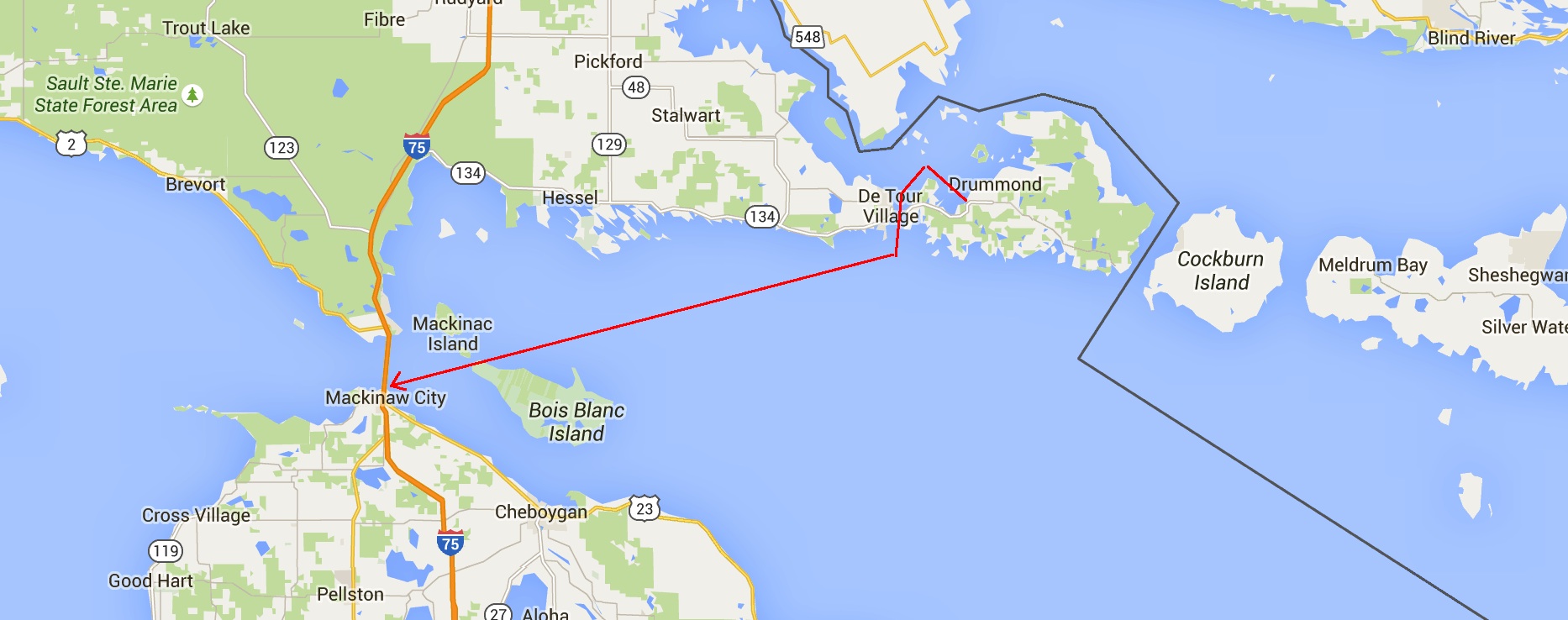
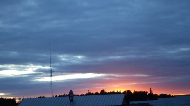
Good morning!!  We are up in time for a great sunrise.  Even before the robin gets the first worm!!  We have a 60 mile cruise today.  Should be an easy run from Mackinaw City to Petosky, MI.  At least, on the charts, it looks easy.

Mackinaw City to Petosky

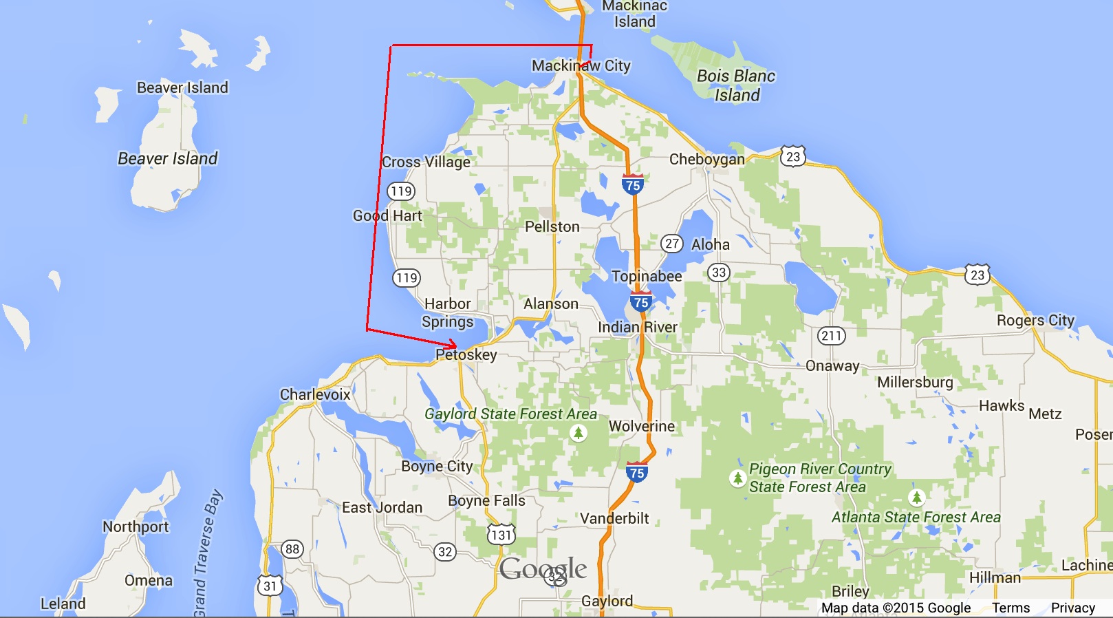
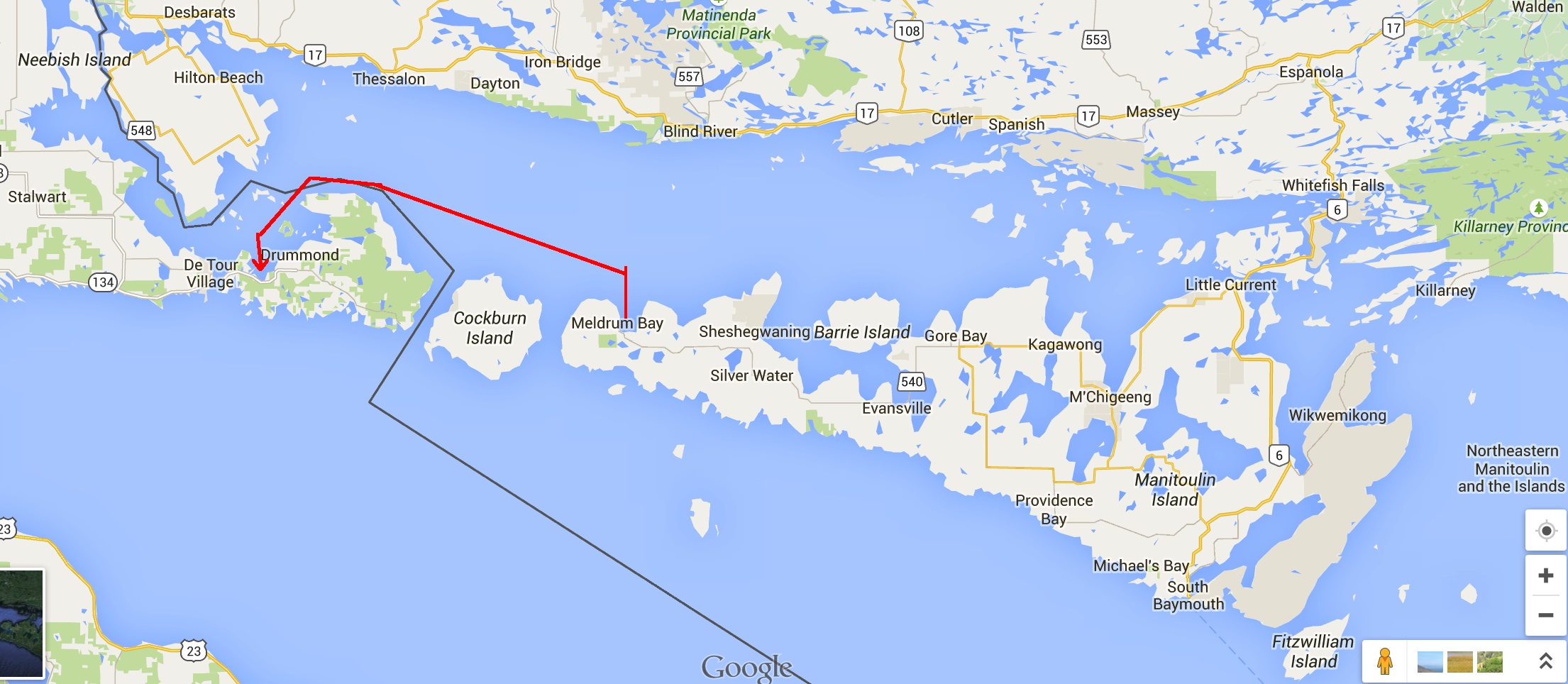
Today’s Route to Petosky, MI

6.38am - leaving Mackinaw City Marina 8-15-15

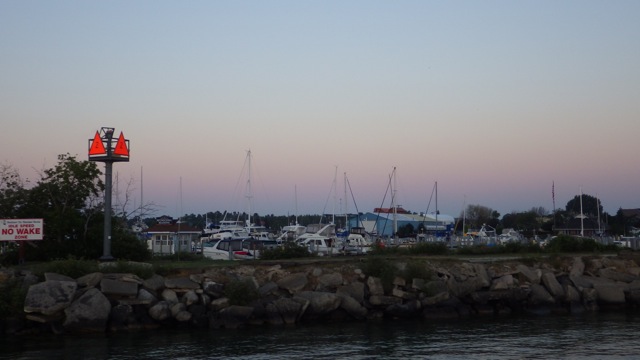
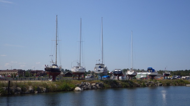
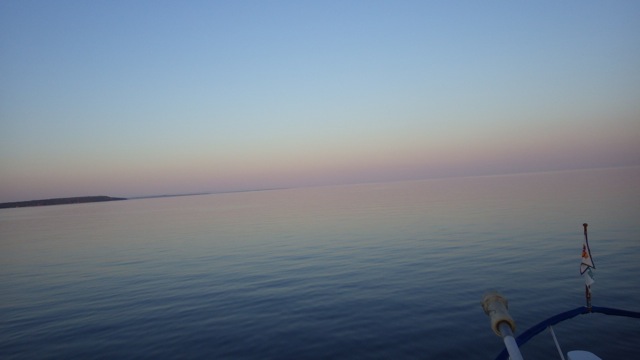
Leaving Mackinaw City, MI

6.38am - sun peaking up D 8-15-15

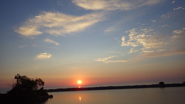
Sun peeking up at 6:30am

The Mackinaw Suspension Bridge is the longest suspension bridge in North America.   It is almost 5 miles long.  When the sun was setting yesterday, the cars going across the bridge looked like sparkles.  Neat affect.  This early morning, the bridge is just starting to wake up with the sun shining on the supports.   This bridge connects upper and lower Michigan.   Prior to the bridge, the only way across the Mackinaw Straight was by ferry.
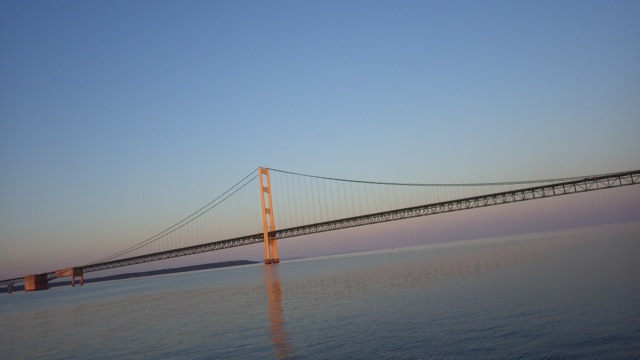
6.56am - Mackinaw City Bridge 8-15-15

Mackinaw Bridge

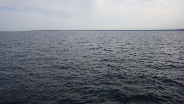
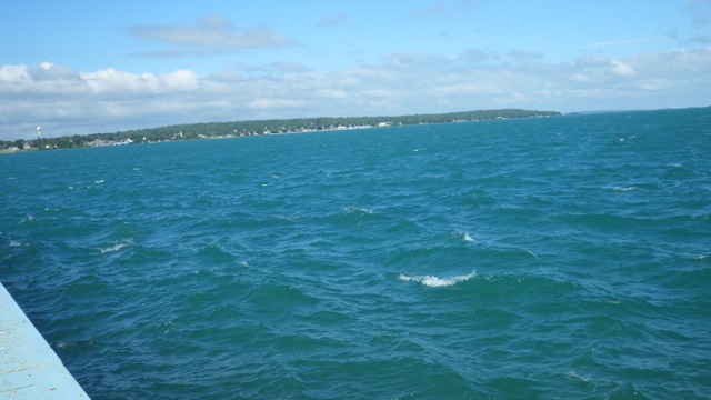
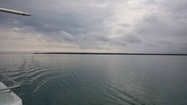
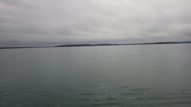
Do you see what a great travel day today is?  See the flat water?!  Oh my goodness.  Waiting a day was a great idea.  I wonder who decided that?!?

6.58am - flat water!! sunrise 8-15-15

7am Early Morning

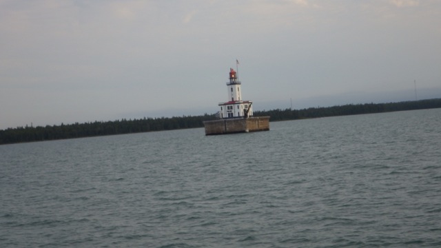
Distance is really deceptive out here on the water.  The White Shoal Light is 125 feet tall.  It looks like a candy cane.  Red and white striped.  The light doesn’t look 125 ft tall.  The beauty is that it can be seen for miles and miles.  That is the point, after all.

8.41am - light - barber pole 8-15-15

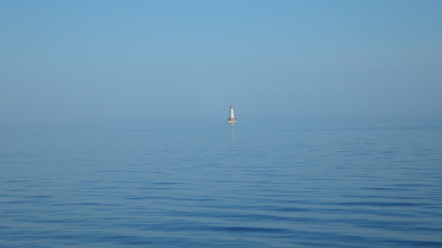
White Shoal Light – 125 ft tall

9.06am -Grey's Reef Light

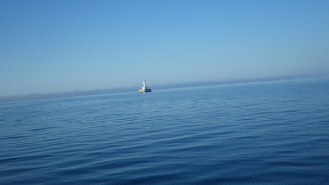
Grey’s Reef Light – 82 feet tall

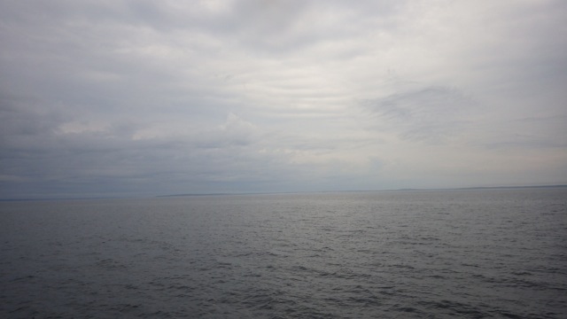
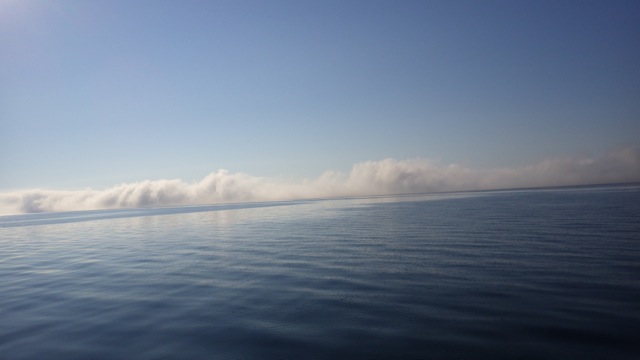
We looked into the distance and saw clouds on the horizon.   Blue water.  Blue skies.  Hardly a whisper of wind.  White clouds.   Clouds, right?  Looks interesting.
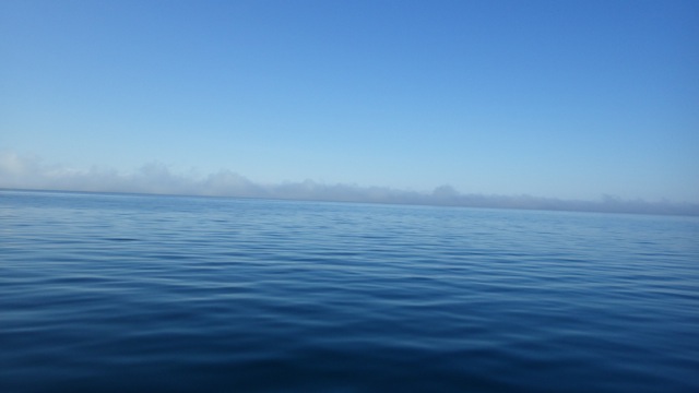
9.11am - fog or clouds? 8-15-15

9 am Clouds??

9.12am - clouds? or fog? 8-15-15

9:12am The clouds are getting closer?

Not Clouds!!  FOG.  What in the world??  Right out of an old SyFy movie.  Fog in the middle of Lake Michigan.  Of course, there is!

9.21am - fog behind us 8-15-15

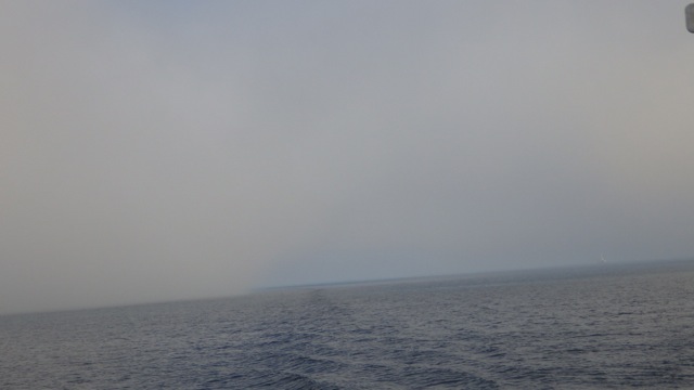
Fog as I look behind the boat

We made sure we had our radar on.  We saw several “blips” on the chart plotter.  A couple didn’t change course and were coming straight for us.  Oh NO!!  Wayne adjusted our course to get out of their way.  2 trawlers passed us by within a 1/2 mile going north.  No big deal.  But, they didn’t alter their course. When they got with that 1/2 mile, I was able to see them through the fog.  Surely, they saw us on their radar?  We saw one huge blip on the radar that we never did put our eye balls on.  They must have been over 2 miles away.

9.19am - fog bank approaching 8-15-15

Fog bank

Look at the next picture.  You can see the fog bank we cruised out of.  Amazing.  Like a line of clouds above the water.  On this side, blue skies.  On that side, fog.

11.10am - fog bank behind us 8-15-15

Fog Bank

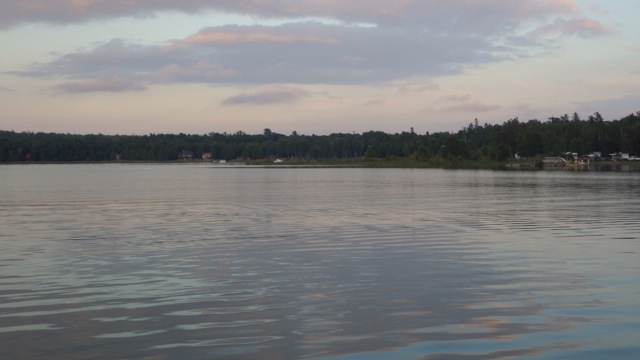
We drove in fog for about an hour before we turned toward Little Traverse Bay toward Petosky, Michigan.

12.28pm - at Petosky Marina! 8-15-15

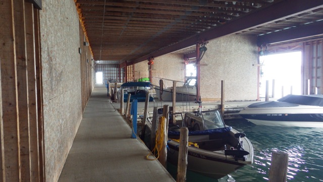
Welcome to Petosky Marina

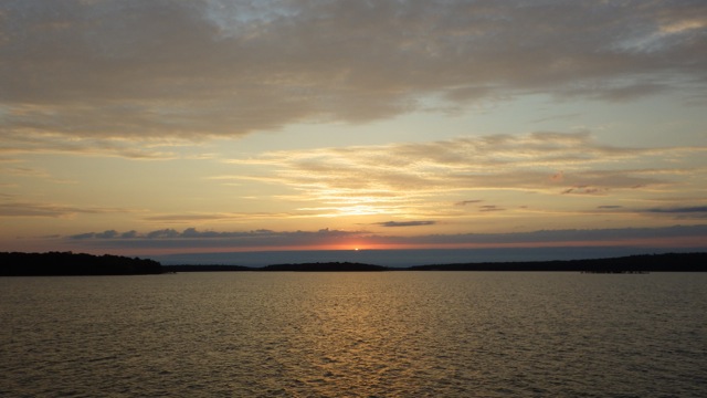
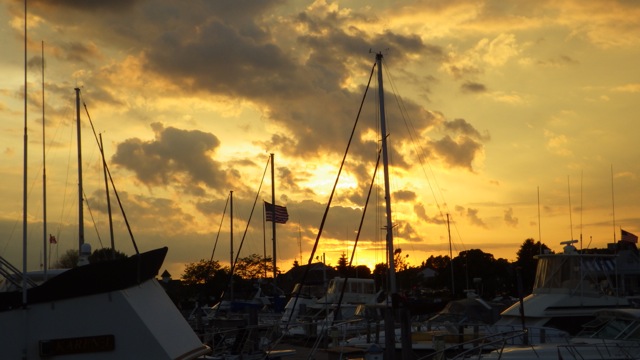
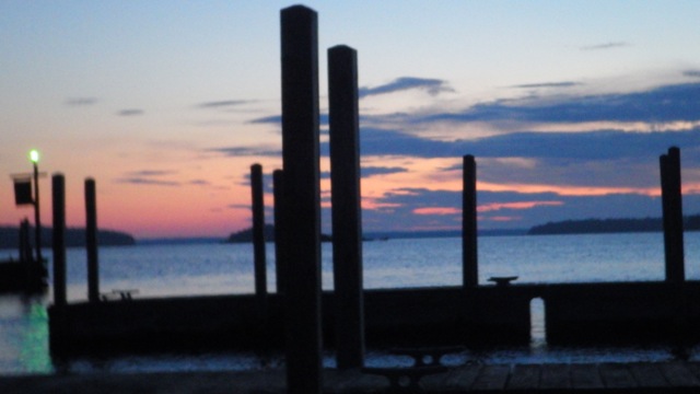
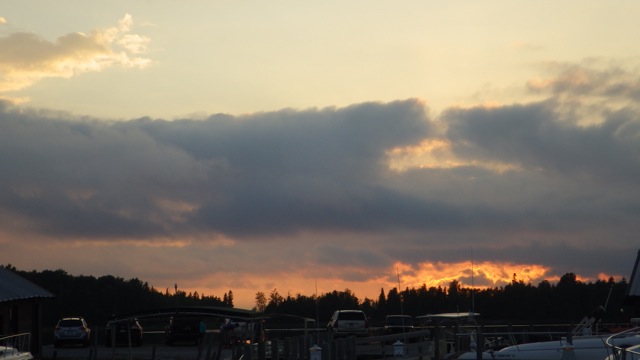
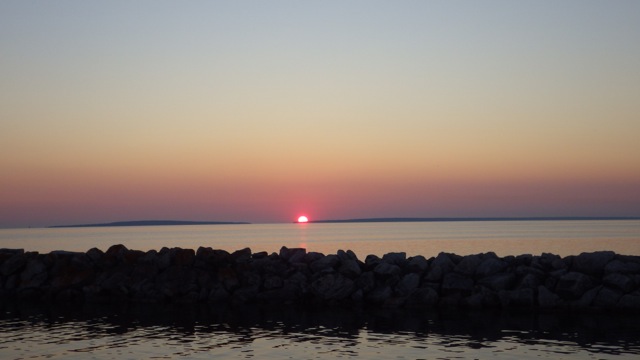
A good day on the water.  We are safely docked.  Dinner made.  Ready for bed.  Wait… I need my sunset picture.  Here it is!

20.19 - 8.19pm - sunset 8-15-15

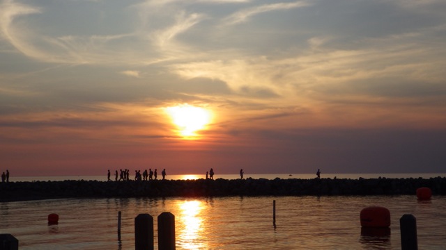
Sunset at Petosky, Michigan


Posted in Looping | 1 Comment

August 14, 2015 – in Mackinaw City, MI – day 2

Good morning.  We slept in so there is no early morning sunrise.  Sorry.  I should be more diligent for you, readers, and climb out of bed anyway.  Really?  Nope, not today, at least.

We have some boat chores to do today.  Laundry, dishes, vacuuming, cleaning.  You know. Household chores that just couldn’t wait.  Besides, the weather forecast is dubious.  We will wander a bit later when we have all our chores done.
10.54am - mackinaw city sign 8-14-15


Dry storage.  These boats are a neat visual.  Sail boats on the hard.  Seems so lonely all by themselves at the side of the road.

12.13pm - dry storage along the side of the road 8-14-15


Just when we got our boat chores done and we were ready to go over to Mackinac Island, a horrible thunderstorm arose suddenly.  Lightning.  Rain.  We said no.  No reason to go over on the ferry during a storm.  We stayed on Always Home and got ready for tomorrow.  Mackinac Island is a no-car island.  Quite a tourist mecca, we heard.  Horses, bicycles, and walking are allowed.  The highlight of the island would have been sitting on the porch of the Grand Hotel.  Alas, it wasn’t meant to be, this trip.  It seems this visit went far too fast. We didn’t get our second scoop of ice-cream.

Tomorrow, Petoskey, MI where we hope to find comfortable dockage for the next impending storm that is on its way.

18.47 - 6.47pm - sunset Mackinaw City 8-14-15

Sunset Mackinaw City, MI

Posted in Looping | 1 Comment

August 13, 2015 – Westward to Mackinaw Island, MI

Good Morning to all you Cruisers!!  The weather window is open.  Get your life vests on.  Get your coffee mug ready to take to the fly bridge.  It is a cool cloudy morning around 63°F.  Light jacket is all you will need.  Here we go!!

6.41am - sunrise 8-13-15

Sunrise leaving Drummond Island, MI

I was so excited about moving along that I forgot to get my “leaving the marina” picture.  I do think I was watching for channel markers for Wayne as he guided us from Drummond Island Marina through Sturgeon Bay into the DeTour Passage.  We were on the lookout for large ships and barges.

Today’s journey will be slightly over 50 miles.  Does this look like that far?  Looks like just a couple of inches to me!  Up and around the corner, through the De Tour Passage, across the water, through Mackinac Island Inlet, and finally into the Straights of Mackinaw.

Drummond to Mackinaw City

Drummond Island Marina to Mackinaw City Marina

DeTour Village Marina is just across the DeTour Passage and where lots of boaters stop after checking in at Drummond.  That is where the ferry goes.  A popular hangout from what I hear.  What does it look like in the light of day?  Probably not enough light?!

7.31am - DeTour Village Marina - 8-13-15

DeTour Village Marina

As we passed the DeTour Reef Light, we are officially in Lake Huron for these 50-53 miles.  I cannot tell you how many pictures I had to take until I timed the light just right!  The light is 74 feet tall according to the charts.  We must be quite a bit away for it to look so small.

7.51am - LIGHT flashing on the light house 8-13-15

De Tour Reef Light

The water was very nice.  See?

8.09am - 8-13-15

8am Smooth Lake Huron – over 100 foot deep

9.29am - flat water? 8-13-15

9.30am Still smooth sailing for us!  – still over 100 foot deep

Then we got close to the Straights of Mackinaw the water got a bit rougher.  Still, less than 2 feet waves.  About an hour of rough water.  I was holding on and keeping watch for ferries and other strange objects on the water.  We don’t know why, but everyone we talked to had the same experience.  Smooth water that changed abruptly to bouncy.

We saw this “rooster tail” ferry go by in the distance so we knew we were getting close to Mackinaw Island.  We stayed out of the Ferry Lane and just followed their trail to Mackinaw City Marina.

11.28am - WJ rooster tail to Mackinaw City 8-13-15

Rooster Tail Ferry going to Mackinac Island

We found the breakwater and entrance without too much trouble.  The wind was beginning to increase, as it always does in the afternoon, and we were hoping that the water would quiet down as we got into the marina basin.  Luckily, the dock attendants were right at the finger pier when we entered.  Wayne had to back up and try to get into the slip at a different angle because the wind gusts were pushing us away from the slip.  He compensated and we slipped in without incident.  Whew.  Within an hour, we had gusts up to 15 mph or higher.  Glad we got here when we did.

12.24pm - Mackinaw City, MI 8-13-15

Mackinaw City, MI

Nice marina.  Since I had made reservations on line, the attendants said they hit the button and Always Home is already checked in.  They gave me the bathroom and WiFi code right at the boat.  I didn’t have to go to the main office to check in.  How cool is that?

Under the boat?  In the slip next to us?  River Weed!  Water plants!  Sea Weed. Everywhere.  I wonder…is there such a thing as a swimming goat?  Something to eat all these plants so they don’t attack the boat, clog the intake vents, or tangle fishing lines?  It seems a bit chilly for Manatees, don’t you think?

17.53 - 5.53pm - clear water below the boat 8-13-15

clear water below the boat

We settled in ( got the lines set, power plug connected, checked the lines again, got water, and took a quick nap ) and then went for a walk around downtown Mackinaw City.  It is a touristy downtown.  We counted at least 6 fudge shops.  Yes, I had to get some.  The first ingredient on the label?  Sugar.  My tooth ached just with from smell alone.  We settled on a double scoop of ice-cream.  Dinner.  ( I saw a KFC down the street.  Don’t tell Wayne.)

Across from the Mackinaw City Marina is Mackinaw Crossing.  A shopping area with all sorts of stores.  It almost reminds me of the Village in Gatlinburg, TN.  Brick winding path between quaint little shops selling T-shirts, moccasins, gifts, candy, and more candy.

17.59 - 5.59pm - Mackinaw city sign 8-13-15

18.09 - 7.09pm - Mackinaw city sign 8-13-15

By the way…. so you don’t sound like you are a tourist…
Mackinac Island is pronounced the same way as Mackinaw.  Both have the “aw” sound at the end of the name.  Just so you know.

20.20 - 8.20pm - sunset Mackinaw City 8-13-15

Sunset at Mackinaw City, MI

Posted in Looping | 2 Comments

August 11 and 12, 2015 – Still in Drummond Island, MI

Good Morning Weather Watchers!!  By now you are probably tired of my constant mentioning of the weather.  Weather dictates when we can move on the water.  Plain and simple.

Rain, Wind and Waves. (RWW) We have experienced gusty winds when we have traveled.  That isn’t too bad until you need to dock.  Then, oh nelly, does Wayne have to work hard to put Always Home in the right place for a soft landing.  Trying to balance wind gusts, angle of the slip entrance and current makes an interesting physics question.   If the wind is gusting from 10 – 15 mph and the current is running opposite of the wind at 2 -4 knots, just how much engine rpm is needed to put a boat weighing 48,000 pounds into a slip 20ft by 60 ft?  I am sure someone can come up with a similar math question.

Waves?  Remember last week or so when we were trying to go from Midland to Killbear?  Waves of 3 feet or more were more than the humans on board could handle.  Other boaters can handle larger waves, they tell me.  Tonight, a boater mentioned they often travel Lake Michigan and get into 6 foot waves.  No problem!  Not for me.  We are just not seasoned enough to venture into the waterways with those kinds of waves.

So, we wait at Drummond Island for better weather.  The wind is expected to be 10mph – 20mph for the next two days. Oh boy!  We decided to sit for a couple of days for the wind to die down.  The waves should follow closely behind.  Theoretically, anyway.

Sunrise out the porthole.  A bit early for me, but I was able to stumble out of bed and take a quick picture of the sunrise.  Good thing there was no boat in the way!  Did I remove the screen on the porthole?  hmmm

5.50am - sunrise at Drummond Island 8-11-15

Sunrise at Drummond Island

Staying an extra day gave us an opportunity to rent a car from the marina ( $12 ), go to breakfast, get some groceries, visit the hardware store, and tour the island.  The car we rented was an old diesel Mercedes with 265,000 miles on the odometer.  It ran pretty well once it got going.  Cool enough not to need the air conditioner.  We weren’t sure if it worked, anyway.  We rolled down the windows…they worked!  The brakes worked.  All good!

The island IGA store is well stocked.  A bit pricey but then they have to cart the groceries all the way over on the ferry.  Right?  A good sampling of almost everything you would need.  Plenty of booze, snacks and a handful of apples.  Good enough!

Drummond Island does not have cell service.  We were hoping nothing crazy happened to the car when we were in it or we would have to walk a ways to get to a land line phone.  Or one of those Tardis-type boxes.  Nothing happened.  The car worked well.  It got us where we needed to go.

Since we had the car, we went to see where the Drummond Island Ferry comes and goes.  That is how Drummond residents get to “the rest of the USA”.  Of course!!

10.59am - ferry just left? Drummond Island 8-11-15

Ferry left early!

We had just missed the Ferry!!  I asked the truck driver in line what happened.  The ferry left before the scheduled time.  “It was full of dump trucks and such.  No room for the rest of us, so they left early.”  There were a couple dozen cars all in line and more coming in hopes of making the 10:30am ferry.  To their chagrin, they would have to wait another hour before they might be able to make the crossing.  30 minutes one way.

I took a picture of the water instead.  This is where we will be cruising by when we leave the Drummond Island Marina to get to Mackinaw City, Michigan.  DeTour Channel.  Looks pretty rough out there, today!

11.02am - rough water at Drummond Island 8-11-15

Rough water at Drummond Island Ferry

Looking at the waves and feeling the wind gusts, we were glad we stayed.

Near the covered boat shed, I saw this little fellow.  A frog!

7.25am - frog!! Drummond Island 8-12-15

Neighbor

Over by the laundromat  I saw this machine…

7.21am - Live bait Drummond Island 8-12-15

I think it is funny that you would have a machine dispense “Live Bait” and a frog nearby.  Wonder if the frog was looking for the bait that escaped!

What did we do with the rest of our time, you ask?  I did go to the laundromat to wash our heavy rugs and large towels.  Too hard for our on board washing machine to handle.  We did dishes, wash clothes, fold clothes, read a book, plot our stops on our Michigan charts we had just bought, and plan which towns we are hoping to stop at along the eastern shore of Lake Michigan.  Aren’t these the kinds of things you do on any given day.  Shop, clean, read, and maybe sneak a nap in?  I know it is.

20.46 - 8.46pm - sunset E Drummond Island 8-11-15

Sunset at Drummond Island, MI

Posted in Looping | Leave a comment

August 10, 2015 – from Meldrum Bay, ON to Drummond Island, Michigan

Good Morning!!  Sadly, we are leaving Canada today.  Happily, we are going back into the great USA!!  Where our cellphones and internet work so much better.  Oh, yea…. and my MGD beer is cheaper.  The little things!

Yesterday when we arrived the dock attendant mentioned the rocks.  We really couldn’t see them too well because of the waves and splashing.  I got a view this morning just before we cast off.  They look really really close!  The deception between the clarity of the water and the depth.   I just told Wayne don’t go forward!! when we left the dock.

7.06am - rocks!! at sunrise Meldrum Bay 8-10-15

7am and we can see the rocks!! right under the boat!

7.09am - leaving Meldrum Bay 8-10-15

Leaving lovely Meldrum Bay, ON

Our cruise today is another short day.  We will be going to Drummond Island, Michigan to check in with Customs and stay for at least 1 night.  We opted for 3 short hops along the southern portion of the North Channel instead of 1 short and 1 long day.  We have really enjoyed cruising in these waters.  Deep – more than 100 feet deep – and little chance of hitting anything.

Meldrum Bay to Drummond Island

Meldrum Bay, ON to Drummond Island, MI

9.13am - another pic out the window 8-10-15

9 am – Nice flat water.

10.51am - more flat water 8-10-15

10.51am – crossed over into the USA!!

10.51am - flat water finally 8-10-15

Time to Hoist the Yellow Quarantine Flag

We had 3 requests from the Drummond Island Marina folks when we got within VHF distance of their harbor.  Pump Out, Fuel, and Customs.  No Problem

A Custom’s Officer met us at the fuel dock.  They have an office right there at the marina.  How convenient is that?  Wayne was ready to talk to the agent but he went down into the engine room to get a fuel reading.  I had the pleasure of interacting with the Officer.  The fuel and pump out would have to wait until we had cleared customs.  The young lady verified who we are via our Passports.  Yes, we still look like our pictures.

She asked for the “Decal Number”.  The “Decal” is required for US boats.  It verifies that we paid our entrance fee of $27.50 to be allowed back into the country.  It is a yearly fee, so we could theoretically come and go many times this year to and fro Canada without having to pay any additional sum.  Who knew that is required?

She asked about fruit and vegetables.  We ate everything before arriving.  No pets.  No guns.  No liquor.  She climbed aboard and walked quickly from room to room.  Nice Boat, was her comment.  She cleared us!!  We can now get off the boat, get fuel, and get pumped out.  All glorious things!  I quickly took down the Yellow Quarantine flag and Canadian courtesy flag.  We had always had our Stars and Stripes up on the stern waving proudly in the wind.

We backed up, turned around and Wayne drove us into our slip.  The slip was across from the fuel dock but a long walk all the way around the basin to the marina office.  To get to the mainland, we had to walk through a Covered boat shed.  It reminded me of several SyFy type movie where something strange would happen to you.  Like a giant tentacle coming from between and beneath the water, grab you and suck you under.  Since it is a shed, no one would see this happening.  Go in one door and never come out again.  mwa ha ha

15.57 - 3.57pm - covered boat storage area Drummond Island 8-10-15

Covered Boat shed

At night we had to use our flashlights to go from one end to the other.  Eeerie!!

FYI – good wifi is available from the marina folks.  BUT terrible…to NO Cell Phone …at least no VerizonWireless coverage.  After all, it is an island.  In the middle of two large bodies of water.  What should I expect?

By nightfall, there are a couple more Loopers at the marina for the night.  We all met and talked ‘weather forecasts’.  Do we go tomorrow or stay another day?  Waves and winds?  Everyone has their favorite website they use for that kind of information.  We generally agreed that we wouldn’t really know until morning when the updated forecasts come out.

20.25 - 8.25pm - sunset at Drummond Island 8-10-15

Sunset at Drummond Island, MI

On the other side of the boat, this sunset was visible:

20.29 - 8.29pm - sunset at Drummond Island 8-10-15

Sunset at Drummond Island, MI


Posted in Looping | 1 Comment