
We have been in Cocoa, FL for a month. It is time for us to move again. I find it very interesting that although we have been on a boat for just a short time, we feel a need to move on. Because we can?
A multitude of conditions were considered for us to select today as our move day. Weather and wind being the most important. Days up to today and following were expected to be quite windy. We are talking about winds of 10 – 15 mph with gusts up to 30mph. The wind was also coming from the north. I figured that with a north wind, the white caps would be showing ( as I have shown before ) and to drive the boat against them seemed counterproductive. So, we waited. Yesterday was actually a calm day with winds less than 10mph. BUT it was very very cold first thing in the morning. If we just waited to Saturday morning to leave the beautiful marina of Cocoa Village, the temperatures would be at least 10 degrees warmer. What’s the difference? 38°F vs 48°F may not seem much but for a cold natured human as I am, it sounds significant!
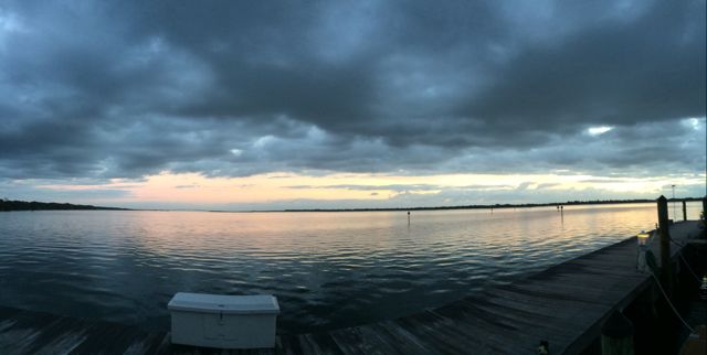
Sunrise greeting us just before leaving Cocoa Village Marina
Time to leave. Water looks pretty calm. Winds were around 7 mph when we left. Wonderful!
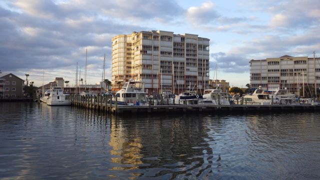
Leaving Cocoa Village Marina, Cocoa, FL
Seagulls and pelicans were waving goodbye as we motored by
The distance between Cocoa, FL and Daytona Beach, FL where we will spend 2 nights is 58 nautical miles. Going at a speedy 10 mph, we figured it will take us at least 6 hours. Well, it took longer. More like 9 hours due to “slow manatee zones”, slowing down as we approached bridges, and being courteous to other boaters and slowing down to let them pass ( mostly going south). We expected only one tricky area where many boaters have raised concerns about shoaling and skinny water. Otherwise, it was a straight run up the coast.
My job when I am not driving the boat is to keep an eye out for boats coming towards us and for boats trying to catch up to us and pass us by. The lookout and navigator. I am supposed to say things like “Go fast boat off the port bow”! Which is supposed to let Wayne know that a fast boat is approaching from the front and should go down our left side. Sounds really official if I can actually convey those words correctly. I usually say things like… “go fast boat on your left..see it?”
What are you supposed to say when you look behind as we entered the ICW from the marina and see a bunch of gulls following us as they did when transiting Lake Okeechobee? Other than, “lots of birds following us, skipper!”
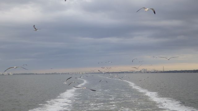
Gulls following us leaving Cocoa Village Marina
They weren’t having a good a ride as the last time. Instead of riding our air, they actually had to flap their wings.
It seems that anytime we see curves and 90° angles, there is usually shoaling. Basically, the water gets shallow due to the sand and sediment shifting with the currents. We tend to slow down and monitor our depth gauge constantly and paranoically. ( That is a real word, by the way. I looked it up. )
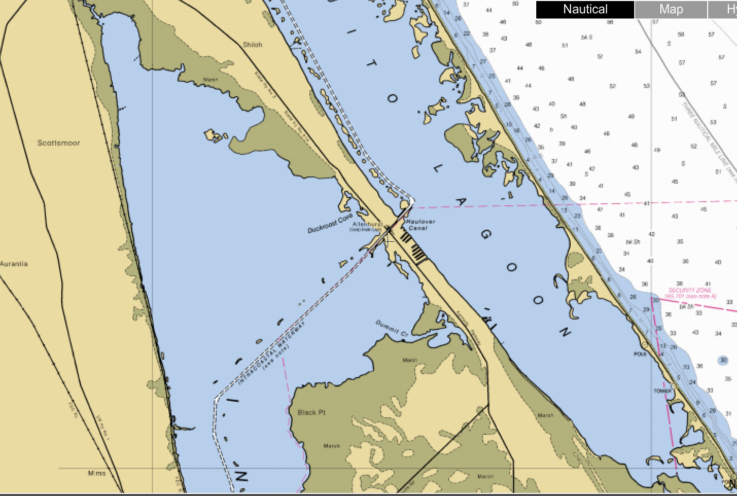
Haulover Canal joining Indian River and Mosquito Lagoon
Lots of fishing folks along the Haulover Canal banks as well as in skiffs, dinghies, and midsize fishing boats. Very slow in the canal to minimize our wake for these fishing folks as well as possible manatees. We didn’t see any manatees. Probably too cold.
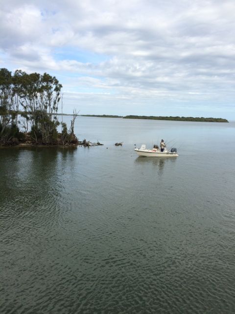
Trying their luck fishing near the Haulover Canal
During our trip north today, we expect to see lots of small land masses. Very few had names other than “Marsh” and “Mangrove”. Isn’t that a TV reference?? Marsha, Marsha, Marsha?!?!
Green marshlands and mangroves to the right of our boat
We saw several examples of “Manmade” land and water areas. At least to my untrained eyes. Either waterways cut into the land or land created into the waterway. Fascinating.

Houses!! On both sides of the canals.
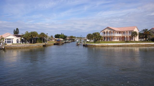
Homes along the man-made canals.
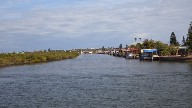
Homes along the canals
Most of the bridges were tall enough for us to go under without any concern. Anywhere from 65 ft to 23 ft in the center. We did have one railroad crossing to make. Luckily, the railroad bridge was open and we had an easy time to go through. It is “normally open unless a train is crossing”. Of course.

Jay Jay Rail Road Bridge
As we approached midday, we saw a couple of other unique fishing boats.
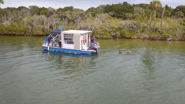
Fishing boat? Or Fishing Hut?
Pelicans following behind the fishing boat/hut in hopes of getting easy food. This is too small to be a real houseboat isn’t it?
As we were running pretty steady we had more dolphins!!
I never tire from watching these creatures play in our wake!

I know what you mean about being ready to move on! Itchy feet come with the vehicle ( or boat) free of charge!
LikeLike