
A beautiful morning greets us in Moore Haven, FL. 65°F
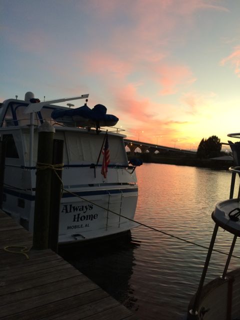
Good Morning Moore Haven, FL
We left Moore Haven just before 8am. We enjoyed this wooden dock. We were able to step right off our boat to the landing without deploying the ladder. The only remaining boats are the three boats that were planning to stay a second night. All the other boats left the docks before sun up. We thought we were late. Looks like a beautiful morning on the river.
Looking back at Moore Haven City Docks
I guess we should have left earlier from what happened next. The first bridge we encountered was this rail road bridge. The bridge is normally open unless a train is going by. So far, this is the first rail road bridge actually closed. The train only took 15 minutes to cross the river.
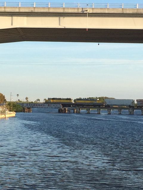
A train passing on the Rail Road Bridge
The swing bridge was supposed to open after the train passed. Right? The swing bridge didn’t open! We waited rather patiently for almost 30 minutes before starting to make some phone calls to find out why the swing bridge hadn’t reopened. It looked like it was stuck. Moore Haven Lock sent someone to check the rail road bridge and he opened it for us. It was an hour before we actually left Moore Haven City. That was interesting.
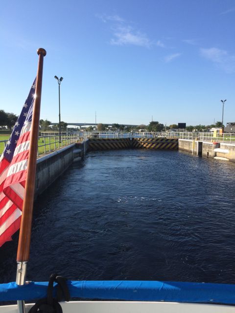
Right after the rail road bridge is the Moore Haven Lock. We were hopeful this lock would be easier than the last one! We were the only boat in the lock.
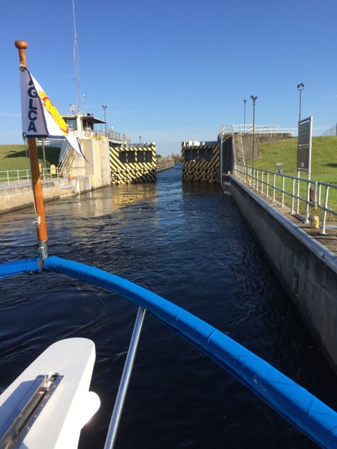
Moore Haven Locks opening
Travel in the lock went pretty well. We grew taller again! At least another 5 feet. Isn’t that exciting?!
Leaving Moore Haven Lock
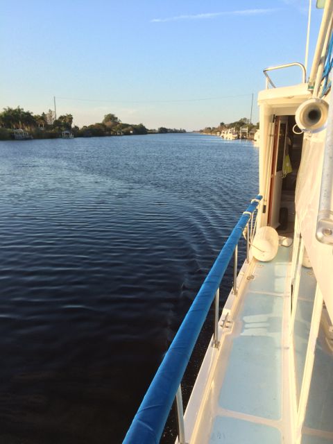
We clung to the wall on the starboard side. See, we are learning already.
Sometimes it is nice to look behind you to see if anyone is following along. Any “go fast boat” that might cause us any trouble? Nope. All clear.
Where we have been
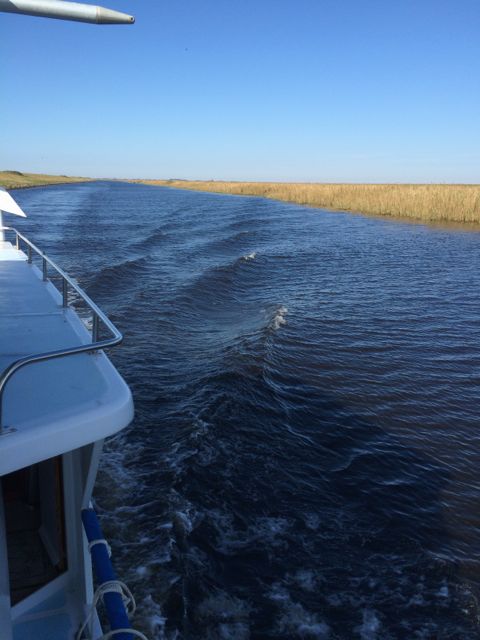
Just like driving along a motor highway, you have…
To the right is grass median

To the left is swamp!
Construction ahead. It looks like it is taking up half of the waterway. We slowed to a crawl to safely go by this huge obstruction. It is reported that there is shoaling and very skinny water around this construction. Skinny water means shallow water, I think. Another term to add to my new language list. Wayne had to drive between the tall metal structure, orange mooring balls on the left and skinny water. It looks like we can barely go through the opening.

Construction – beware
Yea, we made it. Slow and careful! Piece of cake.
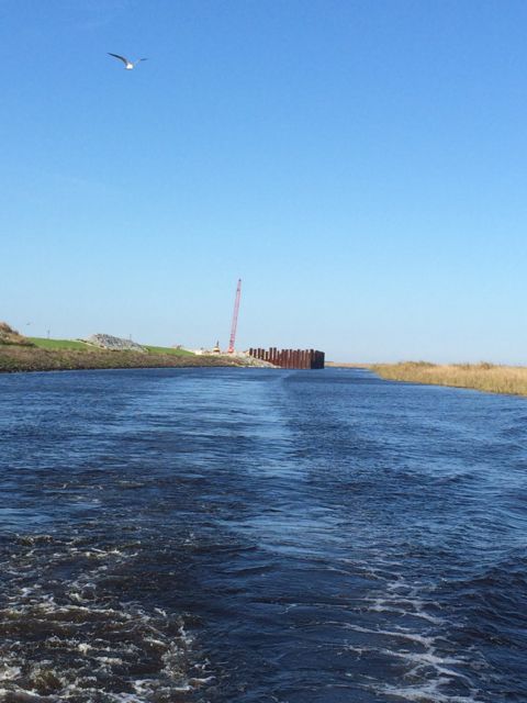
The construction behind us.
You do see a seagull following us? This one had been following long enough for me to give her a name. Gertrude?
We approached a “Y”. One way to a short cut to the Okeechobee but is not recommended to use. We chose the waterway to the right toward Clewiston, FL.
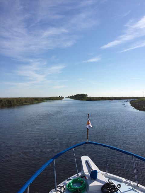
Decisions – Decisions – The road taken
We turned at the sign as we approached Clewiston. Just like on the road, they have places to eat, sleep, and anchor! Those big things in the air are turkey vultures. Wonder what they found so interesting. Maybe I really don’t want to know.
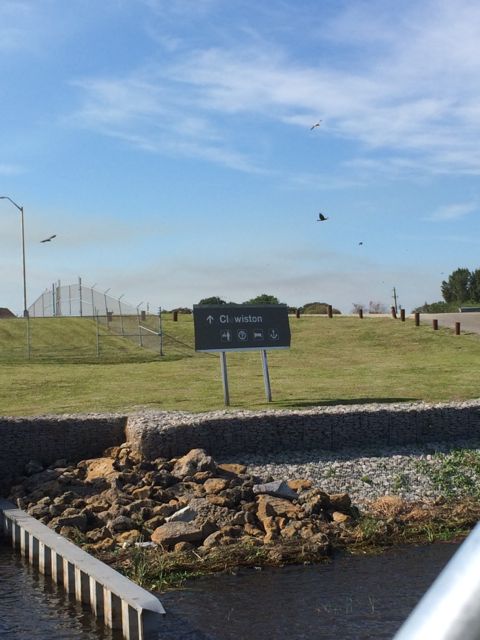
Clewiston ahead
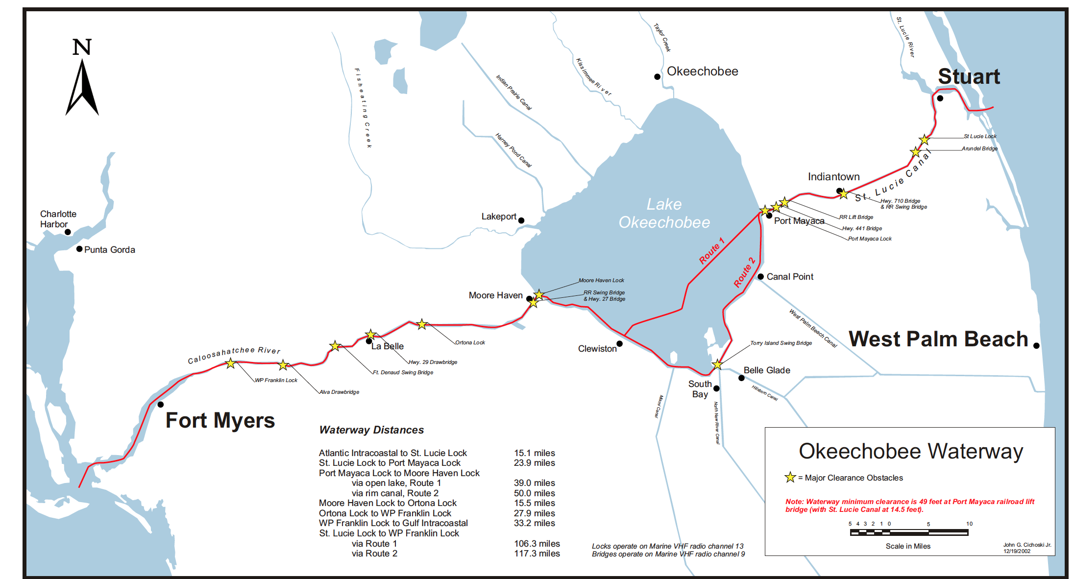
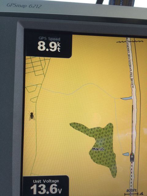
This is the Okeechobee Waterway. We were halfway across the total voyage from Fort Myers to Stuart. The alternative would have been to go around the southern tip of Florida in the Gulf of Mexico. We decided to sail the route across the Lake. For an interactive Lake Okeechobee map go to the link. (http://w3.saj.usace.army.mil/h2o/images/webcams/owwmap.pdf )
Lake Okeechobee Waterway
We had arrived just outside of Clewiston, FL which is the staging point to start across Lake Okeechobee. The Corp of Engineers monitor the lake levels. We will be taking Route 1 across the lake. 39 miles across the lake. Route 2 or the Rim Route is the alternative. The water depth on the Rim Route has 6 feet of water and lots of skinny waters. It is recommended for our sized boat to take Route 1. Today there is over 9 feet of water all across the lake. Pretty good depth for us.
Entering Lake Okeechobee
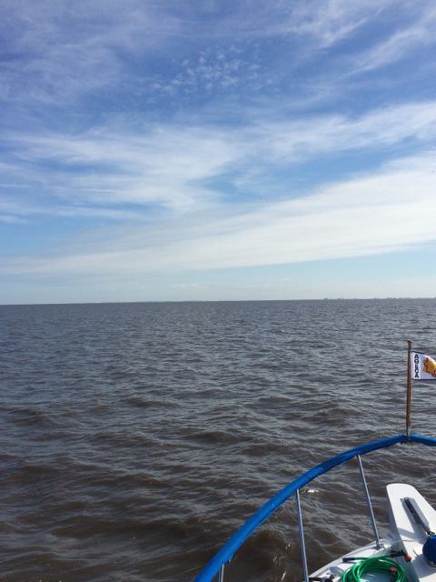
We were told that once you get on the lake, we wouldn’t be able to see land. We saw land all the way across. Comforting, actually. It was in the distance, but we could still see land.
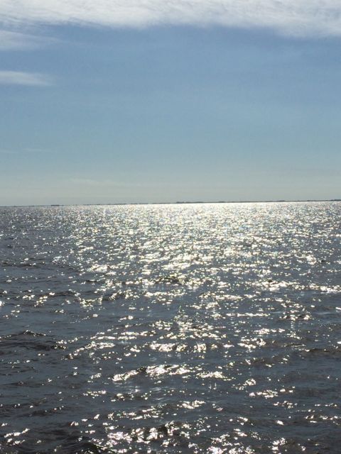
Horizon – land!!
We saw only one small sail boat. Otherwise, we had the Okeechobee all to ourselves. The most marvelous sight was the birds following in our wake. It was as if they were coasting in our airstream. We had heard that the seagulls like to follow boats so they can feed off the guppies brought up by our wake. I didn’t see many birds land and feed. Over a dozen birds followed our boat all the way across the lake. Mostly just follow along…
I am not sure if you notice the land close by out the back door. Obviously, this was shot shortly after entering the Okeechobee. Waves were 1 – 2 feet. That didn’t sound too bad. Especially since the next few days after our crossing the waves were expected to be 6-7 feet high. It was like between riding a bronco bull and walking in a fun house. Several times I just sank abruptly to the bench so that I wouldn’t fall to the floor. My legs got their workout. Hey, maybe that is an idea for all you cross trainers out there. Learn to stay standing during high seas! Ok, we weren’t on high seas, but even low seas can give you quite the workout.
By early afternoon we made the crossing. We knew we made it when we saw the Port Mayaka Lock!
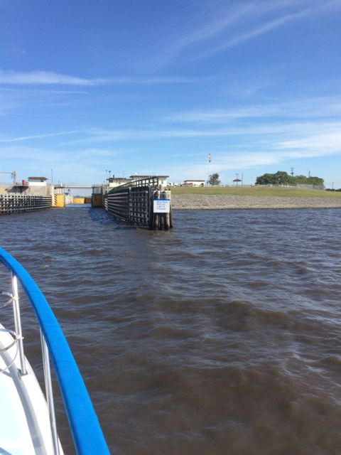
Entering Port Mayaka Lock
Our experience was a bit bumpy mainly due to our recent locking experience and trying to tie up too soon. The lock master again lowered the lines from the wall. We were rocking and rolling from the lake wind and waves. Trying to get the lines and holding on to the side of the boat. Whoa!! Then the lock master closed the lock doors. The waters calmed down and we easily handled the rest of the lock experience. I can’t remember if I grew or shrunk this time.
The first thing I noticed as we entered St. Lucie Canal is flies. We had several hitchhike with us. These were the first flies we have seen in months. How strange. Remember I mentioned there were no flies bothering the street restaurant patrons in Downtown Sarasota? These flies didn’t stay with us for long. Thank goodness.
Hitchhiker
Oh no! Another Rail Road bridge up ahead. Ugh…
Wait. It is up!! The Port Mayaca Rail Road Lift Bridge was up and we easily sailed under it. A lift bridge rather than a swing bridge. Looks fantastic, doesn’t it. The wonders of transportation in America.
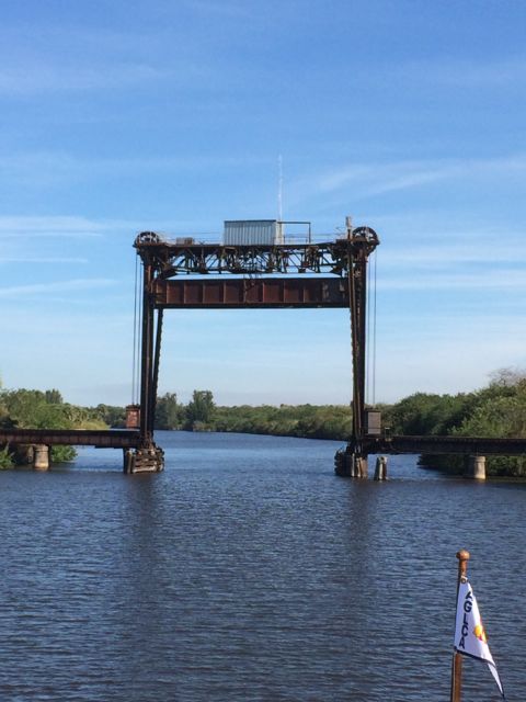
Indiantown Rail Road Bridge
We tucked into Indiantown Marina in Indiantown, FL for the night. It had been a very exciting day and we just didn’t think we needed to go further. At 4pm it was time to call it a day. Indiantown Marina is a small family owned marina. Nice.
We had a very quiet night. No sunset picture… I think I was already asleep.

I am exhausted after reading this. I am slap worn out from maneuvering along with you through all the tight spaces today. As IF steering the course isn’t tough enough- little did you know that construction/obstruction and fear of boat DEstruction were all part of this grand journey to parts unknown. No WONDER sea captains drink so much. Ha!
LikeLike